

- Alsace
- Aquitaine
- Auvergne
- Bourgogne
- Bourgogne-Franche-Comte
- Brittany
- Centre
- Champagne
- France Islands
- Gascogne
- Gironde
- Hauts-de-France
- Ile de France
- Languedoc
- Lothringen
- Midi-Pyrénées
- Nivernais
- Nord-Pas-de-Calais
- Normandie
- Occitanie
- Pas-de-Calais
- Pays de la Loire
- Picardie
- Poitou-Charentes
- Provence-Alpes-Cote d Azur
- Pyrénées
- Rhone- Alpes
- Saintonge
- Savoyen
- Tourain
- Westcoast
Adina Sommer
Antique and Contemporary Art
Winzerer Str. 154
80797 München
telephone
+49 89 304714
business hours:
by appointment
Email
![]()


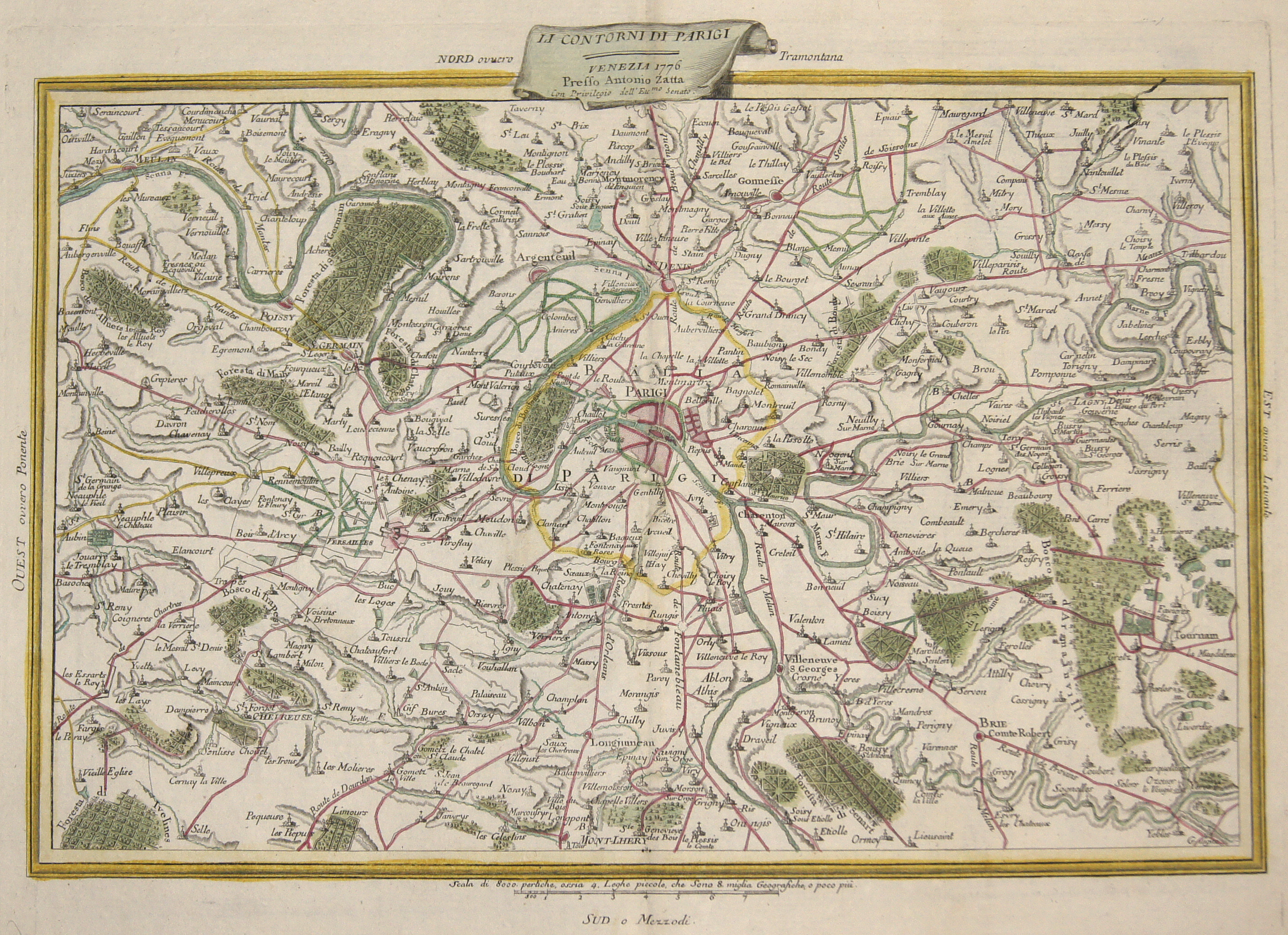
Li Contorni di Parigi

| Article ID | EUF3754 |
Title | Li Contorni di Parigi |
Description | The map shows Paris and the surrounding area in detail, including places, streets, rivers, mountains and forests. |
| Year | c. 1776 |
Artist | Zatta (1757-1797) |
Antonio Zatta (1757 – 1797) was an Italian cartographer who was based in Venice. One of his major contributions include the Atlante Novissimo, a four volume atlas of the world in very high scientific quality. | |
Historical Description | Historically, Île-de-France is the heartland of France, to which names such as Francia or Francia usually referred. Since the subjugation of Syagrius by Clovis I, the area has formed, with only a brief interruption in the 7th century, a political center of the Frankish Empire of the Merovingians and Carolingians and, from the 9th century, of the West Frankish Empire, that is, of the later France. For centuries it was identical with the French crown domain, the Domaine royal. From here spread the Gothic style, which was originally the architectural style only of this region and therefore the French "royal style". From Louis XIV on, the French kings ruled from Versailles, where they created the imposing and much copied Palace of Versailles. Until the French Revolution, Île-de-France was one of the historic provinces of France. With the creation of the departments in 1789/1790, it was dissolved as an administrative unit. |
| Place of Publication | Venice |
| Dimensions (cm) | 30 x 43 cm |
| Condition | Perfect condition |
| Coloring | original colored |
| Technique | Copper print |