

Adina Sommer
Antique and Contemporary Art
Winzerer Str. 154
80797 München
telephone
+49 89 304714
business hours:
by appointment
Email
![]()


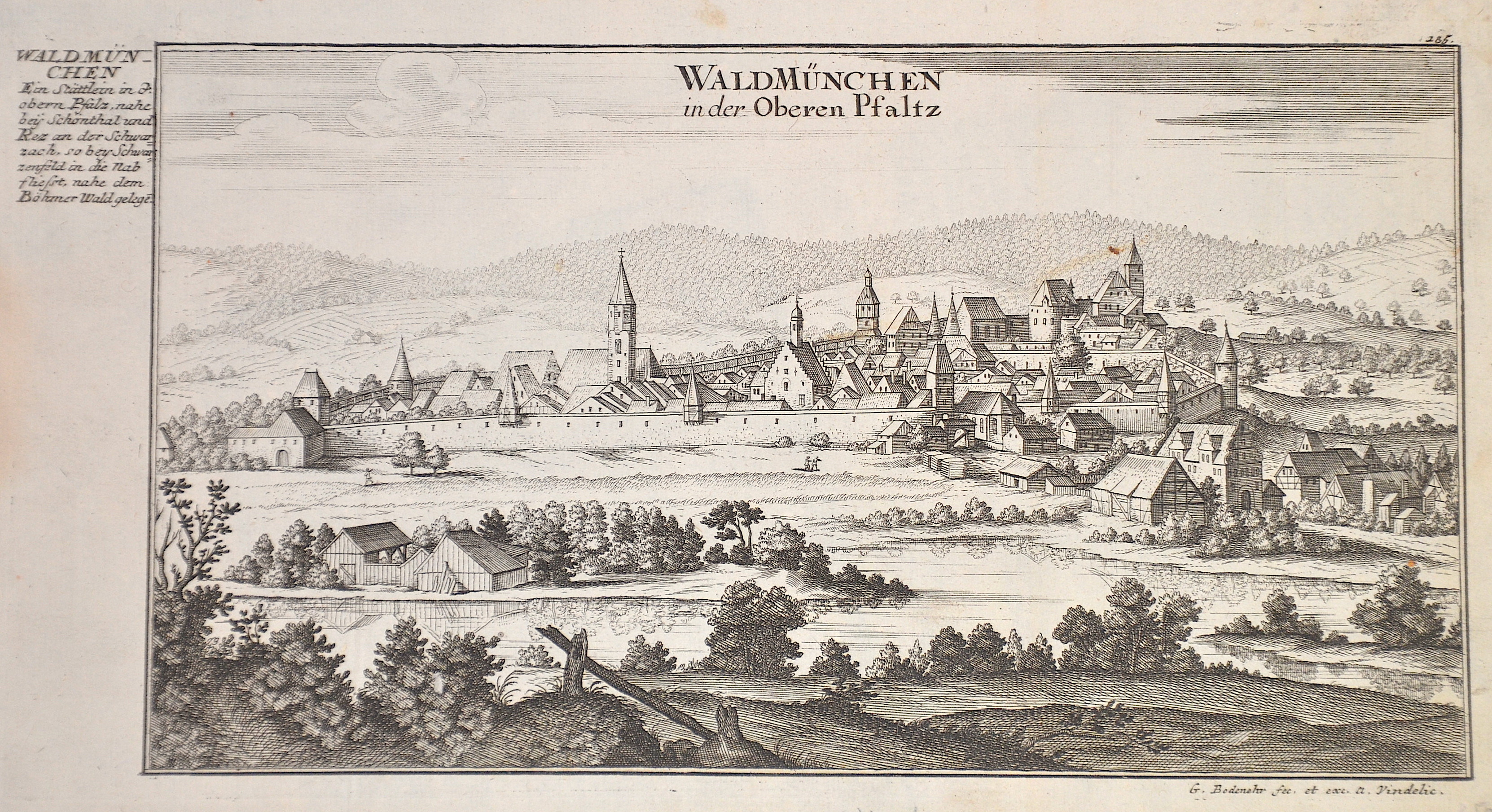
Waldmünchen in der Oberen Pfaltz

| Article ID | EUD5129 |
Title | Waldmünchen in der Oberen Pfaltz |
Description | General view of the town of Waldmünchen on the Schwarzach in the Upper Palatinate. |
| Year | ca. 1725 |
Artist | Bodenehr (1664-1765) |
Gabriel Bodenehr the Elder (1664-1765) was a German map maker and member of a famous engraver and publisher family of Augsburg. His main work was "Atlas Curieux" first published 1704. He was the son of Johann Georg Bodenehr (1631-1703). Gabriel's son was Gabriel Bodenehr the Younger (1705–1792). | |
Historical Description | Waldmünchen is a town in the Upper Palatinate district of Cham. The village is located in the southern Upper Palatinate Forest, which there already belongs to the Upper Bavarian Forest Nature Park, on the border with the Czech Republic, it is located on the upper reaches of the river Schwarzach. There are several theories about the origin of the village. The most probable is that in the 10th century, during the reign of King Henry I (919-936), the Margraves of Cham built a fortification to protect the Arnstein Pass, then the connecting road to Bohemia.The settlement was then probably given the name Waldmünchen because those monks who provided pastoral care for the inhabitants were called "forest monks". |
| Place of Publication | Augsburg |
| Dimensions (cm) | 16 x 31 cm |
| Condition | Perfect condition |
| Coloring | black/white |
| Technique | Copper print |