

Adina Sommer
Antique and Contemporary Art
Winzerer Str. 154
80797 München
telephone
+49 89 304714
business hours:
by appointment
Email
![]()


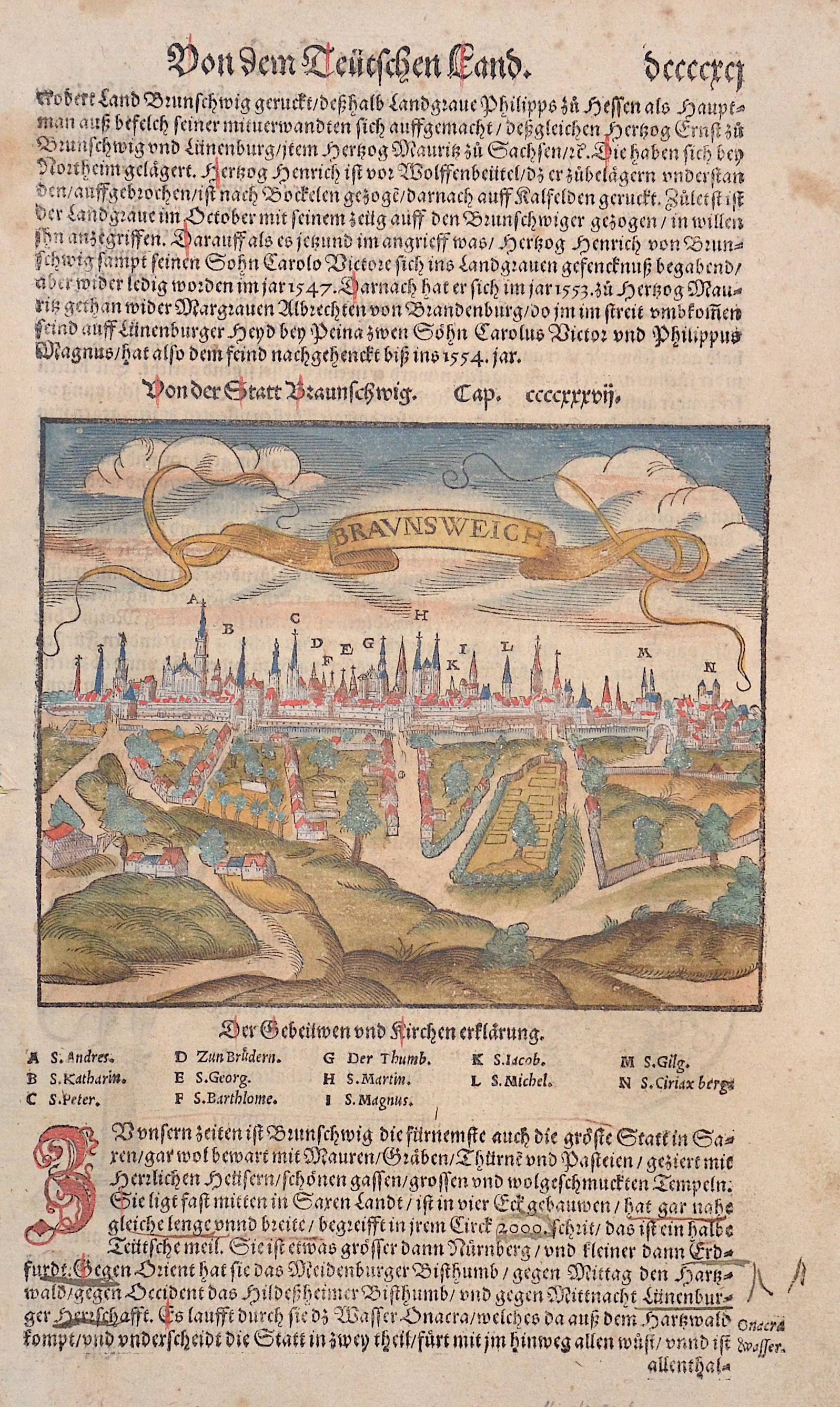
Von der Stadt Braunschweig

| Article ID | EUD1076 |
Title | Von der Stadt Braunschweig |
Description | Map shows the city of Braunschweig, on reverse the Luneburg arms. |
| Year | ca. 1550 |
Artist | Münster (1489-1552) |
Sebastian Münster (1489–1552) was a leading Renaissance cosmographer. His most famous work, the Cosmographia (1544), was a comprehensive description of the world with 24 maps, based on research dating back to 1528. Continuously revised, the 1550 edition already included many new maps. It was the first scientific yet accessible world description published in German, illustrated with numerous woodcuts by artists such as Hans Holbein the Younger. Between 1544 and 1650, the Cosmographia appeared in 46 editions (27 in German) and was translated into several languages. Münster’s work combined the knowledge of scholars, artists, and travelers and remained influential long after his death. | |
Historical Description | The name Saxony is derived from that of the Germanic confederation of tribes called Saxons. Before the late Middle Ages there was a single duchy of Saxony. The term "Lower Saxony" was used after the dissolution of the original duchy in the late 13th century to distinguish the parts of the former duchy that were ruled by the House of Welfare, on the one hand from the electorate of Saxony and from the duchy of Westphalia on the other. The name and coat of arms of today's state go back to the Germanic tribe of the Saxons. During the migration period, some of the Saxon peoples left their homeland in Holstein around the 3rd century and advanced south across the Elbe, where they expanded into the sparsely populated regions in the rest of the lowlands in today's northwestern Germany and the northeastern part of today's Netherlands. From the 7th century onwards, the Saxons occupied a settlement area that roughly corresponds to today's federal state of Lower Saxony, Westphalia and a number of areas in the east, for example in today's west and north Saxony-Anhalt. From the 14th century onwards it referred to the Duchy of Saxony-Lauenburg (as opposed to Saxony-Wittenberg). When the imperial districts were created in 1500, a distinction was made between a district in Lower Saxony and a district in Lower Rhine-Westphalia. The latter comprised the following areas, which today belong wholly or partially to the state of Lower Saxony: the Diocese of Osnabrück, the Diocese of Münster, the County of Bentheim, the County of Hoya, the Principality of East Friesland, the Principality of Verden, the district of Diepholz, the district of Oldenburg, the district of Schaumburg and the district of Spiegelberg .The close historical links between the domains of the Lower Saxon Circle now in modern Lower Saxony survived for centuries especially from a dynastic point of view. The majority of historic territories whose land now lies within Lower Saxony were sub-principalities of the medieval, Welf estates of the Duchy of Brunswick-Lüneburg. All the Welf princes called themselves dukes "of Brunswick and Lüneburg" despite often ruling parts of a duchy that was forever being divided and reunited as various Welf lines multiplied or died out. |
| Place of Publication | Basle |
| Dimensions (cm) | 28 x 15 |
| Condition | Very good |
| Coloring | original colored |
| Technique | Woodcut |