

Adina Sommer
Antique and Contemporary Art
Winzerer Str. 154
80797 München
telephone
+49 89 304714
business hours:
by appointment
Email
![]()


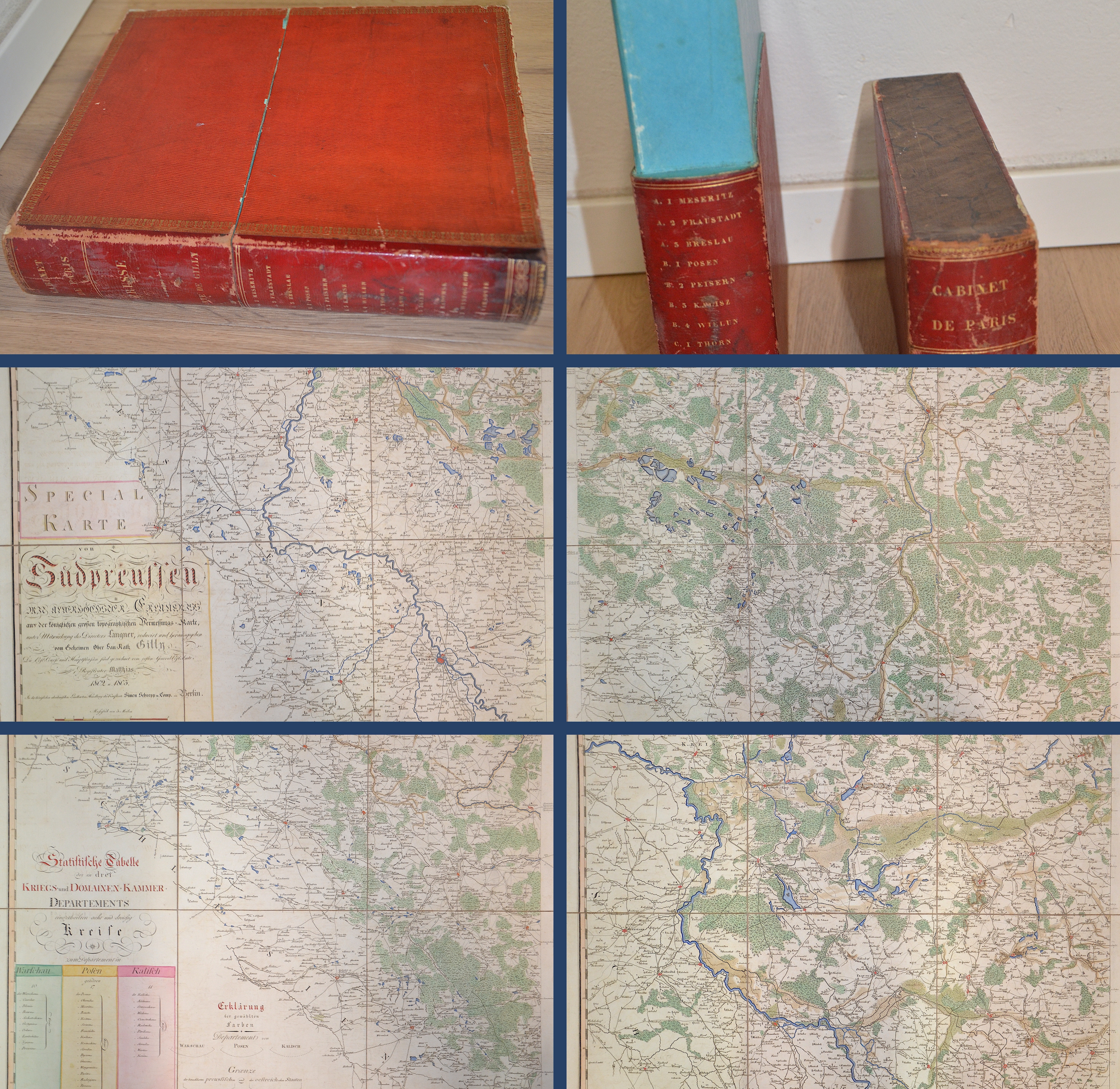
Preussen. Spezial Karte von Südpreussen. Mit allerhöchster Erlaubnis aus der königlichen großen topographischen Vermessungs-Karte, unter Mitwirkung..

| Article ID | EUP3374 |
Title | Preussen. Spezial Karte von Südpreussen. Mit allerhöchster Erlaubnis aus der königlichen großen topographischen Vermessungs-Karte, unter Mitwirkung.. |
Description | Preussen. Spezial Karte von Südpreussen. Mit allerhöchster Erlaubnis aus der königlichen großen topographischen Vermessungs-Karte, unter Mitwirkung des Directors Langner, reducirt und herausgegeben vom Geheimen Ober Lau= Katz Gilly..........The large folding map is mounted on linnen on 13 sheets. The map shows the south part of Prussia with post ways, post stations and main streets. Drawn by the first general of the post registration Matthias 1802 u. 1803. |
| Year | dated 1803 |
Artist | Gilly/ Sotzmann (1748-1808) |
David Gilly was a German architect and architecture-tutor in Prussia, known as the father of the architect Friedrich Gilly. In 1788 Gilly was recalled to Berlin, into the Oberbaudepartement. There he was promoted that very year to be architectural advisor for the provinces of Pomerania, East Prussia and West Prussia. In 1760, Gilly started to draw maps and 1789 he issued a map devided into 6 sections from upper and lower Pommerania and between 1802 and 1803 he issued a map in 13 sections of Soth Prussia which has been printed from Friedrich Sotzmann. | |
| Place of Publication | Berlin |
| Dimensions (cm) | 320 x 270 |
| Condition | Stored in a hardcover case in leather hardcover, embossed in gold. |
| Coloring | colored |
| Technique | Copper print |