

- Alsace
- Aquitaine
- Auvergne
- Bourgogne
- Bourgogne-Franche-Comte
- Brittany
- Centre
- Champagne
- France Islands
- Gascogne
- Gironde
- Hauts-de-France
- Ile de France
- Languedoc
- Lothringen
- Midi-Pyrénées
- Nivernais
- Nord-Pas-de-Calais
- Normandie
- Occitanie
- Pas-de-Calais
- Pays de la Loire
- Picardie
- Poitou-Charentes
- Provence-Alpes-Cote d Azur
- Pyrénées
- Rhone- Alpes
- Saintonge
- Savoyen
- Tourain
- Westcoast
Adina Sommer
Antique and Contemporary Art
Winzerer Str. 154
80797 München
telephone
+49 89 304714
business hours:
by appointment
Email
![]()


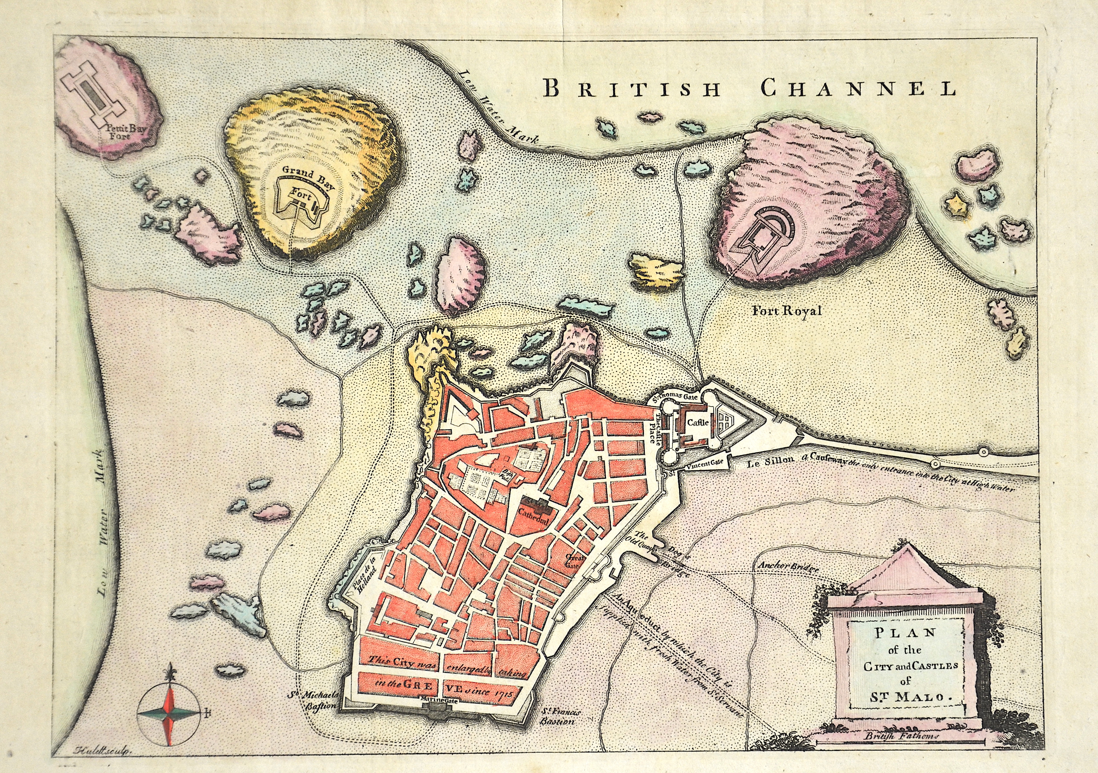
Plan of the City and Castles of St. Malo.

| Article ID | EUF4496 |
Title | Plan of the City and Castles of St. Malo. |
Description | City map of Saint-Malo in Brittany in north-western France. |
| Year | ca. 1767 |
Artist | Rollos |
| Dimensions (cm) | 19 x 26 cm |
| Condition | Minor stains |
| Coloring | colored |
| Technique | Copper print |