

Adina Sommer
Antique and Contemporary Art
Winzerer Str. 154
80797 München
telephone
+49 89 304714
business hours:
by appointment
Email
![]()


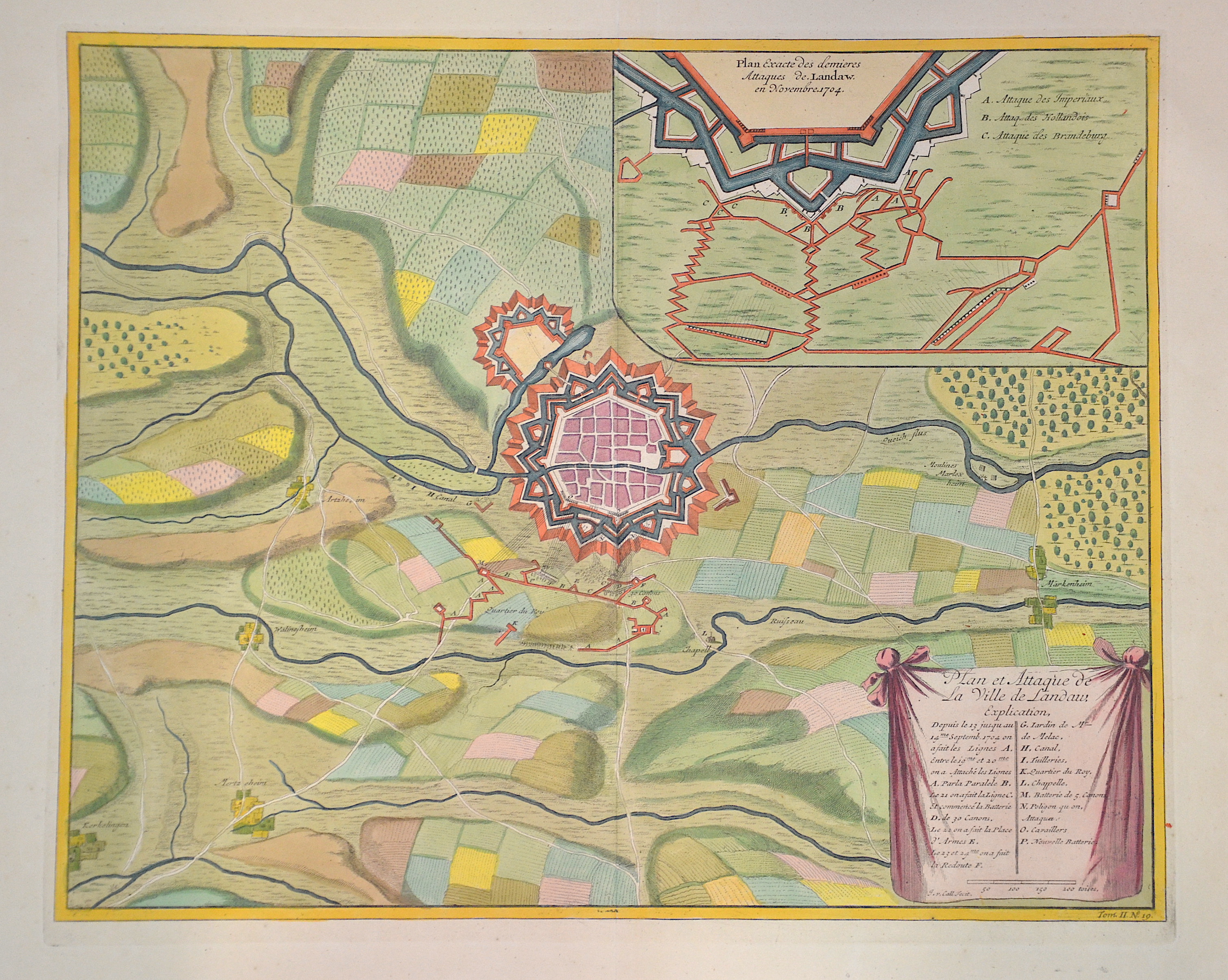
Plan et Attaques de la ville de Landaw /Plan Exacte des Demieres Attaques de. Landaw . En Novembre 1704

| Article ID | EUD1199 |
Title | Plan et Attaques de la ville de Landaw /Plan Exacte des Demieres Attaques de. Landaw . En Novembre 1704 |
Description | Map shows the city map of landau at the River Queich in the year of 1704 |
| Year | ca. 1720 |
Artist | Call |
Historical Description | Landau was founded around 1260 by Count Emich IV von Leiningen-Landeck. This had an upstream fortification built as additional protection for his Landeck castle. In 1274 Landau received city rights from King Rudolf I of Habsburg. As a result of the Peace of Westphalia, large parts of Alsace came to France in 1648. Landau and the other cities in Alsace remained formally German, but were abandoned by the Reich. In the War of the Spanish Succession, the French fortress Landau changed hands several times after extensive sieges. In 1702 the Imperial troops replaced the French, in 1703 the French recovered Landau after the Battle of Speyerbach, in 1704 Landau became imperial again. In 1814, after the first victory in the liberation war over Napoléon Bonaparte, Landau remained French for the time being. Due to the agreements in the Second Paris Peace of November 1815, the area north of the Lauter and Landau came under the sovereignty of Austria. In April 1816, the entire Palatinate was ceded from Austria to the Kingdom of Bavaria in a treaty. |
| Dimensions (cm) | 35,5 44 |
| Condition | Very good |
| Coloring | original colored |
| Technique | Copper print |