

Adina Sommer
Antique and Contemporary Art
Winzerer Str. 154
80797 München
telephone
+49 89 304714
business hours:
by appointment
Email
![]()


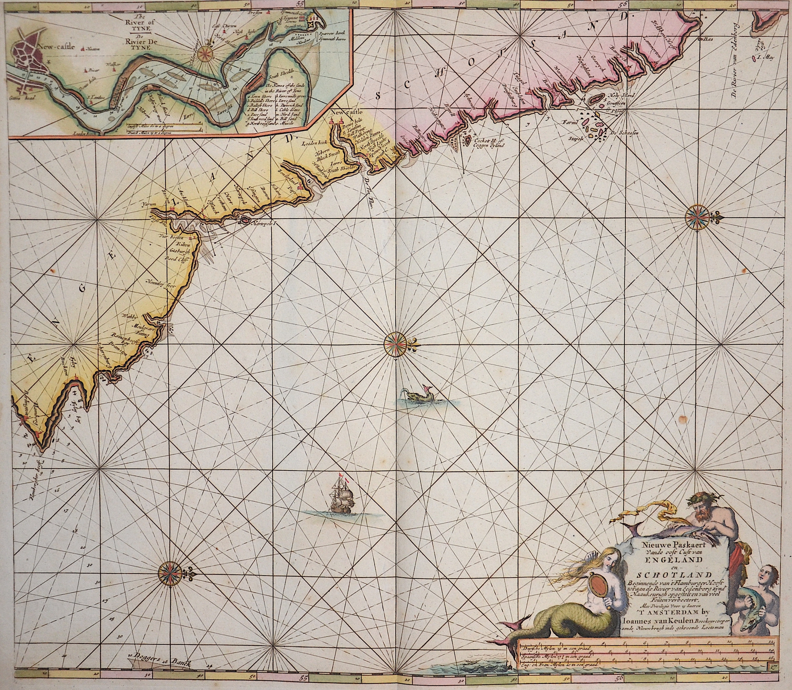
Nieuwe Paskaert van de Oost Cust van Engeland en Schotland…..

| Article ID | SE0273 |
Title | Nieuwe Paskaert van de Oost Cust van Engeland en Schotland….. |
Description | Map shows the North Sea with the coasts of Engalnd and Scottland from Flamborough Head to Berwick, inset maps shows the river Tyne from the city New Castle to the estuary. |
| Year | ca. 1724 |
Artist | Keulen (1654-1715) |
Johannes van Keulen (1654 - 1715) was a 17th-century Dutch cartographer. He published the influential nautical atlas the Zee-Atlas and the pilot guide Zee-Fakkel .In 1678 Johannes van Keulen established himself in Amsterdam and in 1680 he obtained a patent from the States of Holland and West Friesland allowing him to print and publish maritime atlases and shipping guides. These were books of maps and descriptions of itineraries, used by helmsmen for safe navigation. The patent was a kind of protection against illegal copying of produced books and charts. This was especially important for the atlases which were made with extensive initial costs. Van Keulen named his firm ‘In de Gekroonde Lootsman’ ('In the Crowned Pilot'). Soon Van Keulen struck a deal with cartographer Claes Jansz. Vooght. | |
| Place of Publication | Amsterdam |
| Dimensions (cm) | 51 x 58,5 |
| Condition | Upper margin perfectly enlarged |
| Coloring | original colored |
| Technique | Copper print |