

- Alsace
- Aquitaine
- Auvergne
- Bourgogne
- Bourgogne-Franche-Comte
- Brittany
- Centre
- Champagne
- France Islands
- Gascogne
- Gironde
- Hauts-de-France
- Ile de France
- Languedoc
- Lothringen
- Midi-Pyrénées
- Nivernais
- Nord-Pas-de-Calais
- Normandie
- Occitanie
- Pas-de-Calais
- Pays de la Loire
- Picardie
- Poitou-Charentes
- Provence-Alpes-Cote d Azur
- Pyrénées
- Rhone- Alpes
- Saintonge
- Savoyen
- Tourain
- Westcoast
Adina Sommer
Antique and Contemporary Art
Winzerer Str. 154
80797 München
telephone
+49 89 304714
business hours:
by appointment
Email
![]()


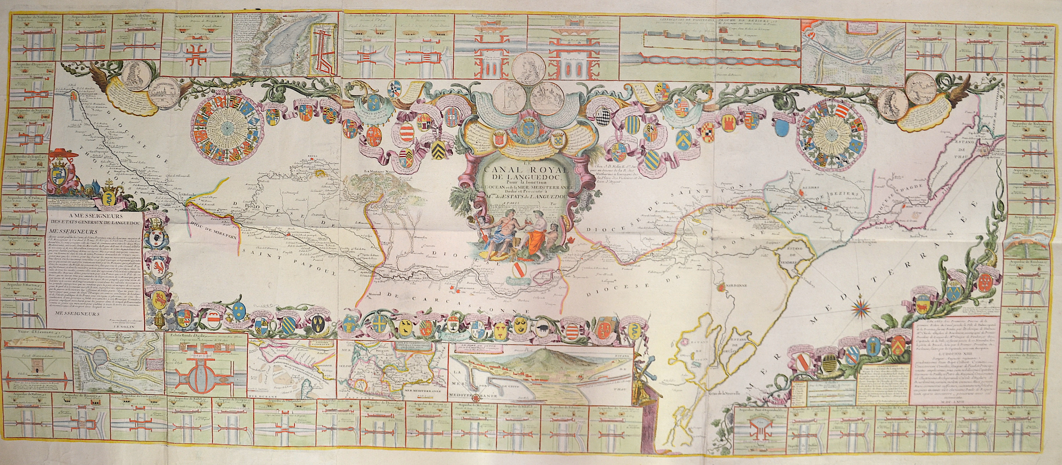
Le Canal Royal de Languedoc, Pour la Ionction de L’ Ocean et de la Mer Mediterranee

| Article ID | EUF3302 |
Title | Le Canal Royal de Languedoc, Pour la Ionction de L’ Ocean et de la Mer Mediterranee |
Description | Large and very decorative view of the Canal Royal de Languedoc. The canal was built through southwestern France to connect the Mediterranean with the Atlantic. The map includes 58 insets and 59 coats of arms of the men associated with the construction of the canal, along with a history of the project. |
| Year | dated 1697 |
Artist | Nolin (1657-1725) |
Jean-Baptiste Nolin (ca. 1657-1708) set up the family publishing business in Paris. Many of his maps were based on the work of Vincenzo Coronelli and Sieur de Tillemon. His son (1686-1762), continued the business for many years and prepared an Atlas General which was published posthumously in 1783. | |
| Place of Publication | Paris |
| Dimensions (cm) | 59 x 143,5 cm |
| Condition | Printed on 3 sheets joined together |
| Coloring | colored |
| Technique | Copper print |