

Adina Sommer
Antique and Contemporary Art
Winzerer Str. 154
80797 München
telephone
+49 89 304714
business hours:
by appointment
Email
![]()


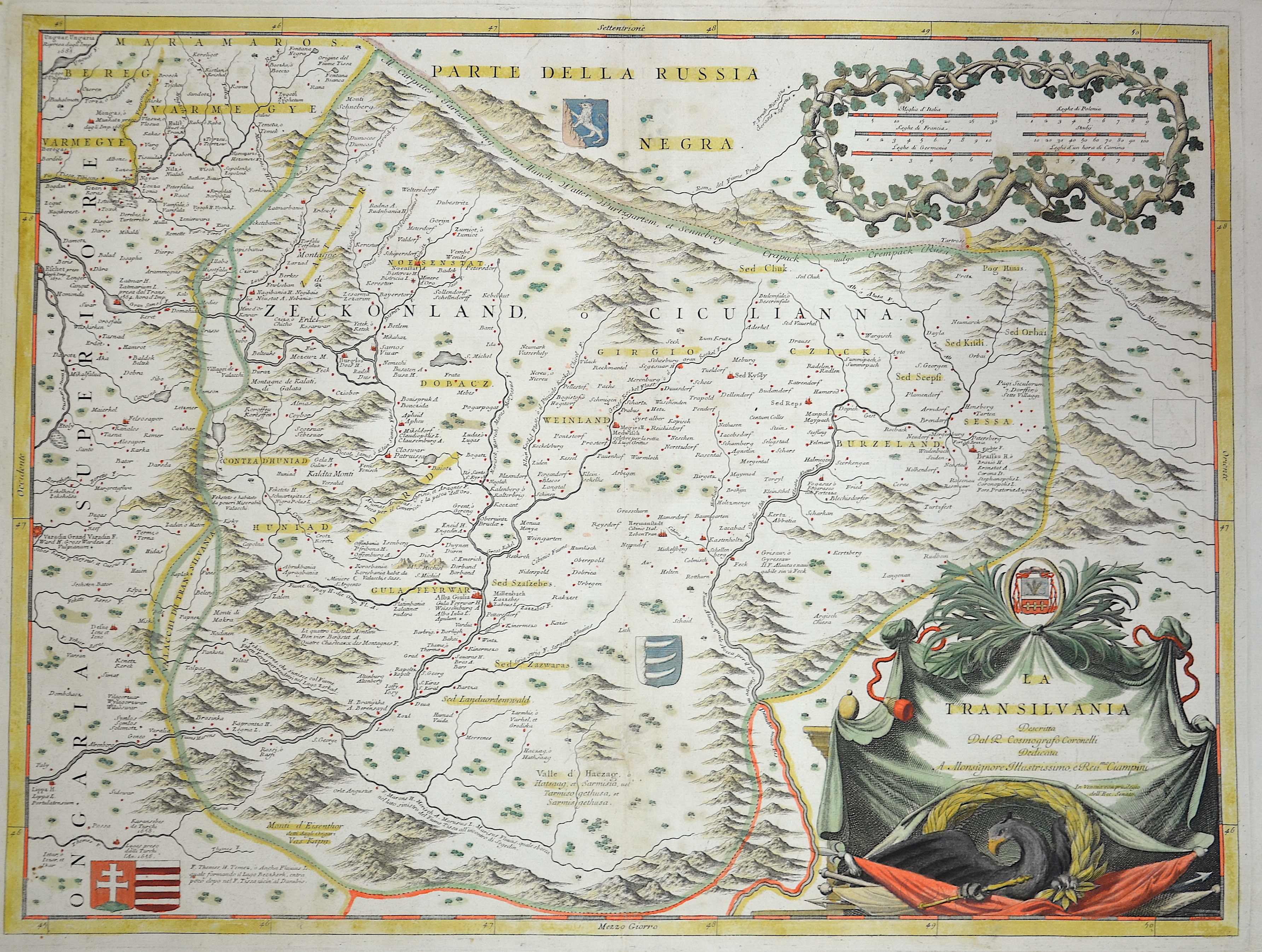
La Transilvania

| Article ID | EUR734 |
Title | La Transilvania |
Description | The map shows the entire Transylvania (Siebenbürgen) with numerous coats of arms from Transylvania and other provinces of Romania in the country. Furthermore, it features a magnificent title cartouche and a mileage indicator cartouche. |
| Year | ca. 1695 |
Artist | Coronelli (1650-1718) |
Coronelli Vincenzo, (1650 – 1718). He was a cosmographer, geographer, biographer, encyclopedist, globe maker, inventor and an expert of engeneering and hydraulics. Extraordinarily versatile mind and an extremely tireless man, he produced more than 140 pieces in different genres. At the age of 15, he entered the Franciscan Order, which he then guided as Gran Generale from 1699. He became famous as geographer and mathematician, awakening the interest in these subjects in Italy at the end of the XVII century. | |
Historical Description | Transilvania is a historical region located in what is today the central part of Romania. Bound on the east and south by its natural borders, the Carpathian mountain range, historical Transylvania extended westward to the Apuseni Mountains. The region of Transylvania is known for the scenic beauty of its Carpathian landscape and its rich history. It also contains major cities such as Cluj-Napoca, Brașov, Sibiu and Târgu Mureș. The Habsburgs acquired the territory shortly after the Battle of Vienna in 1683. In 1687, the rulers of Transylvania recognized the suzerainty of the Habsburg emperor Leopold I, and the region was officially attached to the Habsburg Empire. |
| Place of Publication | Venice |
| Dimensions (cm) | 45 x 60 cm |
| Condition | Very good |
| Coloring | colored |
| Technique | Copper print |