

Adina Sommer
Antique and Contemporary Art
Winzerer Str. 154
80797 München
telephone
+49 89 304714
business hours:
by appointment
Email
![]()


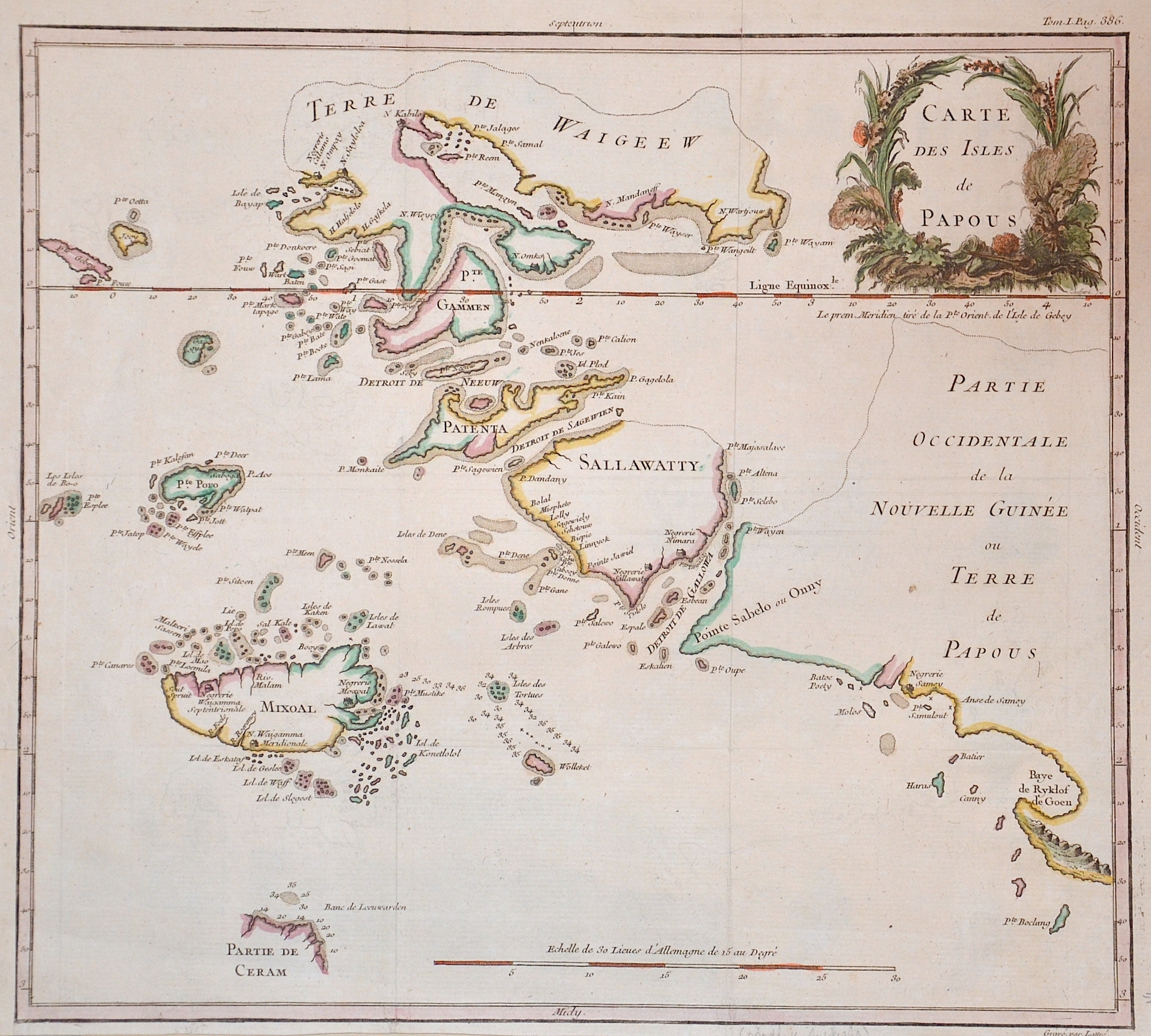
Kaart van de Papoasche Eilanden

| Article ID | ASS181 |
Title | Kaart van de Papoasche Eilanden |
Description | Map of the eastern islands of New Guinea. |
| Year | dated 1753 |
Artist | Tirion (1705-1765) |
Isaak Tirion (1705 1765) was a Dutch bookseller and publisher. He is known for his Hedendaagsche historie (Modern History) and his Vaderlandse Historie, both historical reference works illustrated with engravings by leading Amsterdam artists. Of particular interest today are his map works, such as the United Netherlands in twelve parts and "Tegenwoordige Staat van alle Volken" ("Present State of All Nations") in 45 parts. Some of his atlases were published after his death, such as the Atlas van Zeeland in 1760, which was published again and again until 1784. | |
Historical Description | Independent State of Papua New Guinea, is an oceanic country that occupies the eastern half of the island of New Guinea and its offshore islands in Melanesia, a region of the southwestern Pacific Ocean north of Australia. The Portuguese Jorge de Meneses, who explored the north coast and offshore islands in 1526/27, is considered the island's European explorer. In 1545 the Spaniard Íñigo Ortiz de Retez landed and named the island "New Guinea" because the coast reminded him of that of the African Guinea, which he had previously passed. In 1623 Jan Carstenszoon mapped large parts of the coast on behalf of the Dutch East India Company. Since then, the Dutch East India Company has maintained business and political contacts with the region and the Sultanate of Tidore. |
| Place of Publication | Amsterdam |
| Dimensions (cm) | 32 x 36 |
| Condition | Very good |
| Coloring | colored |
| Technique | Copper print |