

Adina Sommer
Antique and Contemporary Art
Winzerer Str. 154
80797 München
telephone
+49 89 304714
business hours:
by appointment
Email
![]()


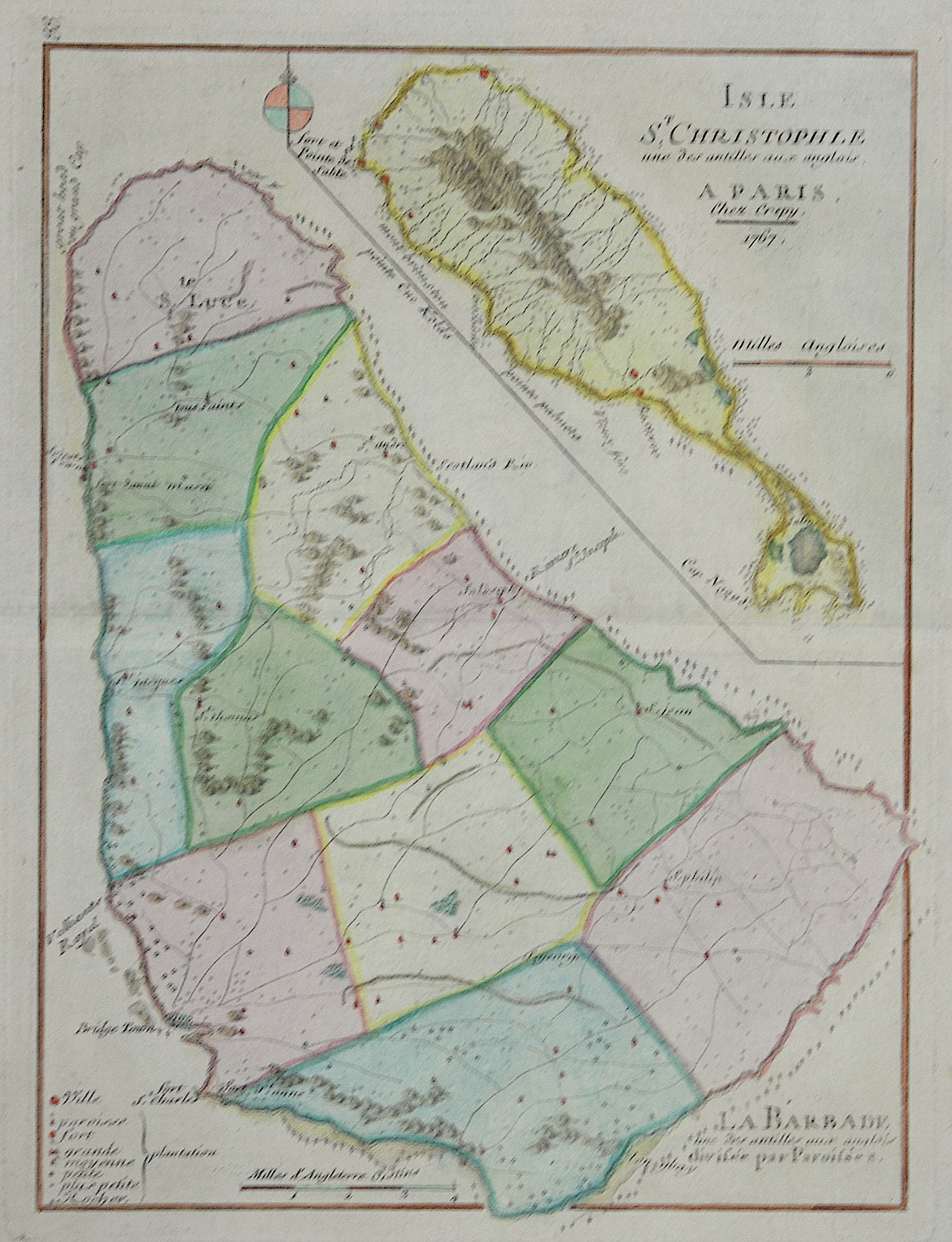
Isle St. Christoope..

| Article ID | AMW1389 |
Title | Isle St. Christoope.. |
Description | Map shows the island of St. Kitts and Barbados with division of all areas of the island. |
| Year | c. 1767 |
Artist | Crepy |
Jean Babtiste Crepy was a french engraver and painter. | |
Historical Description | The Caribbean reached the island around 1300. Christopher Columbus was the first European to reach the island. In 1538 Huguenots from Dieppe founded the first European settlement on the island and named them Dieppe after their hometown; This settlement was destroyed by the Spaniards after a short time. In 1623 the English established a first permanent settlement under Captain Thomas Warner, followed by a French settlement which was laid out in 1625 by Pierre Belain d'Esnambuc. In 1626 the Caribbean planned an attack on the Europeans in order to destroy them or to drive them off the island. The Europeans found out about the plan and in turn either killed the entire Caribbean or took them as slaves. In 1629 the island was conquered and sacked by a Spanish squadron under Admiral Fadrique Álvarez de Toledo y Mendoza during the Anglo-Spanish War from 1625 to 1630. The English and French fled - but they returned in 1631. In April 1666, the French fleet captured the island during the Second Anglo-Dutch War. In June 1667 an English attempt to retake it failed. However, in the Peace of Breda, the English got the island back. The English and French alternated in the rule of St. Kitts, but it finally fell to Great Britain in the Peace of Paris in 1783. Nevis was united with St. Kitts and Anguilla with St. Christopher-Nevis-Anguilla in 1882. |
| Place of Publication | Paris |
| Dimensions (cm) | 27 x 20 |
| Condition | Very good |
| Coloring | original colored |
| Technique | Copper print |