

Adina Sommer
Antique and Contemporary Art
Winzerer Str. 154
80797 München
telephone
+49 89 304714
business hours:
by appointment
Email
![]()


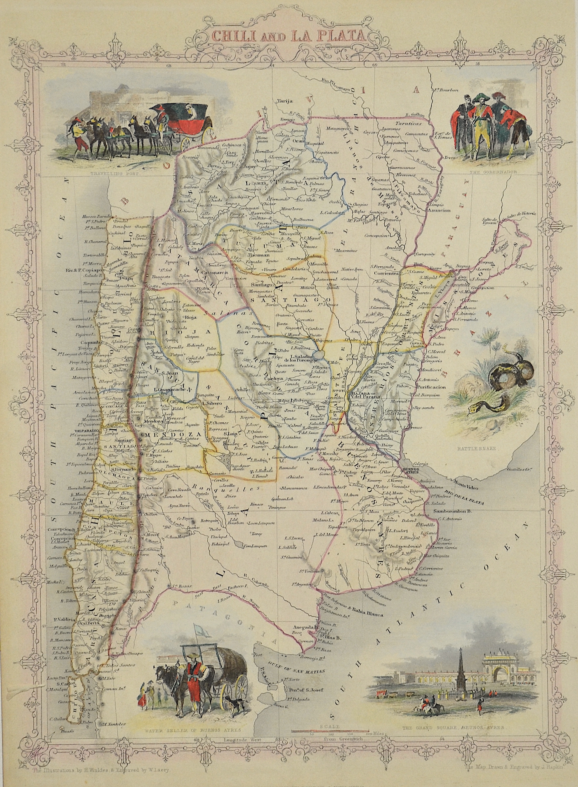
Chili and la Plata

| Article ID | AMS1090 |
Title | Chili and la Plata |
Description | Map shows Chili and Argentinia from Bolivia to the river Negro with 5 beautiful views of Buenos Aires, a mail train, Governor, water seller and a snake.him |
| Year | ca. 1850 |
Artist | Tallis (1817-1876) |
John Tallis was an English cartographic publisher. His company, John Tallis and Company, published views, maps and atlases in London from roughly 1838 to 1851. | |
Historical Description | Ferdinand Magellan (1480 –1521) was a Portuguese explorer who organised the Spanish expedition to the East Indies from 1519 to 1522, resulting in the first circumnavigation of the Earth, completed by Juan Sebastián Elcano. Born into a Portuguese noble family in around 1480, Magellan became a skilled sailor and naval officer and was eventually selected by King Charles I of Spain to search for a westward route to the Maluku Islands (the "Spice Islands"). Commanding a fleet of five vessels, he headed south through the Atlantic Ocean to Patagonia, passing through the Strait of Magellan into a body of water he named the "peaceful sea" (the modern Pacific Ocean). Despite a series of storms and mutinies, the expedition reached the Spice Islands in 1521 and returned home via the Indian Ocean to complete the first circuit of the globe. Magellan did not complete the entire voyage, as he was killed during the Battle of Mactan in the Philippines in 1521.Tierra del Fuego is an archipelago off the southernmost tip of the South American mainland, across the Strait of Magellan. The archipelago consists of the main island, Isla Grande de Tierra del Fuego. Europeans first explored the islands during Ferdinand Magellan's expedition of 1520; Tierra del Fuego and similar namings stem from sightings of the many bonfires that the natives built. |
| Place of Publication | London |
| Dimensions (cm) | 34 x 25 |
| Condition | Perfect condition |
| Coloring | original colored |
| Technique | Lithography |