

Adina Sommer
Antique and Contemporary Art
Winzerer Str. 154
80797 München
telephone
+49 89 304714
business hours:
by appointment
Email
![]()


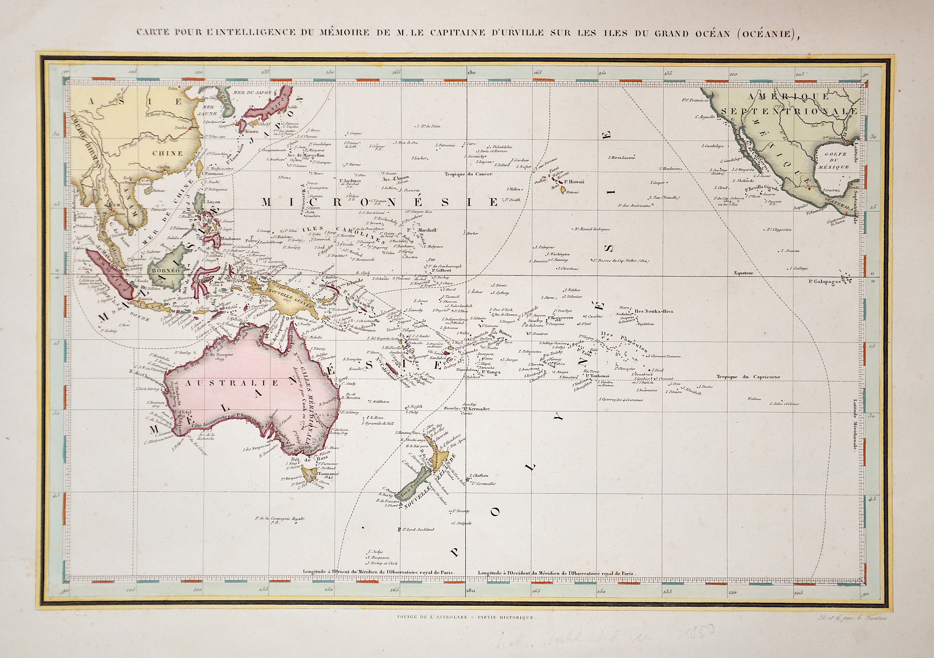
Carte … du Grand Océan

| Article ID | OZ190 |
Title | Carte … du Grand Océan |
Description | Detailed map of the Pacific Ocean with Australia and Polynesia. |
| Year | ca. 1840 |
Artist | Tardieu (1746-1816) |
Ambroise Tardieu ( 1788 - 1841 in Paris) was an eminent French cartographer and engraver, and is celebrated for his version of John Arrowsmith's 1806 map of the United States. Tardieu's son, Auguste Ambroise Tardieu (1818-1879), was also an artist and a famous forensic medical scholar, who supplied the illustrations for Dr. Pierre François Olive Rayer's three-volume Traité des maladies des reins (1839-41), a treatise on diseases of the kidneys. | |
Historical Description | The Pacific Ocean is the largest and deepest of Earth's oceanic divisions. Though the peoples of Asia and Oceania have traveled the Pacific Ocean since prehistoric times, the eastern Pacific was first sighted by Europeans in the early 16th century when Spanish explorer Vasco Núñez de Balboa crossed the Isthmus of Panama in 1513 and discovered the great "southern sea" which he named Mar del Sur (in Spanish). In 1519, Portuguese explorer Ferdinand Magellan sailed the Pacific East to West on a Spanish expedition to the Spice Islands that would eventually result in the first world circumnavigation. Magellan called the ocean Pacífico (or "Pacific" meaning, "peaceful") because, after sailing through the stormy seas off Cape Horn, the expedition found calm waters. The ocean was often called the Sea of Magellan in his honor until the eighteenth century. |
| Place of Publication | Paris |
| Dimensions (cm) | 33,5 x 44 |
| Condition | Very good |
| Coloring | colored |
| Technique | Steel engraving |