

Adina Sommer
Antique and Contemporary Art
Winzerer Str. 154
80797 München
telephone
+49 89 304714
business hours:
by appointment
Email
![]()


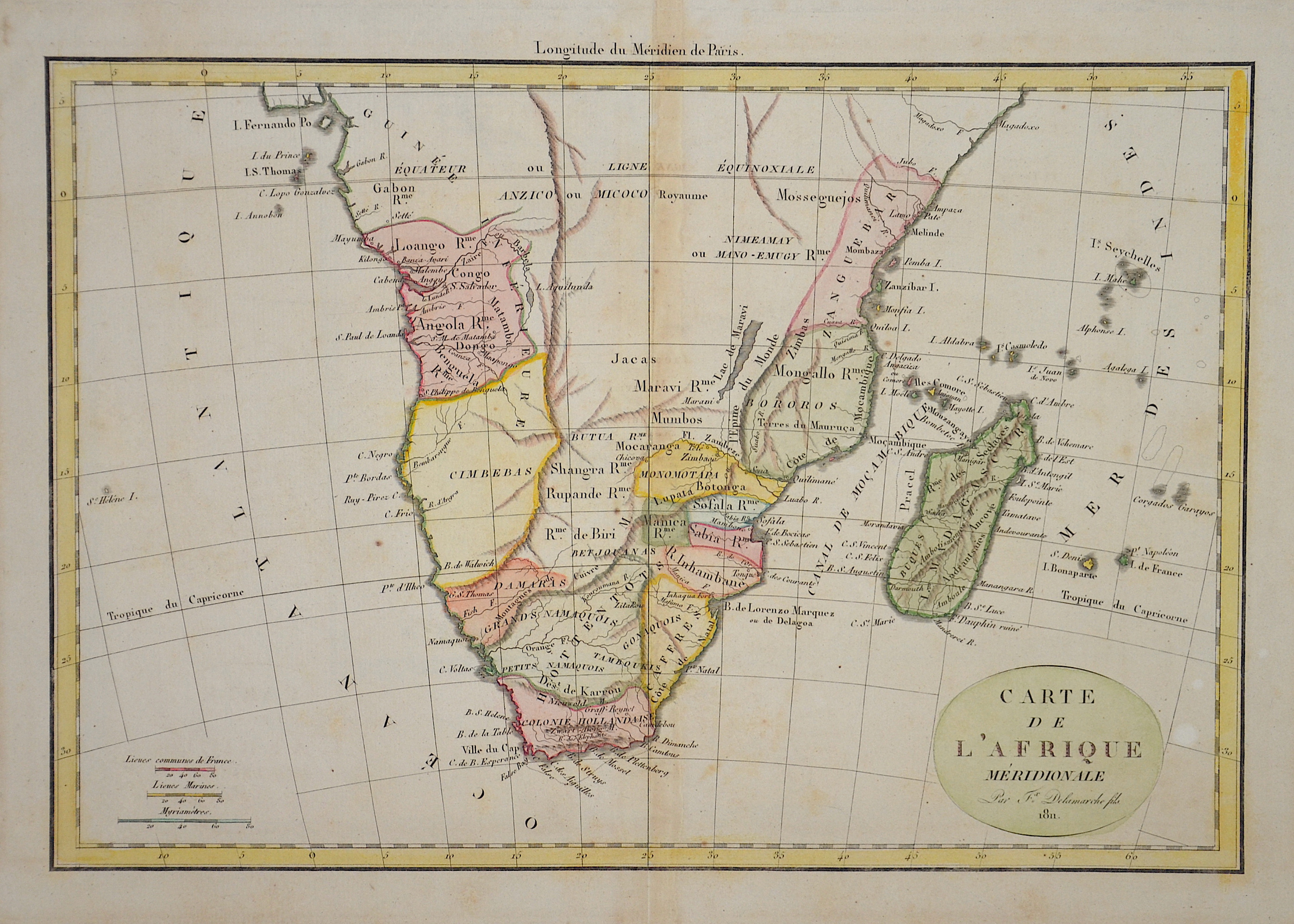
Carte de L’Afrique Meridionale

| Article ID | AF0507 |
Title | Carte de L’Afrique Meridionale |
Description | Map shows Southern Africa up to the equator with Madagascar, the Seychelles, Mauritius and Reunion Island in the Indian Ocean. |
| Year | c. 1811 |
Artist | Delamarche (1779-1835) |
Félix Delamarche was a French geographer and engineer who flourished during the 18th century and early 19th century. His father was the map publisher Charles Francois Delamarche. Félix Delamarche became the owner of his father's map publishing company, Maison Delamarche. He ran the company alongside cartographer Charles Dien. Delamarche created Atlas de la géographie ancienne et moderne in 1820. The atlas was reprinted during the 19th century. In 1786,after his death, he took over the company of Didier Robert Vauondy and reissued his maps. | |
Historical Description | The term Southern Africa , refers to the southern part of the African continent. It includes Angola, Botswana, Democratic Republic of Congo, Eswatini, Comoros, Lesotho, Madagascar, Malawi, Mauritius, Mozambique, Namibia, Zambia, Seychelles, South Africa, Tanzania and Zimbabwe. According to the "Out-of-Africa theory", Africa is considered the "cradle of mankind", where homo development led to the development of the anatomically modern human Homo sapiens. One of the earliest advanced civilizations in mankind was formed in ancient Egypt. Over the millennia, various "great empires" such as the Empire of Abyssinia emerged on the continent. There were other kingdoms in West Africa, such as the Ashanti and Haussa, but they emerged much later. There were also some important cultures in East and South Africa, as in the area of today's Sudan, then called Nubia or Kush. Nubian pharaohs ruled all of Egypt for a dynasty. For example, the inhabitants of Greater Zimbabwe were important cultures in southern Africa. This stone castle was architecturally a masterpiece at that time and important for trade between the peoples of the south and east. The Swahili were known in East Africa. North Africa was connected to Europe and the Near East by the Mediterranean rather than separated. Carthage, a foundation of the Phoenicians in what is now Tunisia, was around the middle of the 1st millennium BC. The dominant power in the western Mediterranean until it was replaced by Rome in the Punic Wars. This prevailed from 30 BC. BC (conquest of Egypt) over all of North Africa. Even the ancient Egyptians (Queen Hatshepsut) made trips to Punt, probably in what is now Somalia. The kingdom of the Queen of Sheba, which probably had its center in southern Arabia, is said to have spanned parts of the Horn from Africa to the north of Ethiopia. |
| Place of Publication | Paris |
| Dimensions (cm) | 26 x 38 cm |
| Condition | Little stains |
| Coloring | original colored |
| Technique | Copper print |