

Adina Sommer
Antique and Contemporary Art
Winzerer Str. 154
80797 München
telephone
+49 89 304714
business hours:
by appointment
Email
![]()


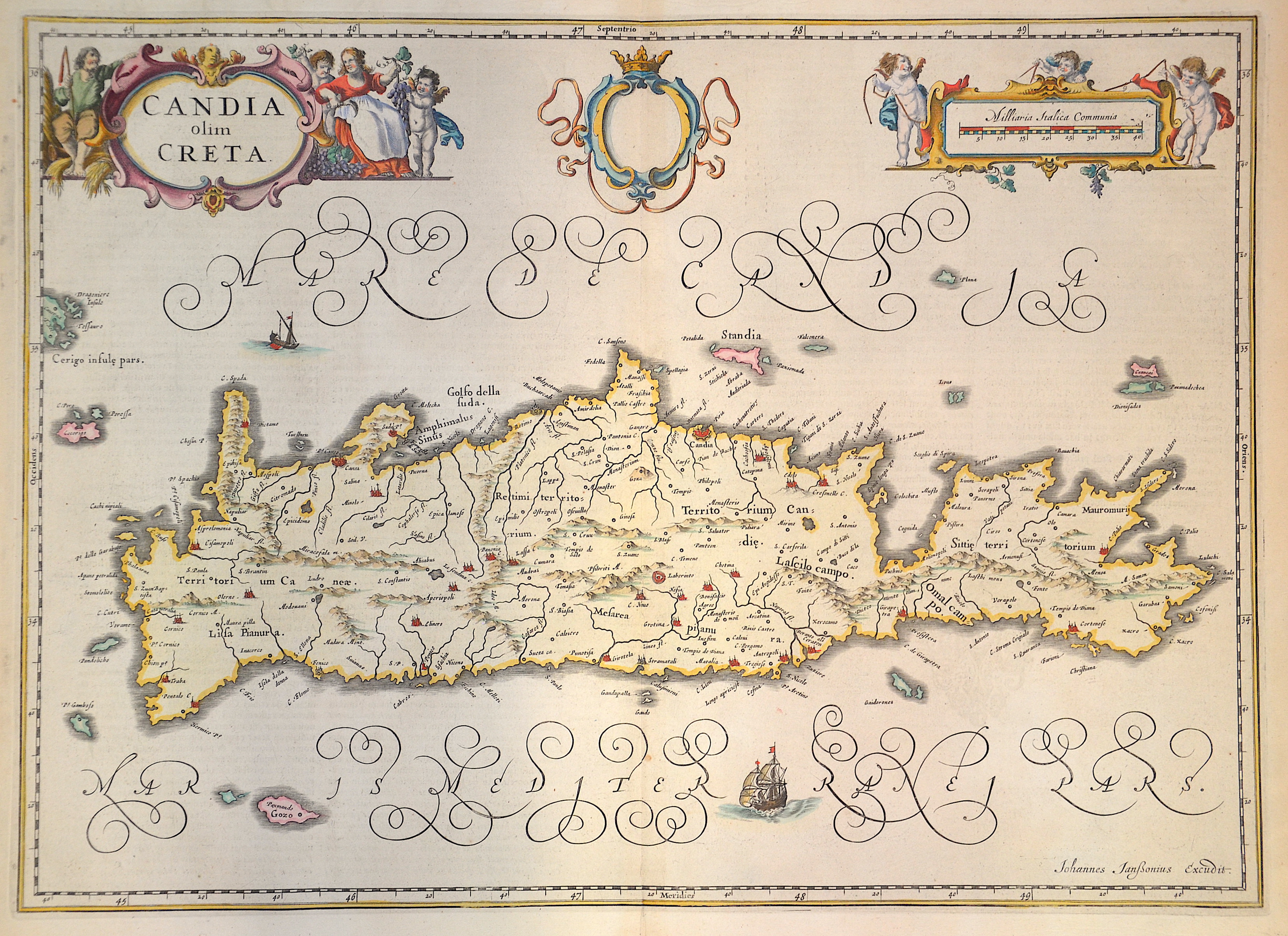
Candia olim Creta.

| Article ID | EUK4917 |
Title | Candia olim Creta. |
Description | Map shows the Greek island of Crete (Candia) with title cartouche and two other cartouches, one with mileage indicator and three putti. Furthermore, the port city of Iraklio (Candia), Chania, Rethymno, a labyrinth and many more cities. |
| Year | ca. 1630 |
Artist | Janssonius (1588-1664) |
Johannes Janssonius (Jansson)( 1588- 1664) Amsterdam, was born in Arnhem, the son of Jan Janszoon the Elder, a publisher and bookseller. In 1612 he married Elisabeth de Hondt, the daughter of Jodocus Hondius. He produced his first maps in 1616 of France and Italy. In 1623 Janssonius owned a bookstore in Frankfurt am Main, later also in Danzig, Stockholm, Copenhagen, Berlin, Königsberg, Geneva and Lyon. In the 1630s he formed a partnership with his brother in law Henricus Hondius, and together they published atlases as Mercator/Hondius/Janssonius. Under the leadership of Janssonius the Hondius Atlas was steadily enlarged. Renamed Atlas Novus, it had three volumes in 1638, one fully dedicated to Italy. 1646 a fourth volume came out with ""English County Maps"", a year after a similar issue by Willem Blaeu. Janssonius' maps are similar to those of Blaeu, and he is often accused of copying from his rival, but many of his maps predate those of Blaeu and/or covered different regions. By 1660, at which point the atlas bore the appropriate name ""Atlas Major"", there were 11 volumes, containing the work of about a hundred credited authors and engravers. It included a description of ""most of the cities of the world"" (Townatlas), of the waterworld (Atlas Maritimus in 33 maps), and of the Ancient World (60 maps). The eleventh volume was the Atlas of the Heavens by Andreas Cellarius. Editions were printed in Dutch, Latin, French, and a few times in German. | |
Historical Description | The island of Crete is first referred to as Kaptara in texts from the Syrian city of Mari from the 18th century BC, which are later repeated in Neo-Assyrian records and in the Bible (Caphtor). It was also known in ancient Egypt as Keftiu, strongly suggesting that a similar form to both was the Minoan name for the island. In classical times, Crete lay on the edge of the Greek cultural area, it was regarded as the "island of 100 poleis" and was therefore divided into numerous small city-states. The stone-carved legal text of the then powerful polis of Gortyn is the only completely preserved codex of this type from Greek antiquity. From 1645 to 1648, the Turks conquered almost the entire island and incorporated it into the Ottoman Empire as Girit, with only Candia withstanding a siege until 1669. Numerous uprisings by the population in the 19th century against Ottoman sovereignty were bloodily suppressed. From 1830 to 1840, Crete was formally under the administration of the Vali of Egypt, Muhammad Ali Pasha. In 1898, the intervention of France, Russia and the United Kingdom forced Crete into almost complete autonomy under the sovereignty of the High Porte. The Treaty of London in 1913 finally made Crete part of the Greek state, and a comprehensive population exchange was agreed in the Treaty of Lausanne in 1923. |
| Place of Publication | Amsterdam |
| Dimensions (cm) | 38 x 52,5 cm |
| Condition | Perfect condition |
| Coloring | original colored |
| Technique | Copper print |