

- Alsace
- Aquitaine
- Auvergne
- Bourgogne
- Bourgogne-Franche-Comte
- Brittany
- Centre
- Champagne
- France Islands
- Gascogne
- Gironde
- Hauts-de-France
- Ile de France
- Languedoc
- Lothringen
- Midi-Pyrénées
- Nivernais
- Nord-Pas-de-Calais
- Normandie
- Occitanie
- Pas-de-Calais
- Pays de la Loire
- Picardie
- Poitou-Charentes
- Provence-Alpes-Cote d Azur
- Pyrénées
- Rhone- Alpes
- Saintonge
- Savoyen
- Tourain
- Westcoast
Adina Sommer
Antique and Contemporary Art
Winzerer Str. 154
80797 München
telephone
+49 89 304714
business hours:
by appointment
Email
![]()


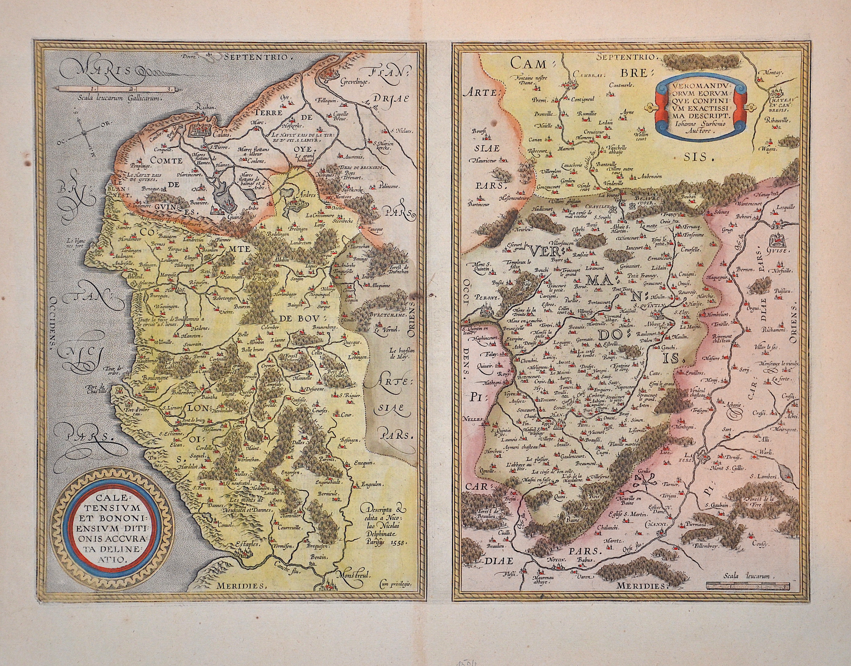
Caletensium et Bononiensium ditionis accurata delineatio. / Veromanduorum eorumque confinium exactissima descript.

| Article ID | EUF5159 |
Title | Caletensium et Bononiensium ditionis accurata delineatio. / Veromanduorum eorumque confinium exactissima descript. |
Description | Two detailed maps by Ortelius. The left map shows the French coastal region of Pas-de-Calais, from Étaples via Boulogne-sur-Mer and Calais to Grevelingen (Holland). The map on the right shows the Hauts-de-France region around Péronne and Saint-Quentin. The cartographic source of this map was Jean de Surhon, who was granted the royal privilege to produce a map of the region in 1557. This is the replaced right map of 1598, showing the Veromanduorum region with the north at the top, not the south at the top like the previous editions. Watermark on the right side. Back with Latin description, page 31, 1612. |
| Year | ca. 1612 |
Artist | Ortelius (1527-1598) |
Abraham Ortelius (1527–1598) was a Flemish cartographer and publisher from Antwerp. Originally a map colorist, he became a major figure in cartography through his Theatrum Orbis Terrarum (1570), considered the first modern atlas—a uniform collection of reliable maps in book form. Influenced by Gerardus Mercator, Ortelius published several maps before compiling the Theatrum, which clearly showed America as a separate continent. The work was published in 42 editions and 7 languages by 1612. Unlike many of his peers, Ortelius cited his sources, and his atlas became a milestone in mapmaking and geographic knowledge. | |
Historical Description | Pas-de-Calais is one of the 83 departments created in 1790 during the French Revolution in application of the law of December 1789. It was created by merging Artois and parts of Picardy, the Boulonnais and part of the Ponthieu. |
| Place of Publication | Antwerp |
| Dimensions (cm) | 34 x 47 cm |
| Condition | Perfect condition |
| Coloring | original colored |
| Technique | Copper print |