

Adina Sommer
Antique and Contemporary Art
Winzerer Str. 154
80797 München
telephone
+49 89 304714
business hours:
by appointment
Email
![]()


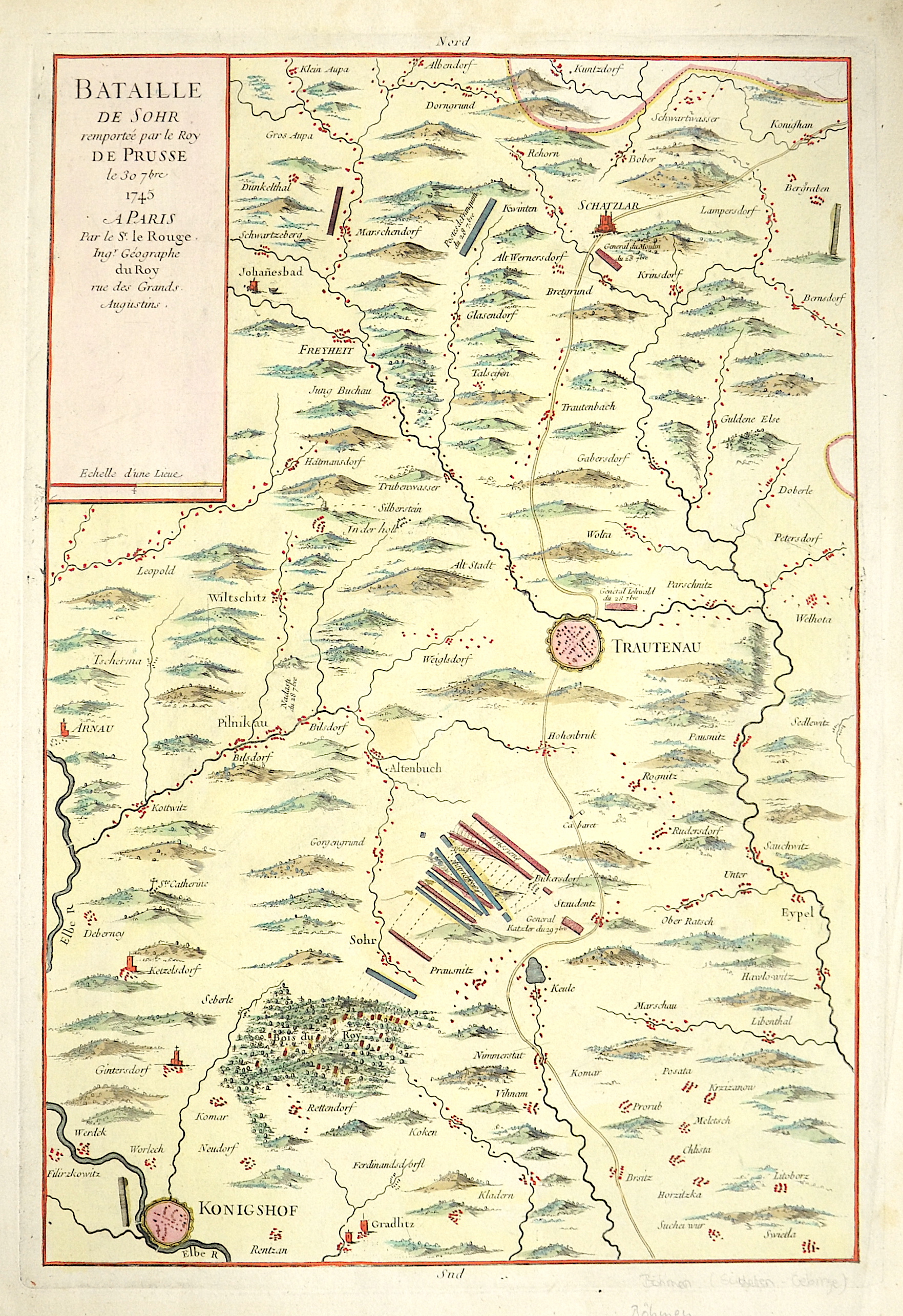
Bataille de Sohr remprtee par le Roy de Prusse le 30 7 bre 1745 a Paris

| Article ID | EUT3419 |
Title | Bataille de Sohr remprtee par le Roy de Prusse le 30 7 bre 1745 a Paris |
Description | Map depicts the surrounding of Trautenau (Truthov), Königinhof at the river Elbe and Schatzlar in the northeast of Czech. |
| Year | dated 1745 |
Artist | Le Rouge (1707-1790) |
Georges Louis Le Rouge (ca 1707 -1790) He was established as a publisher, compiler and editor of maps in Paris. He later became the Ingenieur Geographe de Roi. Le Rouge is particularly known for such atlas works as the Atlas Nouveau of 1746 and the Atlas Nouveau Portatif or the Introduction A La Geographie of 1756. French publications of some merit. | |
Historical Description | Bohemia is the westernmost and largest historical region of the Czech lands in the present-day Czech Republic. In a broader meaning, Bohemia sometimes refers to the entire Czech territory, including Moravia and Czech Silesia, especially in a historical context, such as the Lands of the Bohemian Crown ruled by Bohemian kings. Bohemia was a duchy of Great Moravia, later an independent principality, a kingdom in the Holy Roman Empire, and subsequently a part of the Habsburg Monarchy and the Austrian Empire. After World War I and the establishment of an independent Czechoslovak state, Bohemia became a part of Czechoslovakia. Between 1938 and 1945, border regions with sizeable German-speaking minorities of all three Czech lands were joined to Nazi Germany as the Sudetenland. |
| Place of Publication | Paris |
| Dimensions (cm) | 47,5 x 31 cm |
| Condition | Perfect condition |
| Coloring | colored |
| Technique | Copper print |