

- Alsace
- Aquitaine
- Auvergne
- Bourgogne
- Bourgogne-Franche-Comte
- Brittany
- Centre
- Champagne
- France Islands
- Gascogne
- Gironde
- Hauts-de-France
- Ile de France
- Languedoc
- Lothringen
- Midi-Pyrénées
- Nivernais
- Nord-Pas-de-Calais
- Normandie
- Occitanie
- Pas-de-Calais
- Pays de la Loire
- Picardie
- Poitou-Charentes
- Provence-Alpes-Cote d Azur
- Pyrénées
- Rhone- Alpes
- Saintonge
- Savoyen
- Tourain
- Westcoast
Adina Sommer
Antique and Contemporary Art
Winzerer Str. 154
80797 München
telephone
+49 89 304714
business hours:
by appointment
Email
![]()


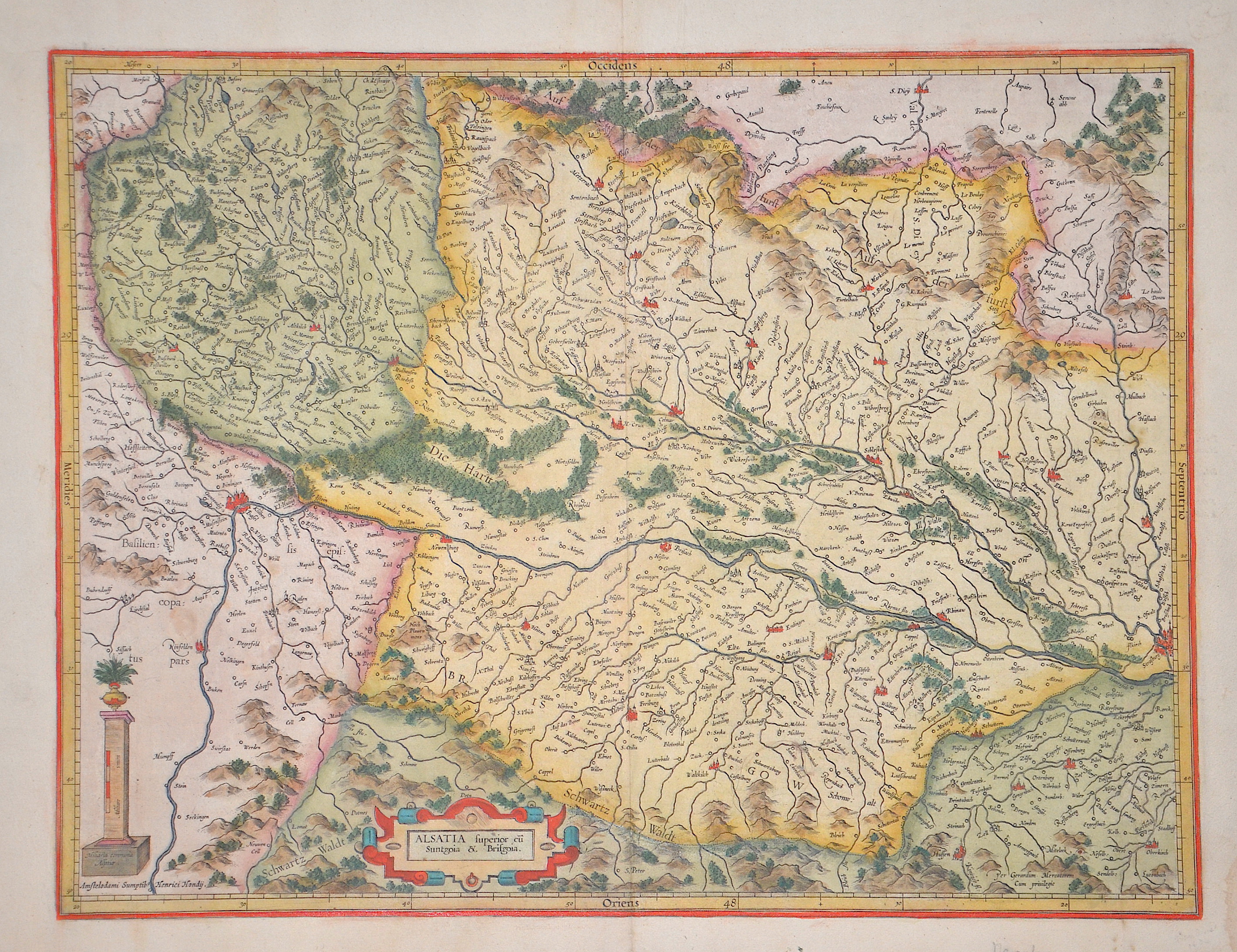
Alsatia superior cu Suntgoia u. Brisgoia.

| Article ID | EUF5158 |
Title | Alsatia superior cu Suntgoia u. Brisgoia. |
Description | Map shows Alsace, Breisgau, the Black Forest with the Rhine from Basel to Strasbourg. From the Mercator-Hondius Atlas, reverse with French description. |
| Year | ca. 1630 |
Artist | Mercator (1512-1594) |
Gerardus Mercator (1512 - 1594). He was a cartographer, philosopher and mathematician. He is best known for his work in cartography, in particular the world map of 1569 based on a new projection which represented sailing courses of constant bearing as straight lines. He is renowned to the present day as the cartographer who created a world map based on a new projection which represented sailing courses of constant bearing as straight lines. In his own day he was the world's most famous geographer but in addition he had interests in theology, philosophy, history, mathematics and magnetism as well as being an accomplished engraver, calligrapher and maker of globes and scientific instruments. He wrote few books but much of his knowledge is to be found in the copious legends on his wall maps and the prefaces that he composed for his atlas ,the first in which the term "atlas" appears and the sections within it. | |
Historical Description | The history of Alsace, a region on the western edge of the German-speaking area, is shaped by the fruitful influence of two of Europe's great cultural areas: Germanic (German) and Romance (French). After the Great Migration, it was first Germanised and incorporated into the cultural currents of German history. Since modern times it has increasingly come under the political control of the French kingdom. Various forms emerged here, the Duchy of Alsace (7th – 8th centuries), the two landgravates of Alsace (12th – 17th centuries) and the early modern French province of Alsace (17th – 18th centuries). Today's Alsace was first settled by humans around 700,000 years ago and was one of the core regions of the Celts. After a period of unclear and changing power relations, Alsace became part of Alemannia until the 7th century, which was a more or less autonomous administrative district of the Franconian Empire. In 988 at the latest, Alsace became part of the Duchy of Swabia, with which it remained until the end of 1250. After 1250, a large number of different territories developed, most of which came under French rule between 1633 and 1697/1714. The French province of Alsace was established, its borders partially differing from those of the earlier landgravates. At the beginning of the French Revolution, all special political rights were abolished in 1789 and the two departments of Haut-Rhin and Bas-Rhin were created in 1790. Between 1871 and 1918, Alsace, as part of Alsace-Lorraine, belonged to the German Empire, which was led by Prussia. In 1918 the two Alsatian districts came back to France as departments. |
| Place of Publication | Amsterdam |
| Dimensions (cm) | 36 x 47,5 cm |
| Condition | Corner outside completed lower right. |
| Coloring | original colored |
| Technique | Copper print |