

Adina Sommer
Antique and Contemporary Art
Winzerer Str. 154
80797 München
telephone
+49 89 304714
business hours:
by appointment
Email
![]()


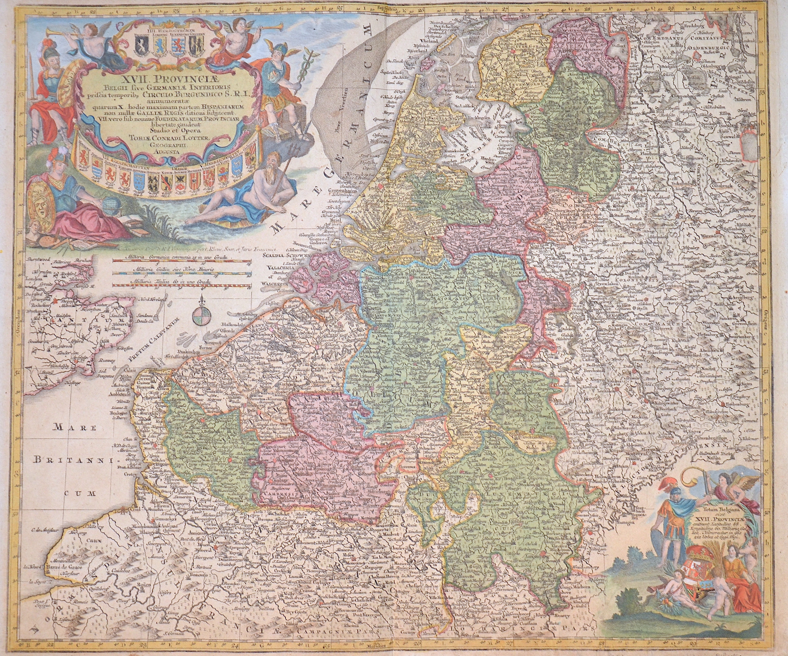
XVII Provinciae Belgii sive Germaniae inferioris Briscis temporiw circulu Burgundicu S.R.I…..

| Article ID | EUB1196 |
Title | XVII Provinciae Belgii sive Germaniae inferioris Briscis temporiw circulu Burgundicu S.R.I….. |
Description | Map shows Luxembourg, Belgium and the Netherlands with a magnificent title curtain with 17 coats of arms (4 duchies, 7 counties, 1 margraviate, 5 lordships) held by winged putti, including the sea god Neptune and Mercury pointing to a globe pointing to the "Mare Pacificum das stille Sud Meer" (Pacific Ocean). Furthermore, a compass rose and a mileage indicator cartouche. |
| Year | ca. 1750 |
Artist | Lotter (1717-1777) |
Tobias Conrad Lotter ( 1717- 1777) was a carthographer and publisher in Augsburg. He married the elder daughter of Matthäus Seutters and worked in the company of his father in la was map maker. He produced under the „ eye“ of M. Seutter his first „ Asia minor“ atlas between 1740 and 1744. The Asia minor altas of Lotter, Praecipua orbis terrarum imperia, regna et provincias, Germania potissimum tabelli 80 exactae delineatis sistens usui militiae ducum ac peregrinantium maxime accommodatus opera contains 63 maps, mosly Lotters work and other maps from Seutter where he put his name in the lower margin. | |
Historical Description | The area, which later includes the Benelux area, is called de Lage Landen in Dutch, Low Countries in English, consisting of Belgium, the Netherlands (Nederland) and Luxembourg. In the 19th century, three countries were united under the crown of the Dutch king from 1815 to 1830, until Belgium became independent. The forerunners of the Benelux Treaty were the economic union concluded between Luxembourg and Belgium on July 25, 1921. |
| Place of Publication | Augsburg |
| Dimensions (cm) | 49 x 57 cm |
| Condition | Perfect condition |
| Coloring | colored |
| Technique | Copper print |