

Adina Sommer
Antique and Contemporary Art
Winzerer Str. 154
80797 München
telephone
+49 89 304714
business hours:
by appointment
Email
![]()


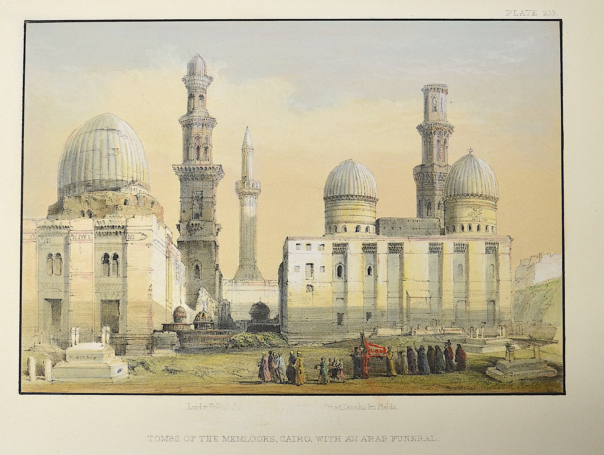
Tombs of the Memlooks, Cairo, with an Arab funeral

| Article ID | AF0125 |
Title | Tombs of the Memlooks, Cairo, with an Arab funeral |
Description | View of the Memlooks tombs in Cairo |
| Year | ca. 1835 |
Artist | Vaugondy, de (1723-1786) |
Didier Robert de Vaugondy (1723 -1786) also known as Le Sieur or Monsieur Robert, and his son, were leading cartographers in France during the 18th century. In 1757, Gilles and Didier Robert De Vaugondy published The Atlas Universel, one of the most important atlases of the 18th century. To produce the atlas, the Vaugondys integrated older sources with more modern surveyed maps. They verified and corrected the latitude and longitude of many regional maps in the atlas with astronomical observations. The older material was revised with the addition of many new place names. In 1760, Didier Robert de Vaugondy was appointed geographer to Louis XV. Gilles and Didier Robert De Vaugondy produced their maps and terrestrial globes working together as father and son. Globes of a variety of sizes were made by gluing copperplate-printed gores on a plaster-finished papier-mache core, a complicated and expensive manufacturing process, employing several specialists. In some cases it is uncertain whether Gilles or Didier made a given map. Gilles often signed maps as M.Robert, while Didier commonly signed his maps as ""Robert de Vaugondy"", or added ""fils"" or ""filio"" after his name. The Robert de Vaugondys were descended from the Nicolas Sanson family through Sanson's grandson, Pierre Moulard-Sanson. From him, they inherited much of Sanson's cartographic material, which they combined with maps and plates acquired after Hubert Jaillot's death in 1712 to form the basis the Atlas Universel. | |
Historical Description | Cairo's significance really changed in the 19th century with the emergence of the Khedive Empire. Ismail Pasha, who ruled between 1863 and 1879, had numerous buildings erected in the city and took the opening of the Suez Canal in 1869 as an opportunity to present Cairo to the European powers as a flourishing metropolis. However, most of the development was financed by foreign loans, which increased Britain's influence in particular. During the reign of Ismail Pasha, Cairo, which now became the capital again, expanded westwards across the Nile. European architects were commissioned to renovate the city, the residential districts of Zamalek and Muhandisin were built, but large parts of today's city center also date from this period. As Egypt's industrialization accelerated, the country's capital continued to grow. By the end of the 19th century, Egypt's foreign debt and the weakness of the Ottoman Empire resulted in growing European influence in Cairo. With the occupation of Egypt by British troops and the crushing of the Urabi movement (1881-1882), Great Britain took control of the country without ending its formal affiliation with the Ottoman Empire. The Khediv of Egypt remained formally a vassal of the Ottomans. The Urabi movement emerged in the fall of 1881 when, following the financial ruin of Egypt under Ismail Pasha, the country came under international financial control. The movement opposed this international control of financial and economic policy and the autocratic rule of the Muhammad Ali dynasty. |
| Place of Publication | London |
| Dimensions (cm) | 13,5 x 17,5 |
| Condition | Very good |
| Coloring | colored |
| Technique | Lithography |