

Adina Sommer
Antique and Contemporary Art
Winzerer Str. 154
80797 München
telephone
+49 89 304714
business hours:
by appointment
Email
![]()


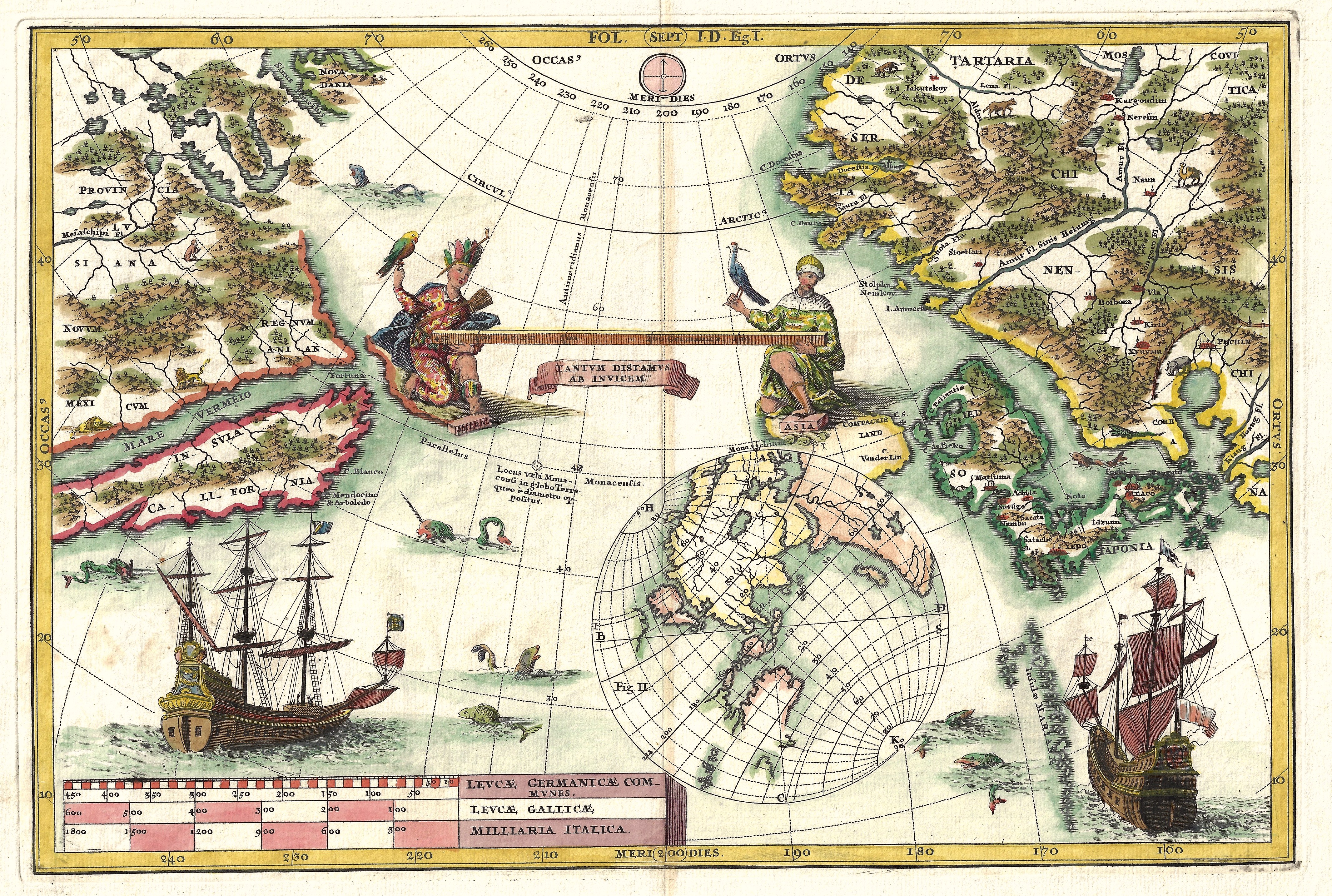
Tantum distamus ap invicem

| Article ID | OZ247 |
Title | Tantum distamus ap invicem |
Description | Map shows the Pacific with California as an island, Japan and the coast of China. |
| Year | ca. 1695 |
Artist | Scherer (1628-1704) |
Heinrich Scherer was German Geographer and Natural scientist. | |
Historical Description | The Pacific Ocean is the largest and deepest of Earth's oceanic divisions. Though the peoples of Asia and Oceania have traveled the Pacific Ocean since prehistoric times, the eastern Pacific was first sighted by Europeans in the early 16th century when Spanish explorer Vasco Núñez de Balboa crossed the Isthmus of Panama in 1513 and discovered the great "southern sea" which he named Mar del Sur (in Spanish). In 1519, Portuguese explorer Ferdinand Magellan sailed the Pacific East to West on a Spanish expedition to the Spice Islands that would eventually result in the first world circumnavigation. Magellan called the ocean Pacífico (or "Pacific" meaning, "peaceful") because, after sailing through the stormy seas off Cape Horn, the expedition found calm waters. The ocean was often called the Sea of Magellan in his honor until the eighteenth century. |
| Place of Publication | Munich |
| Dimensions (cm) | 23 x 34 |
| Condition | Very good |
| Coloring | colored |
| Technique | Copper print |