

Adina Sommer
Antique and Contemporary Art
Winzerer Str. 154
80797 München
telephone
+49 89 304714
business hours:
by appointment
Email
![]()


Tantum distamus ap invicem
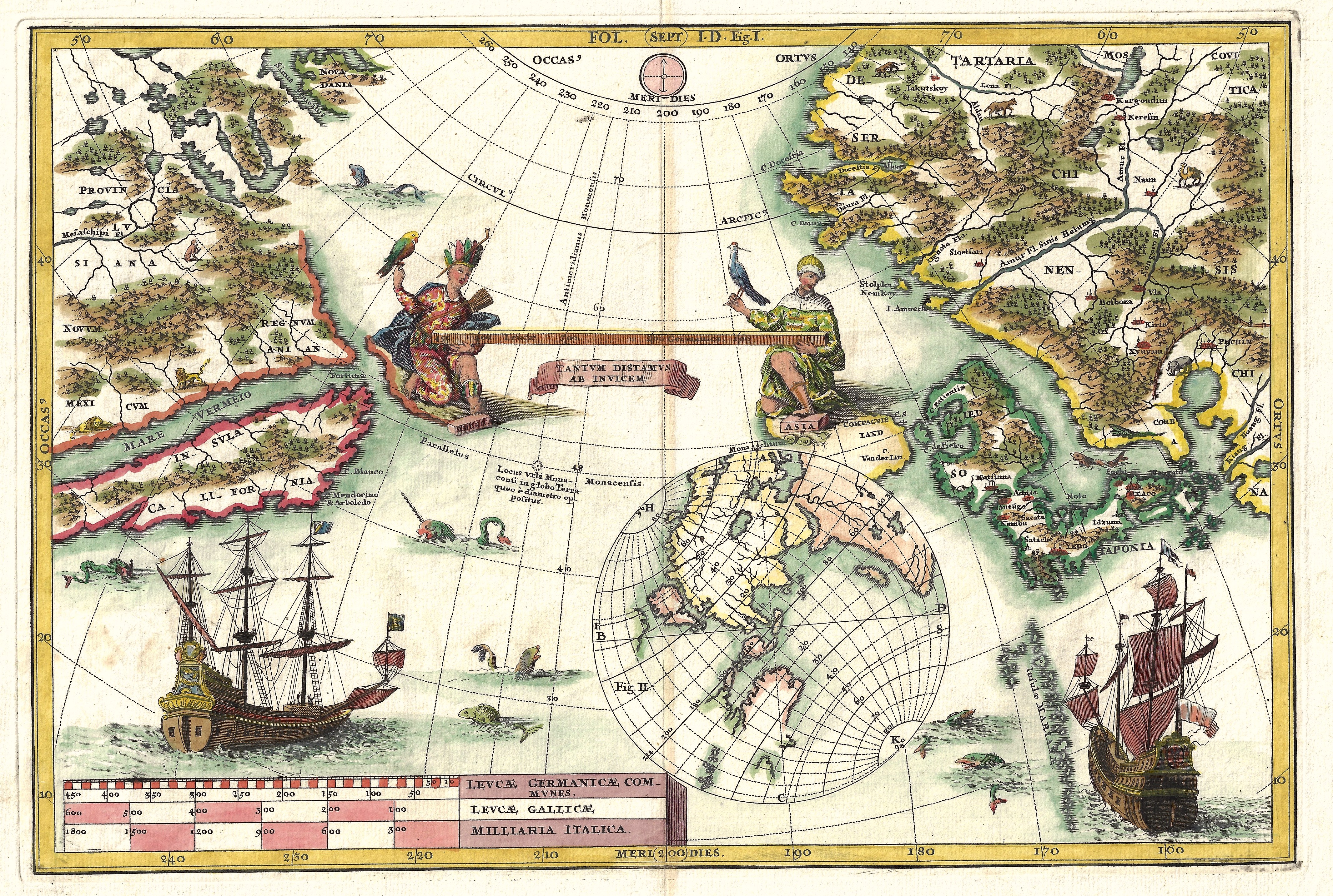
| Article ID | OZ247 |
Title | Tantum distamus ap invicem |
Map shows the Pacific with California as an island, Japan and the coast of China. | |
| Year | ca. 1695 |
Artist | Scherer |
| Place of Publication | Munich |
| Dimensions (cm) | 23 x 34 |
| Condition | Very good |
| Coloring | colored |
| Technique | Copper print |
:
189.00 €
( A reproduction can be ordered individually on request. )