

Adina Sommer
Antique and Contemporary Art
Winzerer Str. 154
80797 München
telephone
+49 89 304714
business hours:
by appointment
Email
![]()


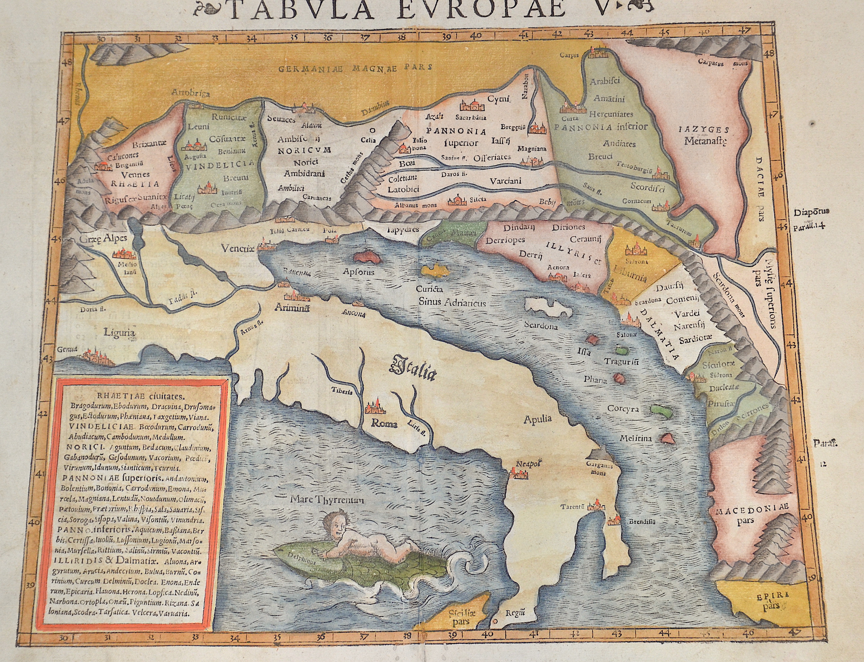
Tabula Europae V.

| Article ID | EUY4839 |
Title | Tabula Europae V. |
Description | Map shows in trapezoidal representation, Eastern Europe with the coast of the whole of Italy and the Adriatic Sea. Croatia, Slovenia, Dalmatia, Serbia and a putto on a dolphin. |
| Year | ca. 1552 |
Artist | Ptolemy/Münster Sebastian (1489-1552) |
Sebastian Münster (1489–1552) was a prominent Renaissance cosmographer. His Cosmographia, published in 1544 with 24 double-page maps based on research from around 1528, was continuously expanded. It was the first widely accessible scientific description of the world in German, combining knowledge from history, geography, astronomy, and natural sciences. The work remained popular for a long time and was published in many editions and languages until 1650. Claudius Ptolemy (c. 100–160 AD) was a Greek mathematician, geographer, and astronomer. His works on astronomy, geography, and astrology were long considered standard references. He described the Earth as the center of the universe (Centrum Mundi) and established the basis for latitude measurement. His Geographia included the known world and the hypothesis of Terra Australis. Ptolemy provided written instructions for mapmaking but made only rough sketches himself; later maps were created under his name. | |
Historical Description | In the historical sense, Eastern Europe refers to Ukraine, the European part of Russia, Belarus and the Republic of Moldova. Occasionally, the Caucasian countries of Georgia, Armenia and, conditionally, Azerbaijan are also seen as part of Eastern Europe. By Christian Giordano and other scholars, one of the six historical regions of Europe is called "Eastern Europe." The Eastern European countries are historically and culturally largely influenced by the Orthodox Church (Islamic Azerbaijan excepted) and were - in contrast to the Ottoman-dominated Balkans - under the rule of the Russian Empire. Like the Balkan countries, the countries of Eastern Europe were for a long time backward agricultural states (cf.: Intermediate Europe) and had no or only a limited share in the social developments of the Renaissance, Reformation and Enlightenment of the Western world. |
| Place of Publication | Basle |
| Dimensions (cm) | 27 x 34,5 cm |
| Condition | Wormholes (6) perfectly restored |
| Coloring | original colored |
| Technique | Woodcut |