

Adina Sommer
Antique and Contemporary Art
Winzerer Str. 154
80797 München
telephone
+49 89 304714
business hours:
by appointment
Email
![]()


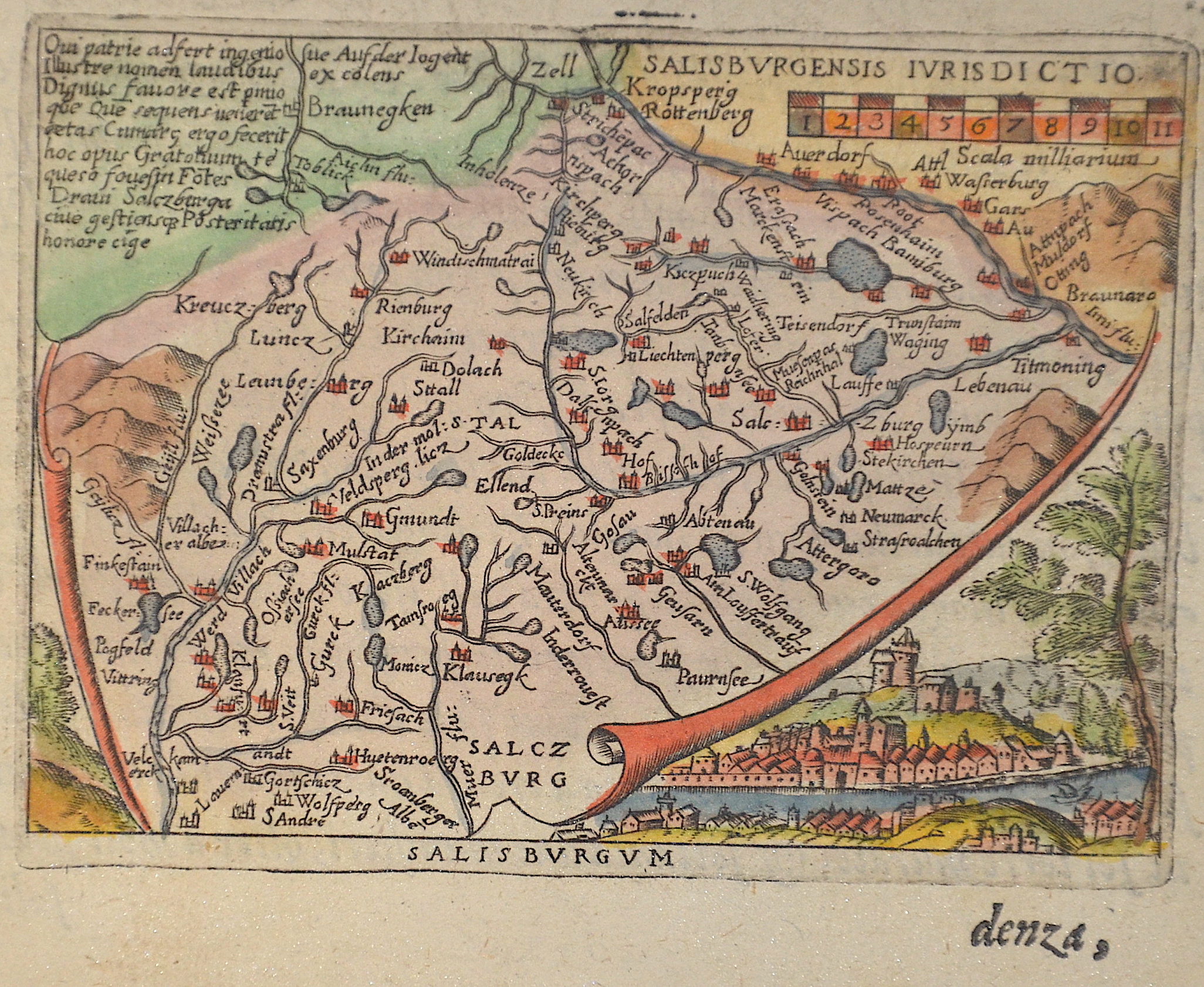
Salisburgum

| Article ID | EUA4706 |
Title | Salisburgum |
Description | Map shows a map of the area around the city of Salzburg with Chiemsee, the Zillertal, and an overall view of Salzburg. |
| Year | ca. 1595 |
Artist | Ortelius (1527-1598) |
Abraham Ortelius (1527–1598) was a Flemish cartographer and publisher from Antwerp. Originally a map colorist, he became a major figure in cartography through his Theatrum Orbis Terrarum (1570), considered the first modern atlas—a uniform collection of reliable maps in book form. Influenced by Gerardus Mercator, Ortelius published several maps before compiling the Theatrum, which clearly showed America as a separate continent. The work was published in 42 editions and 7 languages by 1612. Unlike many of his peers, Ortelius cited his sources, and his atlas became a milestone in mapmaking and geographic knowledge. | |
Historical Description | The territory of the town has been continuously inhabited since the Neolithic period until today. Since the Battle of Mühldorf in 1322, the archbishopric was at enmity with the motherland Bavaria. As a result, Salzburg became an independent archbishopric in the Roman-German Empire. The economic prosperity of the city in the 15th century led to a self-confident bourgeoisie with increasing rights and duties. Archbishop Leonhard von Keutschach, who was economically very successful, ended this autonomy by force. A few years after Martin Luther's posting of the theses, the majority of the town's population was close to Protestantism; the unbending Protestants were then all expelled from the country by 1590. In 1525, rebellious squires and peasants laid siege to the fortress of Hohensalzburg, where Archbishop Matthäus Lang von Wellenburg had entrenched himself. Around 1600, the archdiocese was one of the richest principalities in the Roman-German Empire thanks to salt and gold mining. Paris von Lodron succeeded in keeping Salzburg out of the Thirty Years' War (1618-1648) through a clever policy of neutrality. The city was developed into one of the best fortified cities in Europe. In 1803, by order of Napoleon Bonaparte, Salzburg became a secularized electorate. In 1805, together with Berchtesgaden, it was annexed to the new Empire of Austria, and in 1810, it was reincorporated into the Kingdom of Bavaria. In 1816, with the Treaty of Munich, most of the province of Salzburg again fell to the Austrian Empire and thus under Habsburg rule. |
| Place of Publication | Antwerp |
| Dimensions (cm) | 7,5 x 10,5 cm |
| Condition | Perfect condition |
| Coloring | colored |
| Technique | Copper print |