

Adina Sommer
Antique and Contemporary Art
Winzerer Str. 154
80797 München
telephone
+49 89 304714
business hours:
by appointment
Email
![]()


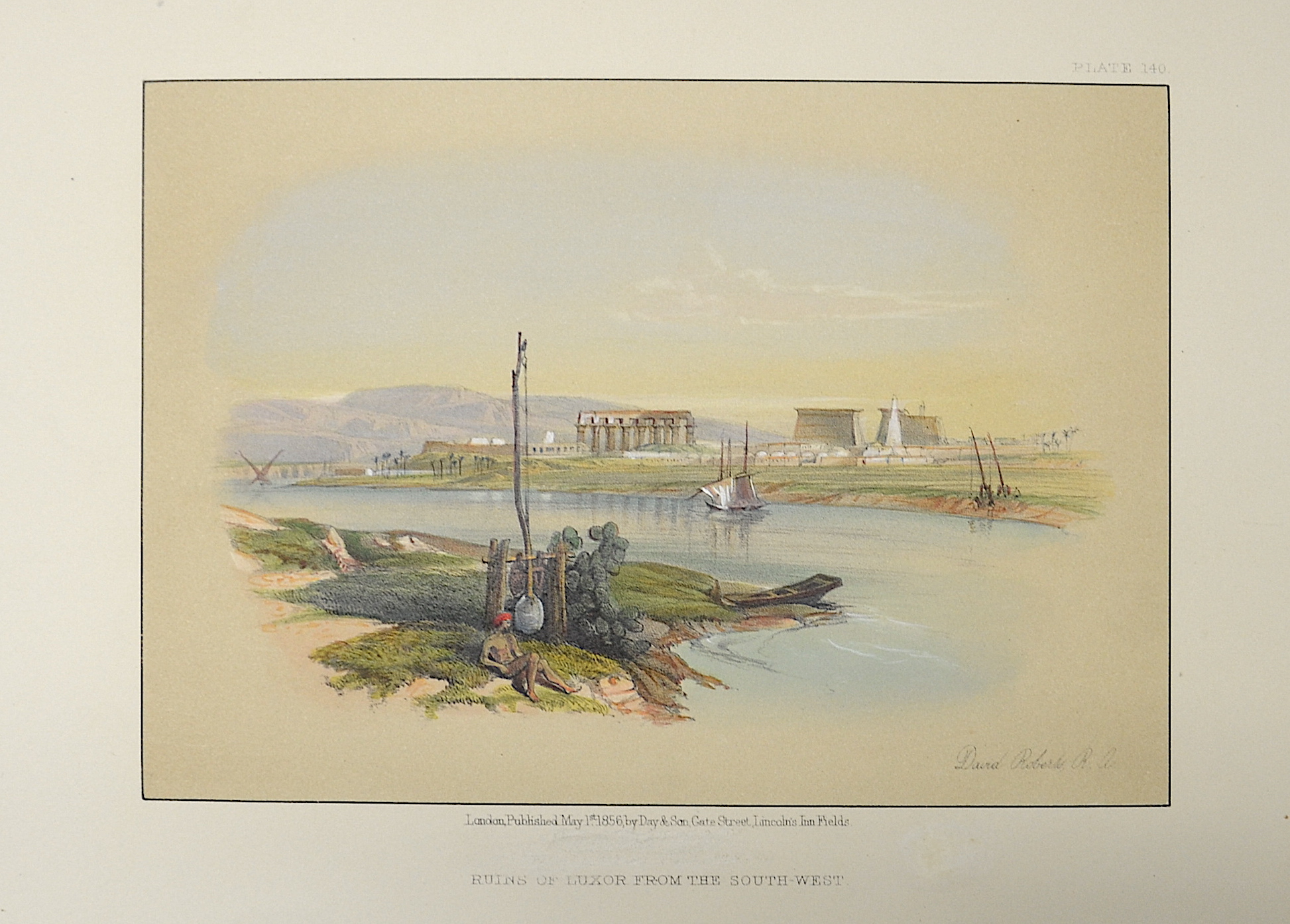
Ruins of Luxor from the South- West

| Article ID | AF0157 |
Title | Ruins of Luxor from the South- West |
Description | View of the ruins of Luxor. |
| Year | dated 1856 |
Artist | Vaugondy, de (1723-1786) |
Didier Robert de Vaugondy (1723 -1786) also known as Le Sieur or Monsieur Robert, and his son, were leading cartographers in France during the 18th century. In 1757, Gilles and Didier Robert De Vaugondy published The Atlas Universel, one of the most important atlases of the 18th century. To produce the atlas, the Vaugondys integrated older sources with more modern surveyed maps. They verified and corrected the latitude and longitude of many regional maps in the atlas with astronomical observations. The older material was revised with the addition of many new place names. In 1760, Didier Robert de Vaugondy was appointed geographer to Louis XV. Gilles and Didier Robert De Vaugondy produced their maps and terrestrial globes working together as father and son. Globes of a variety of sizes were made by gluing copperplate-printed gores on a plaster-finished papier-mache core, a complicated and expensive manufacturing process, employing several specialists. In some cases it is uncertain whether Gilles or Didier made a given map. Gilles often signed maps as M.Robert, while Didier commonly signed his maps as ""Robert de Vaugondy"", or added ""fils"" or ""filio"" after his name. The Robert de Vaugondys were descended from the Nicolas Sanson family through Sanson's grandson, Pierre Moulard-Sanson. From him, they inherited much of Sanson's cartographic material, which they combined with maps and plates acquired after Hubert Jaillot's death in 1712 to form the basis the Atlas Universel. | |
Historical Description | Egypt: The ancient Egyptian country name Kemet means "Black Land" and refers to the fertile soil of the Nile Valley in contrast to the "Red Land" of the neighboring deserts. The European terms Egypt, engl. Egypt comes from the Latin Aegyptus and thus ultimately from the ancient Greek Aigypto. The Copts claim to be the direct descendants of the ancient Egyptian pharaohs. From their name came the Greek Aigyptos, which became Egypt in German. Islamic Arabs conquered the Nile valley around 640; From now on Egypt was dominated by changing power centers - Damascus, Baghdad, Cairo. Under the Umayyads (661–750), Arab tribes settled in the fertile plains and from then on determined the cultural appearance of Egypt. With the coming to power of Saladin, the founder of the Ayyubid dynasty (1171–1249), Cairo became the center of Muslim resistance to the Christian crusades. Around 1250 the palace guard, which was made up of Mamluks, originally mostly Turkish military slaves, rose and took over. At the end of the 13th century, the Mamluks destroyed the last Crusader states on Asian soil. Even after Egypt was conquered by the Ottoman Empire in 1517, administration remained in their hands. The economic decline resulting from the discovery of the sea route to India (1498) made Egypt one of the poorest provinces of the Ottoman Empire. It was not until the landing of the French expeditionary force under Napoleon Bonaparte in 1798 that the Ottoman rule ended. When the French had to abandon their Oriental campaign after the British Admiral Nelson won at Abukir in the same year, the Albanian officer Muhammad Ali Pasha used the situation to seize power (1805–1849). He and his successors were able to achieve a certain independence under Ottoman rule, pursued an expansionary policy and initiated the history of modern Egypt. |
| Place of Publication | London |
| Dimensions (cm) | 14 x 18 |
| Condition | Very good |
| Coloring | original colored |
| Technique | Lithography |