

Adina Sommer
Antique and Contemporary Art
Winzerer Str. 154
80797 München
telephone
+49 89 304714
business hours:
by appointment
Email
![]()


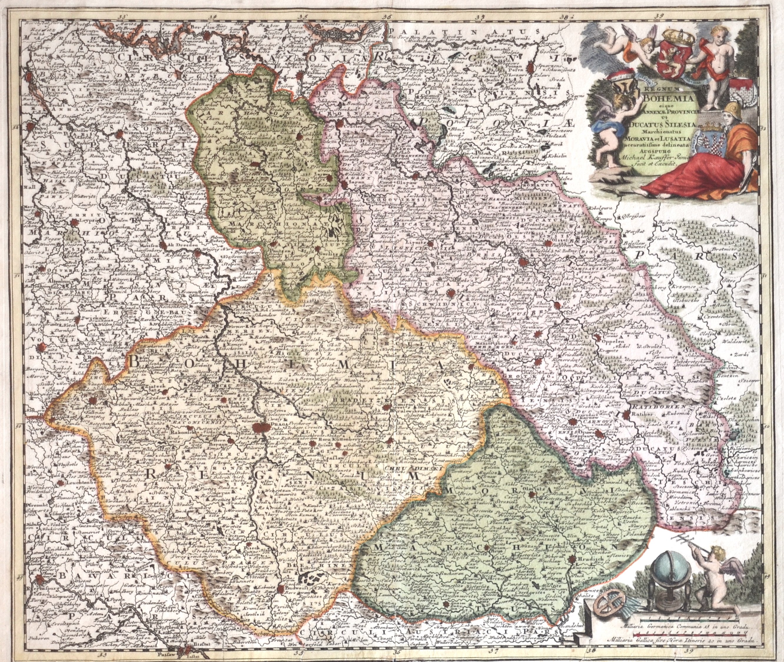
Regnum Bohemia eique annexae Provinciae ut Ducatus Silesia Marchionatus Moravia et Lusatia

| Article ID | EUT4096 |
Title | Regnum Bohemia eique annexae Provinciae ut Ducatus Silesia Marchionatus Moravia et Lusatia |
Description | Map shows Bohemia, Silesia, Maehren, Lausitz and the pricipality Teschen. Decorative and detailed map with 4 coats-of-arms on the titel cartouche. It shows the cities Olmütz, Hradisch, Breslau, Żagań (dt. Sagan), Swidnica (dt. Schweidnitz) etc. From the atlas ;Atlas Manualis;, Christoph Weigel, Nuremberg. |
| Year | ca. 1720 |
Artist | Kauffer (1655-1730) |
Augsburg maps and engravers. Although Michael Kauffer Jr. was known mainly as a type and map engraver, he also seems to have worked as a silver engraver. | |
Historical Description | Bohemia is the westernmost and largest historical region of the Czech lands in the present-day Czech Republic. In a broader meaning, Bohemia sometimes refers to the entire Czech territory, including Moravia and Czech Silesia, especially in a historical context, such as the Lands of the Bohemian Crown ruled by Bohemian kings. Bohemia was a duchy of Great Moravia, later an independent principality, a kingdom in the Holy Roman Empire, and subsequently a part of the Habsburg Monarchy and the Austrian Empire. After World War I and the establishment of an independent Czechoslovak state, Bohemia became a part of Czechoslovakia. Between 1938 and 1945, border regions with sizeable German-speaking minorities of all three Czech lands were joined to Nazi Germany as the Sudetenland. |
| Place of Publication | Augsburg |
| Dimensions (cm) | 33 x 38 |
| Condition | Tears on lower margin perfectly restored |
| Coloring | original colored |
| Technique | Copper print |