

Adina Sommer
Antique and Contemporary Art
Winzerer Str. 154
80797 München
telephone
+49 89 304714
business hours:
by appointment
Email
![]()


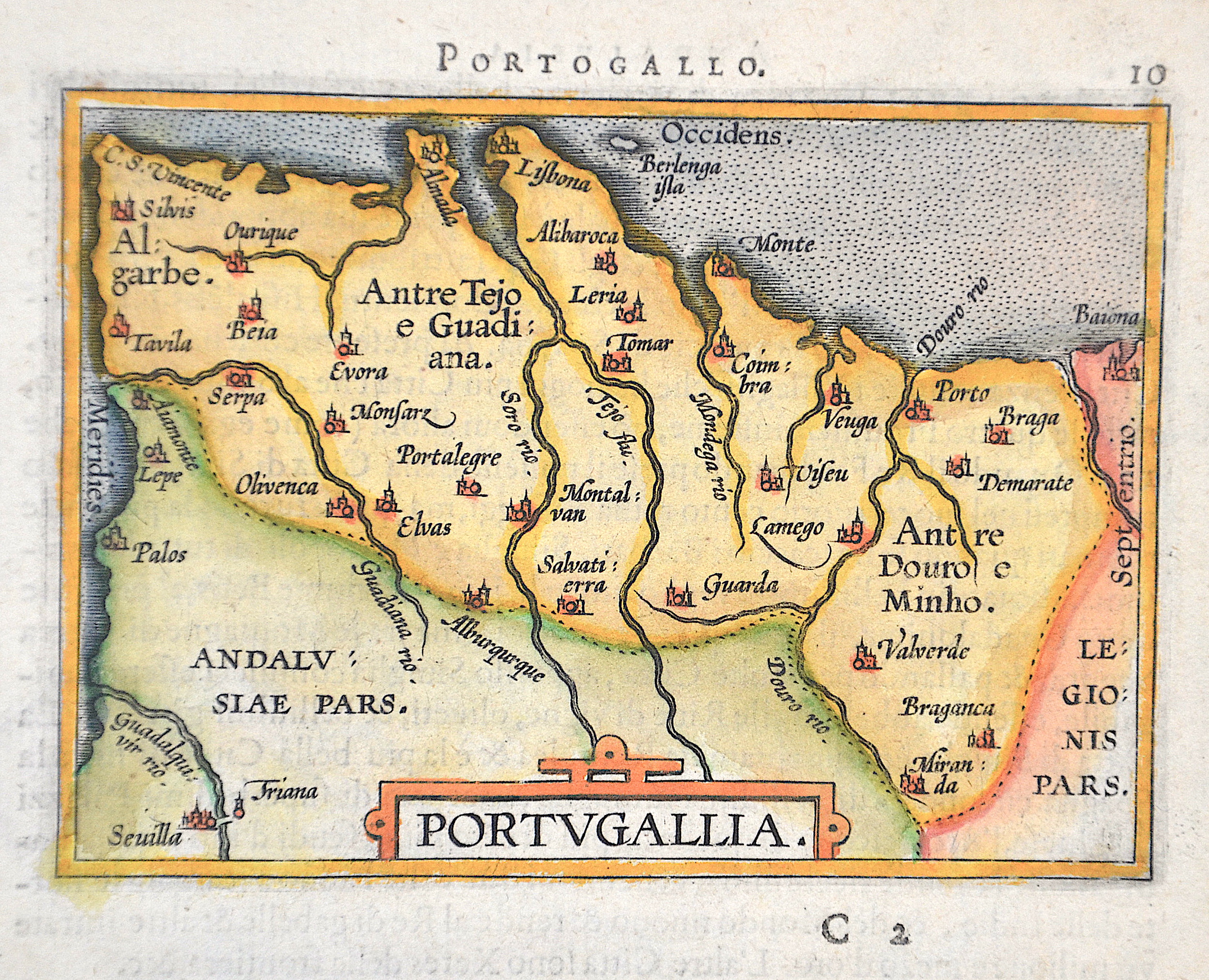
Portogallo. 10 / Portugallia.

| Article ID | EUE4990 |
Title | Portogallo. 10 / Portugallia. |
Description | Map shows the whole of Portugal with a title cartouche. |
| Year | ca. 1610 |
Artist | Ortelius (1527-1598) |
Abraham Ortelius (1527–1598) was a Flemish cartographer and publisher from Antwerp. Originally a map colorist, he became a major figure in cartography through his Theatrum Orbis Terrarum (1570), considered the first modern atlas—a uniform collection of reliable maps in book form. Influenced by Gerardus Mercator, Ortelius published several maps before compiling the Theatrum, which clearly showed America as a separate continent. The work was published in 42 editions and 7 languages by 1612. Unlike many of his peers, Ortelius cited his sources, and his atlas became a milestone in mapmaking and geographic knowledge. | |
Historical Description | Portugal is the oldest state on the Iberian Peninsula and one of the oldest in Europe, its territory having been continuously settled, invaded and fought over since prehistoric times. The pre-Celtic people, Celts, Carthaginians and Romans were followed by the invasions of the Visigoths and Suebi Germanic peoples. In the 15th and 16th centuries, Portugal established the first global empire, becoming one of the world's major economic, political and military powers. During this period, today referred to as the Age of Discovery, Portuguese explorers pioneered maritime exploration, notably under royal patronage of Prince Henry the Navigator and King John II, with such notable voyages as Bartolomeu Dias' sailing beyond the Cape of Good Hope (1488), Vasco da Gama's discovery of the sea route to India (1497–98) and the European discovery of Brazil (1500). During this time Portugal monopolized the spice trade, divided the world into hemispheres of dominion with Castille, and the empire expanded with military campaigns in Asia. However, events such as the 1755 Lisbon earthquake, the country's occupation during the Napoleonic Wars, the independence of Brazil (1822), and a late industrialization compared to other European powers, erased to a great extent Portugal's prior opulence. |
| Place of Publication | Antwerp |
| Dimensions (cm) | 8 x 10,5 cm |
| Condition | Perfect condition |
| Coloring | original colored |
| Technique | Copper print |