

Adina Sommer
Antique and Contemporary Art
Winzerer Str. 154
80797 München
telephone
+49 89 304714
business hours:
by appointment
Email
![]()


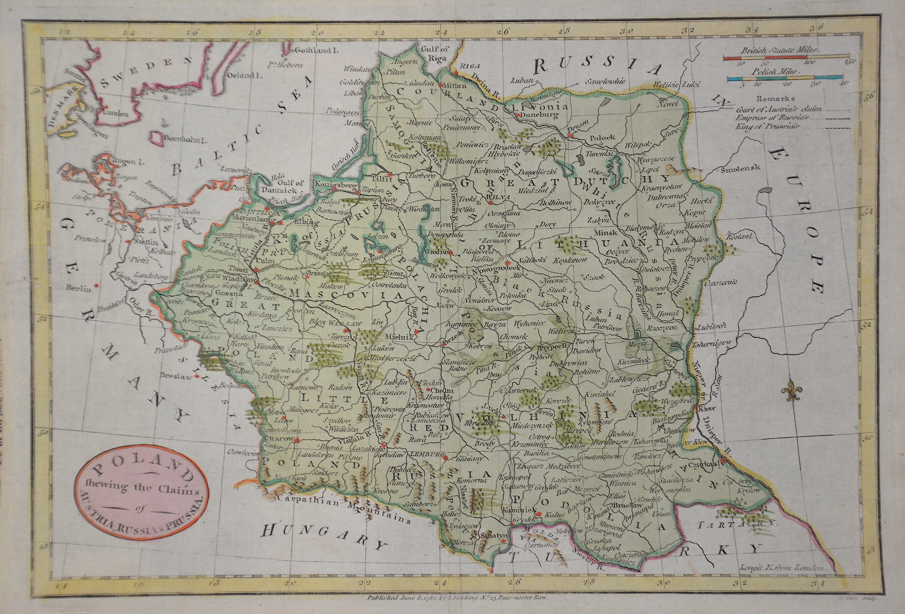
Poland fhewing the Claims of Austria, Russia u. Prussia.

| Article ID | EUP5048 |
Title | Poland fhewing the Claims of Austria, Russia u. Prussia. |
Description | Map shows the Kingdom of Poland with Lithuania and Ukraine. |
| Year | ca. 1790 |
Artist | Bowen (1714-1767) |
Emanuel Bowen (1714- 1767 in London) was an English map engraver, who worked for George II of England and Louis XV of France as a geographer. In spite of his royal appointments and apparent prosperity he died in poverty and his son Thomas, who carried on the business was no more fortunate and died in a Clerkenwell workhouse in 1790. | |
Historical Description | Poland is bordered by the Baltic Sea, Russia's Kaliningrad Oblast and Lithuania to the north, Belarus and Ukraine to the east, Slovakia and Czech Republic, to the south, and Germany to the west. The establishment of the Polish state can be traced back to AD 966, when Mieszko I ruler of the realm coextensive with the territory of present-day Poland, converted to Christianity. The Kingdom of Poland was founded in 1025, and in 1569 it cemented its longstanding political association with the Grand Duchy of Lithuania. This union formed the Polish–Lithuanian Commonwealth, one of the largest at the end of the 18th century. Poland regained its independence in 1918 with the Treaty of Versailles. It was one of the most populous countries of 16th- and 17th-century Europe, with a uniquely liberal political system, which adopted Europe's first written national constitution, the Constitution of 1791. |
| Place of Publication | London |
| Dimensions (cm) | 19,5 x 28 cm |
| Condition | Tear on the left side perfectly restored |
| Coloring | colored |
| Technique | Copper print |