

Adina Sommer
Antique and Contemporary Art
Winzerer Str. 154
80797 München
telephone
+49 89 304714
business hours:
by appointment
Email
![]()


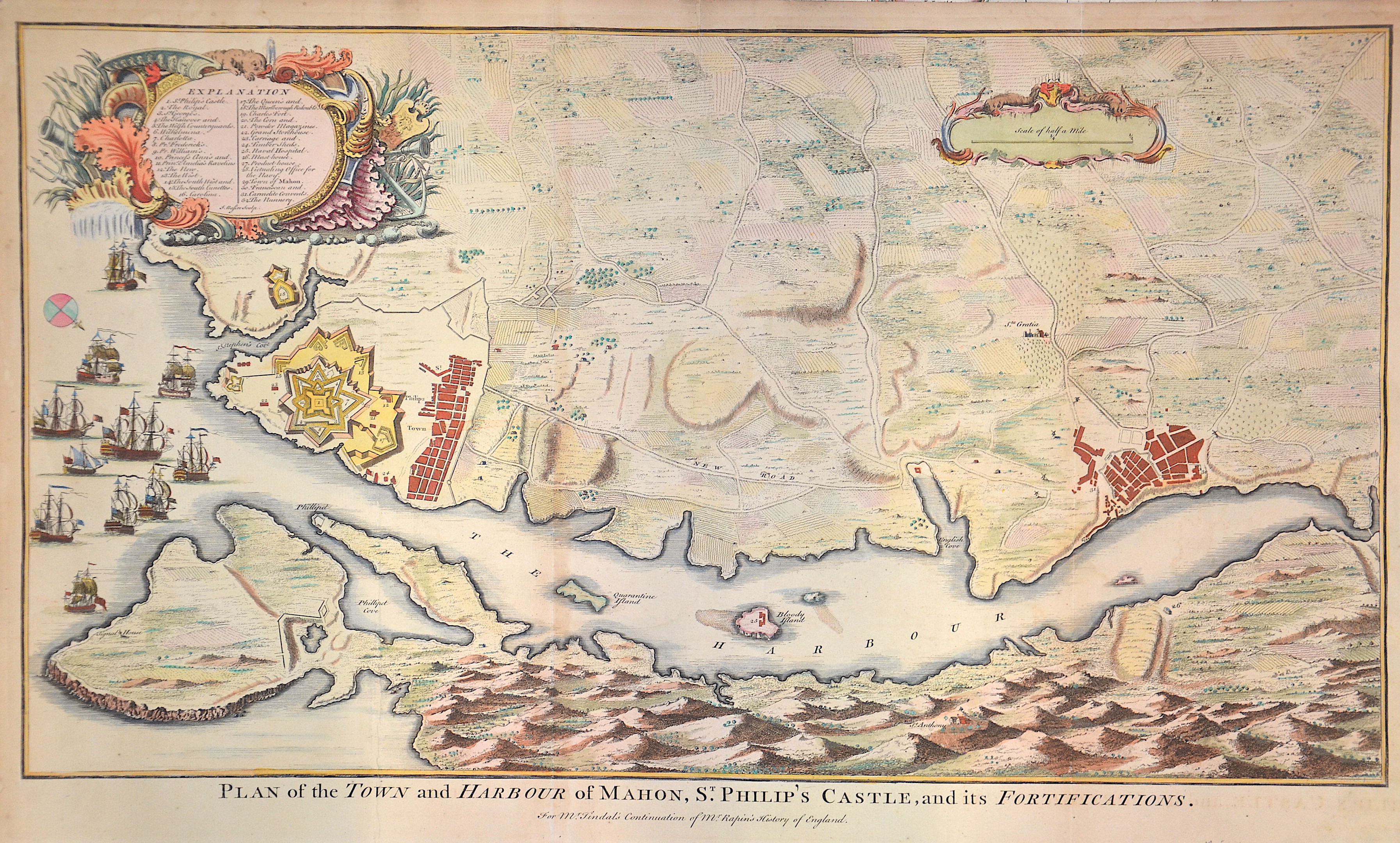
Plan of the Town and Harbour of Mahon, St. Philip’s Castle, and its Fortifications.

| Article ID | EUE3538 |
Title | Plan of the Town and Harbour of Mahon, St. Philip’s Castle, and its Fortifications. |
Description | Map shows the maps of Mahon and St. Philippe (Fort St. Philippe) in Menorca depicting the names of all important places. |
| Year | ca. 1745 |
Artist | Basire (1704-1768) |
Isaac Basire (1704 – 1768) was an engraver and first in a family line of prolific and well-respected engravers. Isaac Basire was known as a map engraver. His most well-known work is the frontispiece to an edition of Bailey's dictionary (1755). | |
Historical Description | The indigenous population of the Balearic Islands probably immigrated from the Iberian Peninsula or today's southern France. In ancient times, the islands were called Balearides or Gymnesiae, which meant the islands of Mallorca (Balearis major) and Menorca (Balearis minor). At first they were dependent on the Phoenicians. Mallorca and Ibiza were conquered in 1229 and 1235 respectively by Jacob I of Aragon (Catalan Jaume I), Menorca by his descendant Alfonso III. The Balearic Islands, like Catalonia, now belonged to the Aragon Crown. At times, together with parts of Catalonia, they formed an independent state, the Kingdom of Mallorca, ruled by a branch of the Aragonese royal family. In 1708 Maó was conquered by the British. The Peace of Utrecht (1713), which ended the War of Spanish Succession, gave Menorca to the British Empire. This had to return the island to Spain in the Treaty of Versailles (1783), but remained British until 1802. The Spanish province of the Balearic Islands was founded in 1833. |
| Place of Publication | London |
| Dimensions (cm) | 37 x 62,5 |
| Condition | Perfect condition |
| Coloring | colored |
| Technique | Copper print |