

Adina Sommer
Antique and Contemporary Art
Winzerer Str. 154
80797 München
telephone
+49 89 304714
business hours:
by appointment
Email
![]()


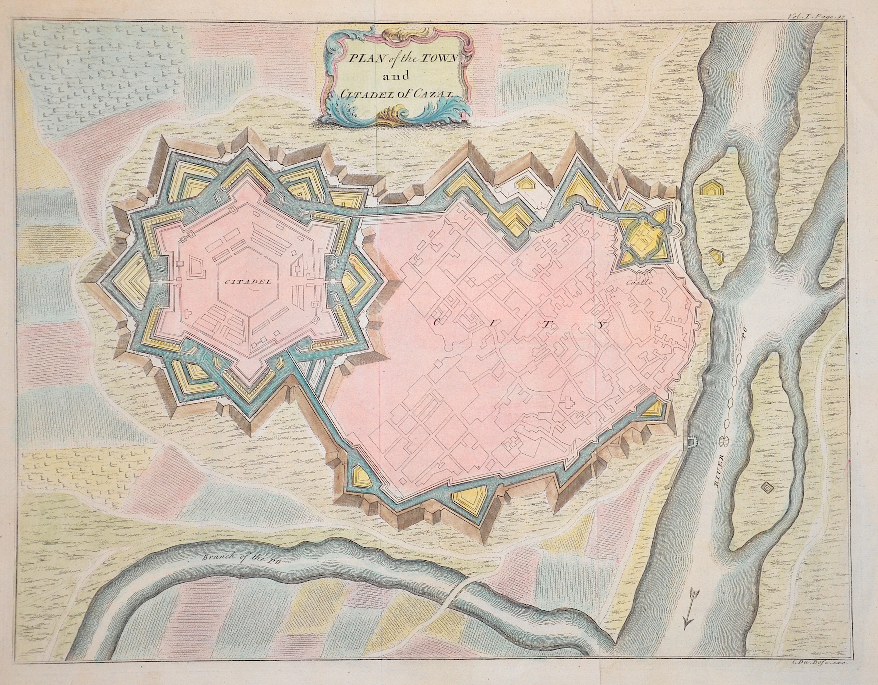
Plan of the Town and Citadel of Cazal.

| Article ID | EUI4887 |
Title | Plan of the Town and Citadel of Cazal. |
Description | City map of Casale Monferrato in the region of Piedmont, Italy with title cartouche. |
| Year | ca. 1736 |
Artist | Bosc Du |
Historical Description | Casale Monferrato: The bishop of Asti, Sant'Evasio, named the small village Casale (after the Italian word for country house). The first written mention of the name dates back to 988. After Charlemagne donated the village to the Church of Vercelli, it regained its freedom under the rule of Frederick Barbarossa. In 1215 it was successively sacked by the troops of Vercelli, Alessandria and Milan, then rebuilt and fortified five years later. From 1305 it was dominated by the Palaiologi, and in 1474 the settlement obtained the status of town. As a result of the treaty concluded between France and Spain in 1559, within the framework of the Peace of Cateau-Cambrésis, the town came under the rule of the Gonzaga family from Mantua, who made Casale a fortress. During the War of the Mantuan Succession (1629-1631), French troops entered Casale; Spanish troops besieged the town and the fortress in 1629 and 1630. In the War of the Spanish Succession, Duke Ferdinando Carlo of Gonzaga-Nevers sided with France; Emperor Joseph I then declared treason against the Empire, confiscated the part of the Duchy of Montferrat that remained with the House of Gonzaga, including Casale, in 1708, and transferred it to the House of Savoy in 1713. |
| Dimensions (cm) | 32 x 41,5 cm |
| Condition | Perfect condition |
| Coloring | colored |
| Technique | Copper print |