

Adina Sommer
Antique and Contemporary Art
Winzerer Str. 154
80797 München
telephone
+49 89 304714
business hours:
by appointment
Email
![]()


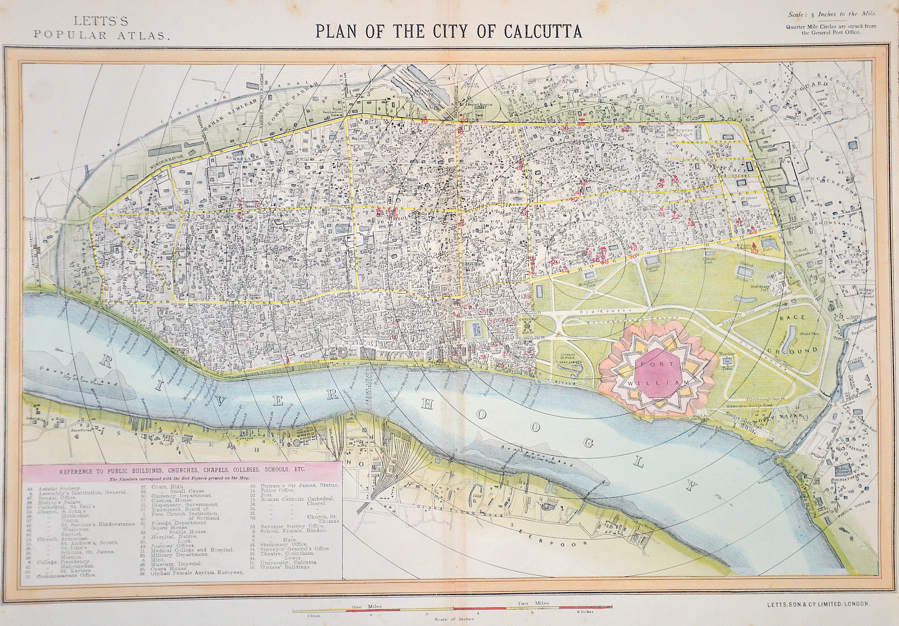
Plan of the City of Calcutta / Letts’s Popular Atlas.

| Article ID | ASI1344 |
Title | Plan of the City of Calcutta / Letts’s Popular Atlas. |
Description | Detailed map of Calcutta in India with index and Fort William (it is located on the eastern bank of the Hooghly River). |
| Year | ca. 1885 |
Artist | Letts Son & Co |
Historical Description | Kolkata is the capital of the Indian state of West Bengal.In the late 17th century, the three villages that predated Calcutta were ruled by the Nawab of Bengal under Mughal suzerainty. After the Nawab granted the East India Company a trading licence in 1690,the area was developed by the Company into an increasingly fortified trading post. Nawab Siraj ud-Daulah occupied Calcutta in 1756, and the East India Company retook it the following year. In 1793 the East India company was strong enough to abolish Nizamat (local rule), and assumed full sovereignty of the region. |
| Place of Publication | London |
| Dimensions (cm) | 29 x 42 cm |
| Condition | Light stains at the edge |
| Coloring | original colored |
| Technique | Lithography |