

Adina Sommer
Antique and Contemporary Art
Winzerer Str. 154
80797 München
telephone
+49 89 304714
business hours:
by appointment
Email
![]()


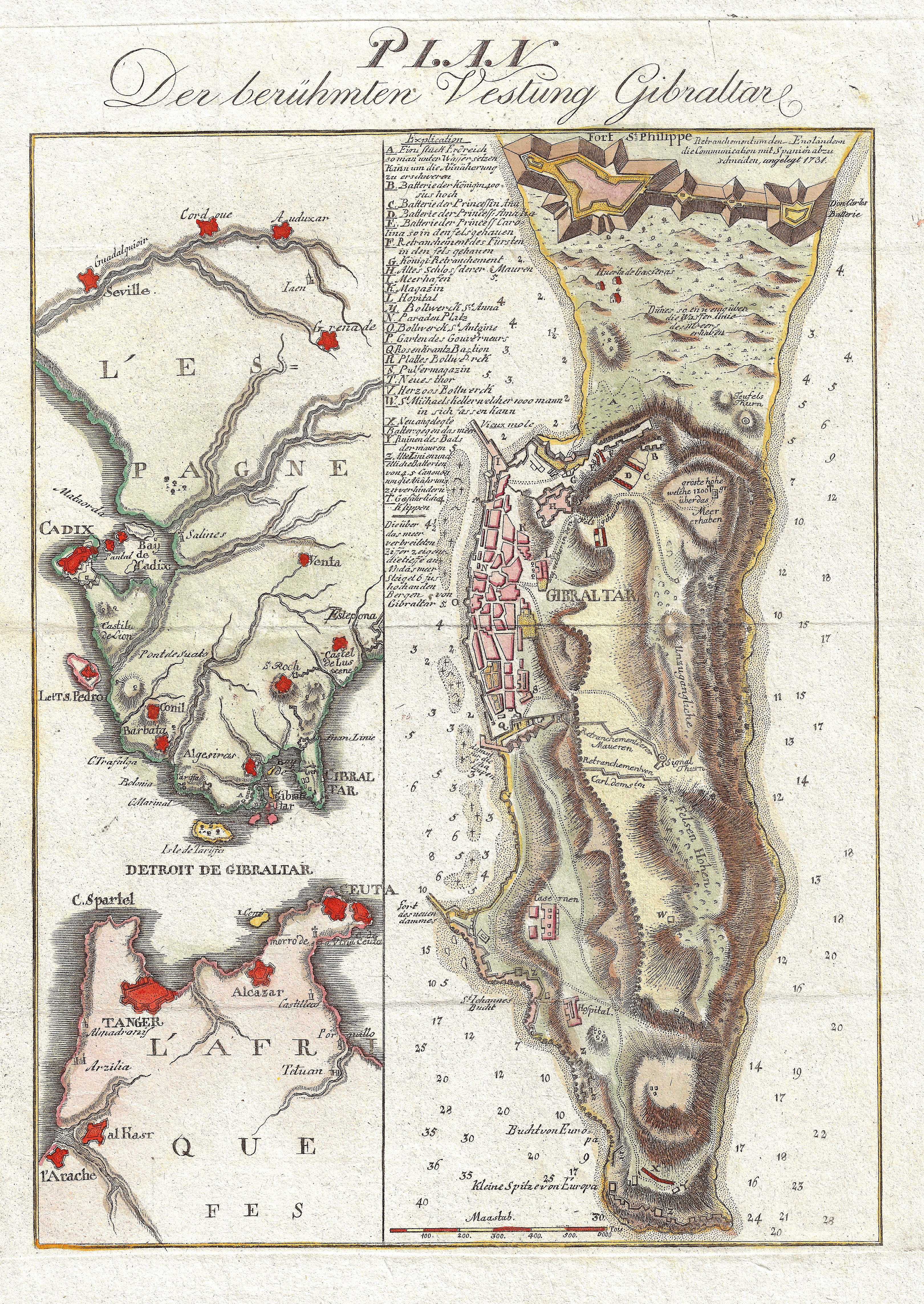
Plan Der berühmten Vestung Gibraltar.

| Article ID | EUE4286 |
Title | Plan Der berühmten Vestung Gibraltar. |
Description | Two maps on one sheet show the Strait of Gibraltar and a map of Gibraltar on the southern tip of the Iberian Peninsula. |
| Year | ca. 1740 |
Artist | Anonymus |
Historical Description | Gibraltar is a British Overseas Territory located on the southern end of the Iberian Peninsula. In 1704, during the War of the Spanish Succession, a combined Anglo-Dutch fleet, representing the Grand Alliance, captured the town of Gibraltar on behalf of the Archduke Charles of Austria in his campaign to become King of Spain. The occupation of the town by Alliance forces caused the exodus of the population to the surrounding area of the Campo de Gibraltar.As the Alliance's campaign faltered, the 1713 Treaty of Utrecht was negotiated and ceded control of Gibraltar to Britain to secure Britain's withdrawal from the war. Unsuccessful attempts by Spanish monarchs to regain Gibraltar were made with the siege of 1727 and again with the Great Siege of Gibraltar (1779 to 1783), during the American War of Independence. Gibraltar became a key base for the Royal Navy and played an important role prior to the Battle of Trafalgar. |
| Place of Publication | Germany |
| Dimensions (cm) | 36,5 x 25 cm |
| Condition | Perfect condition |
| Coloring | original colored |
| Technique | Copper print |