

Adina Sommer
Antique and Contemporary Art
Winzerer Str. 154
80797 München
telephone
+49 89 304714
business hours:
by appointment
Email
![]()


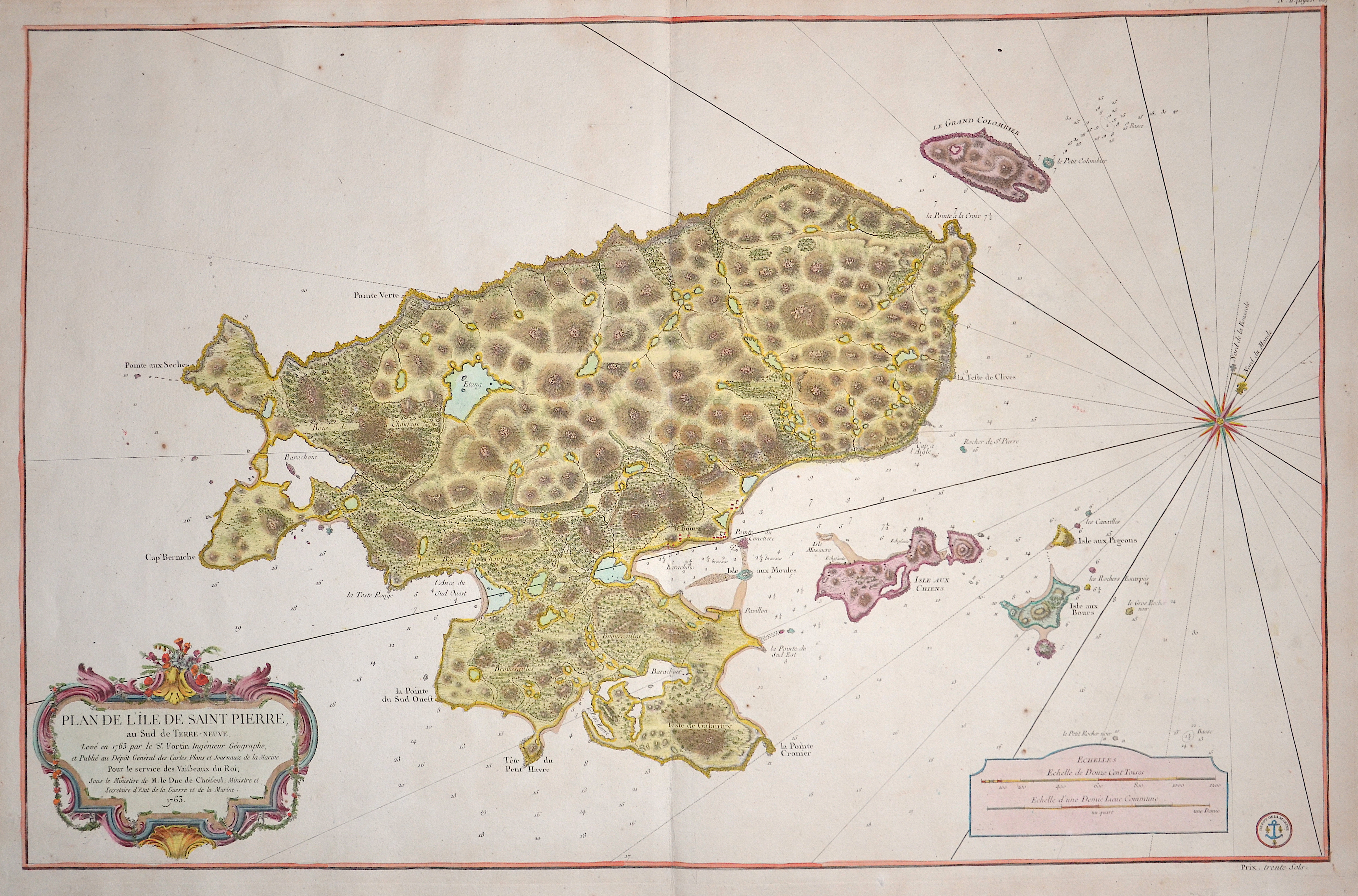
Plan de l´ Ile de Saint Pierre au Sud de Terre- Neuve

| Article ID | AMC0840 |
Title | Plan de l´ Ile de Saint Pierre au Sud de Terre- Neuve |
Description | Map shows the island Saint Pierre with other smaller islands |
| Year | dated 1763 |
Artist | Bellin (1703-1772) |
Jacques-Nicolas Bellin (1703 Paris -1772 Versailles) was a French cartographer, engineer-geographer, marine hydrographer. As a contributor to the Encyclopédie, he wrote more than a thousand articles on maritime topics. As a cartographer, Bellin distinguished himself primarily in the field of sea cartography. From 1721 he worked for the Dépot des Cartes et Plans de la Marine, from 1741 until his death as an engineer-hydrograph of the Navy. In 1753 his atlas Neptune français, which covered all the coasts of France, was published, and in 1756 the hydrography françoise covering all seas of the earth. In 1764 the five-volume Petit Atlas maritime was published, which Bellin prepared on the orders of the Minister of the Navy, Choiseul. In addition, he wrote a number of geographical works and with Nouvelle méthode pour apprendre la geographie (1769) a geographic textbook for teaching. His maps illustrated, among other things, Bougainville's work Voyage autour du monde, published in 1771. As a co-author of the Encyclopédie edited by Diderot and d'Alembert, Bellin wrote more than a thousand articles in the field of shipping and navy. | |
| Place of Publication | Paris |
| Dimensions (cm) | 57 x 87 |
| Condition | Very good |
| Coloring | original colored |
| Technique | Copper print |