

Adina Sommer
Antique and Contemporary Art
Winzerer Str. 154
80797 München
telephone
+49 89 304714
business hours:
by appointment
Email
![]()


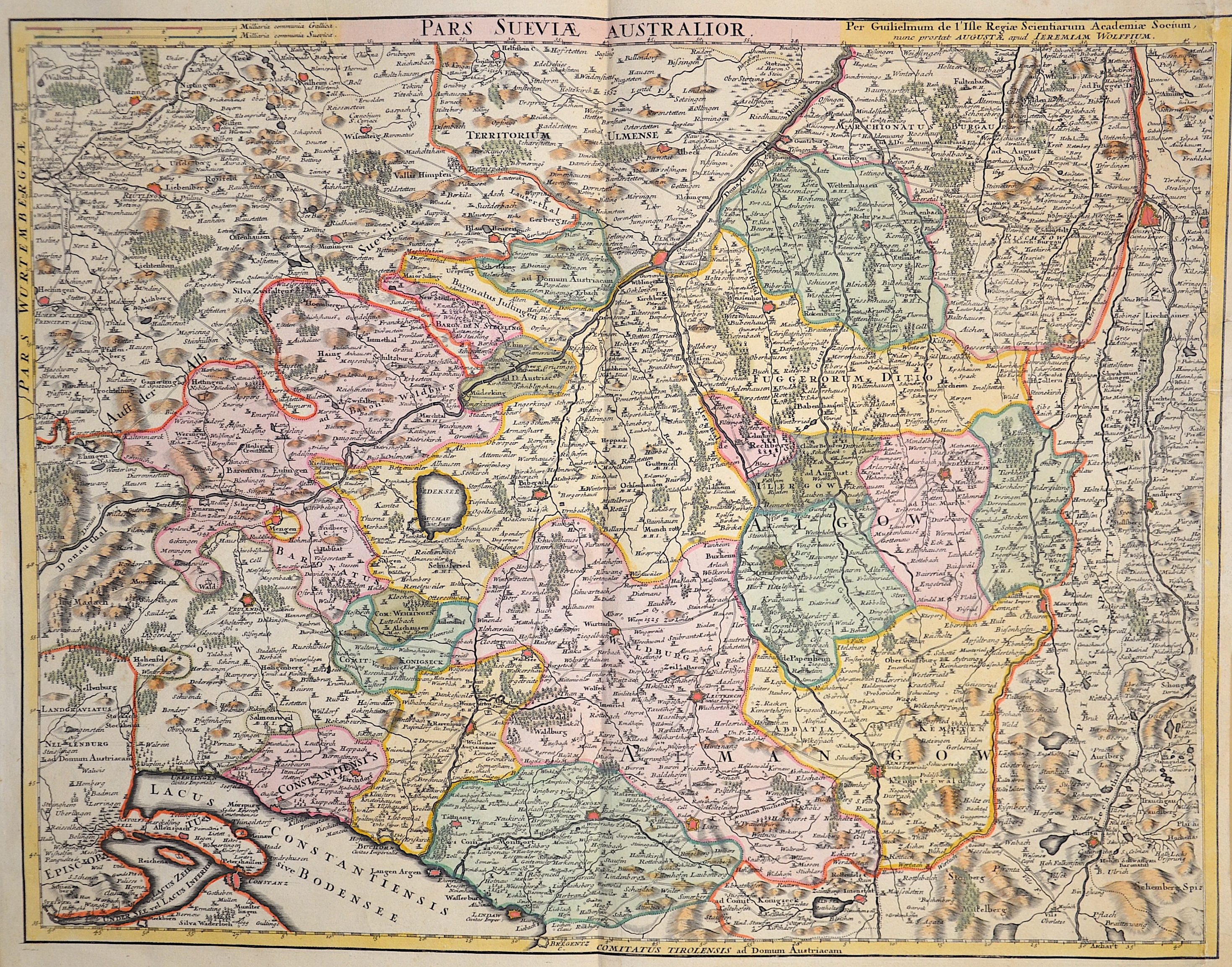
Pars Sueviae Australior

| Article ID | EUD0028 |
Title | Pars Sueviae Australior |
Description | Magnificent map showing the whole of Swabia with the cities of Augsburg, Ulm, Memmingen, Kempten, Nördlingen, Lindau on Lake Constance, and many more; Baden-Württemberg with Constance, Tübingen, Stuttgart, Heidelberg, Pforzheim, Freiburg im Breisgau,... |
| Year | ca. 1730 |
Artist | L´Isle, de /Covens & Mortier (1675-1726) |
Guillaume De L’Isle (1675–1726) was a renowned French cartographer famous for his accurate maps of Europe, the Americas, and Africa. He joined the French Académie Royale des Sciences, signing his maps as “Géographe de l’Académie,” and later became Premier Géographe du Roi in 1718, teaching geography to the Dauphin. De L’Isle mostly worked from his office, relying on a strong network of traveler reports and scientific updates, ensuring his maps were precise and honest. He openly noted uncertain information, such as a disputed river in Louisiana. In 1700, he won a legal case against Jean-Baptiste Nolin for plagiarism. Unlike the Sanson workshop, which often published outdated maps, De L’Isle focused on up-to-date, scientifically grounded cartography. | |
Historical Description | Swabia also Suabia or Svebia, is a cultural, historic and linguistic region in southwestern Germany. The name is ultimately derived from the medieval Duchy of Swabia, one of the German stem duchies, representing the territory of Alemannia, whose inhabitants interchangeably were called Alemanni or Suebi. A new Swabian League (Schwäbischer Bund) was formed in 1488, opposing the expansionist Bavarian dukes from the House of Wittelsbach and the revolutionary threat from the south in the form of the Swiss. The territory of Swabia as understood today emerges in the early modern period. It corresponds to the Swabian Circle established in 1512. The Old Swiss Confederacy was de facto independent from Swabia from 1499 as a result of the Swabian War, while the Margraviate of Baden had been detached from Swabia since the twelfth century. Fearing the power of the greater princes, the cities and smaller secular rulers of Swabia joined to form the Swabian League in the fifteenth century. The League was quite successful, notably expelling the Duke of Württemberg in 1519 and putting in his place a Habsburg governor, but the league broke up a few years later over religious differences inspired by the Reformation, and the Duke of Württemberg was soon restored. The region was quite divided by the Reformation. While secular princes such as the Duke of Württemberg and the Margrave of Baden-Durlach, as well as most of the Free Cities, became Protestant, the ecclesiastical territories (including the bishoprics of Augsburg, Konstanz and the numerous Imperial abbeys) remained Catholic, as did the territories belonging to the Habsburgs (Further Austria), the Sigmaringen branch of the House of Hohenzollern, and the Margrave of Baden-Baden. |
| Place of Publication | Paris |
| Dimensions (cm) | 48 x 61 cm |
| Condition | Right margin replaced |
| Coloring | colored |
| Technique | Copper print |