

Adina Sommer
Antique and Contemporary Art
Winzerer Str. 154
80797 München
telephone
+49 89 304714
business hours:
by appointment
Email
![]()


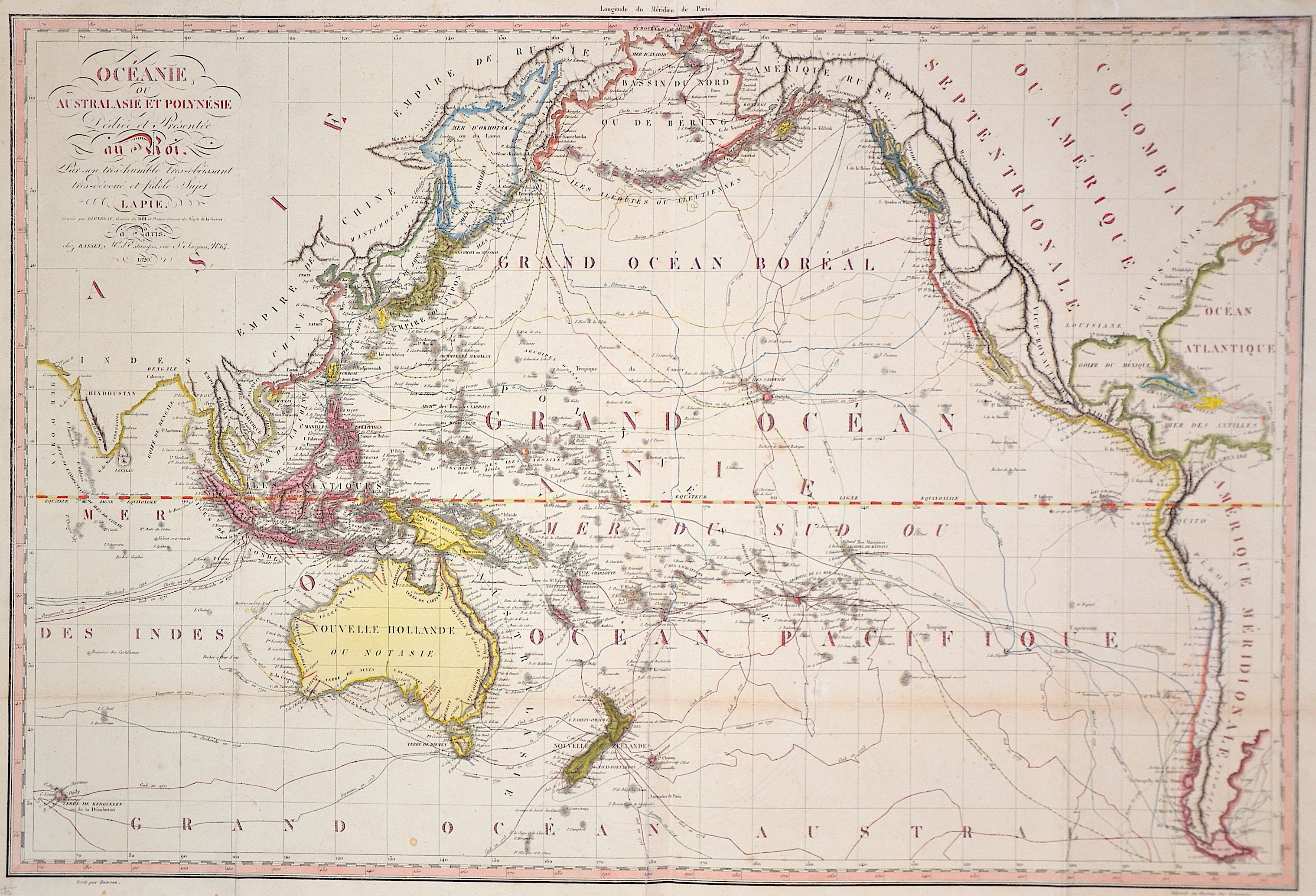
Oceanie ou Australasie et Polynésie

| Article ID | OZ188 |
Title | Oceanie ou Australasie et Polynésie |
Description | Map of the Pacific Ocean. |
| Year | ca. 1820 |
Artist | Lapie |
Pierre M. Lapie (1779 – 1850) was a French cartographer and engraver. He was the father of cartographer Alexandre Emile Lapie. Lapie was a Colonel in the French army, where he worked in the corps of topographical engineers. Lapie worked closely with his son and published works together and individually. The work of Lapie and his son was influential on German commercial map makers in the 19th century. | |
Historical Description | The Pacific Ocean is the largest and deepest of Earth's oceanic divisions. Though the peoples of Asia and Oceania have traveled the Pacific Ocean since prehistoric times, the eastern Pacific was first sighted by Europeans in the early 16th century when Spanish explorer Vasco Núñez de Balboa crossed the Isthmus of Panama in 1513 and discovered the great "southern sea" which he named Mar del Sur (in Spanish). In 1519, Portuguese explorer Ferdinand Magellan sailed the Pacific East to West on a Spanish expedition to the Spice Islands that would eventually result in the first world circumnavigation. Magellan called the ocean Pacífico (or "Pacific" meaning, "peaceful") because, after sailing through the stormy seas off Cape Horn, the expedition found calm waters. The ocean was often called the Sea of Magellan in his honor until the eighteenth century. |
| Place of Publication | Paris |
| Dimensions (cm) | 49 x 73 |
| Condition | Very good |
| Coloring | original colored |
| Technique | Copper print |