

Adina Sommer
Antique and Contemporary Art
Winzerer Str. 154
80797 München
telephone
+49 89 304714
business hours:
by appointment
Email
![]()


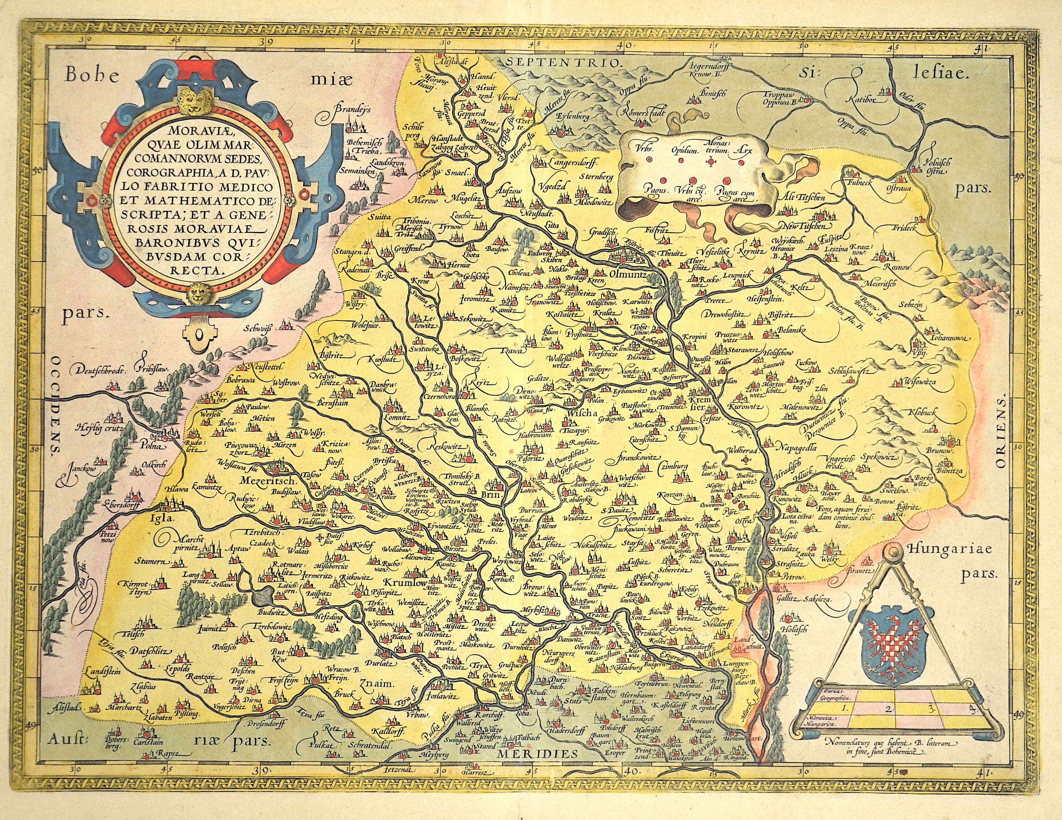
Moraviae Qua Olim Marcomannorum Sedes, Corographia , A.D.Paulo Fabritio Medico et Mathematico Descripta….

| Article ID | EUT1015 |
Title | Moraviae Qua Olim Marcomannorum Sedes, Corographia , A.D.Paulo Fabritio Medico et Mathematico Descripta…. |
Description | Map shows total Moravia |
| Year | ca. 1595 |
Artist | Ortelius (1527-1598) |
Abraham Ortelius (1527–1598) was a Flemish cartographer and publisher from Antwerp. Originally a map colorist, he became a major figure in cartography through his Theatrum Orbis Terrarum (1570), considered the first modern atlas—a uniform collection of reliable maps in book form. Influenced by Gerardus Mercator, Ortelius published several maps before compiling the Theatrum, which clearly showed America as a separate continent. The work was published in 42 editions and 7 languages by 1612. Unlike many of his peers, Ortelius cited his sources, and his atlas became a milestone in mapmaking and geographic knowledge. | |
Historical Description | Moravia developed on both sides of the Amber Road in prehistoric times. Around 60 BC The Celtic Boier withdrew from the area and were replaced by Germanic Marcomanni and Quadi, who moved on to the Alpine foothills around 550 AD together with the Rugians. Today's Moravia was still independent for a short time after the devastating defeat against the Hungarians and came under Bohemian sovereignty around 955. After being ruled briefly by Poland's ruler Boleslaw Chrobry from 999 to 1019, Moravia finally became Bohemian in 1031. The Principality and later Kingdom of Bohemia was ruled by the Přemyslid dynasty until it died out in the male line in 1305. Moravian history has been parallel to the history of Bohemia almost continuously since 1031. After the Přemyslids died out, the kingdom was ruled by the House of Luxembourg until 1437. The Přemyslid and Luxembourg dynasties also included the Moravian margraves, so u. a. the later King Ottokar II. Přemysl, the later King and Emperor Charles IV. and his nephew, the largely independent Margrave Jobst of Moravia. In 1469, the Hungarian King Matthias Corvinus advanced with his armed forces to Moravia to overthrow his father-in-law Georg von Podiebrad, whose daughter Katharina he married in 1461, as King of Bohemia. Matthias could never conquer the actual Bohemia, his rule only extended over the Bohemian neighboring countries Moravia, Silesia (with Breslau), Upper and Lower Lusatia. Nevertheless, he called himself King of Bohemia from 1469 and was crowned in 1471. As early as 1526, one of the first communities of property of the radical Reformation Anabaptist movement was formed around Balthasar Hubmaier in the Nikolsburg area. The impending dissolution of the Anabaptist community after the execution of Hubmaier in 1528 was prevented by Jakob Hutter, who came from Tyrol. The Anabaptists were also called the Hutterite Brothers after him. During the Catholic Reform and Recatholization, which were carried out by the Jesuits in particular, many churches were able to be consecrated Catholic again. The capital of Moravia and the seat of the margraves was the centrally located Olomouc from the rule of the Luxembourgers until 1641. After that, the larger Brno became the capital of the country. As the margraviate of Moravia, it formed its own crown land in the Austrian Empire and, from 1867, in the western half of Austria-Hungary. After Hungary left the empire and the real union Austria-Hungary was created in 1867, the remaining crown lands were officially referred to as Cisleithania or the kingdoms and countries represented in the Imperial Council. |
| Place of Publication | Antwerp |
| Dimensions (cm) | 36 x 47 |
| Condition | Very good |
| Coloring | original colored |
| Technique | Copper print |