

Adina Sommer
Antique and Contemporary Art
Winzerer Str. 154
80797 München
telephone
+49 89 304714
business hours:
by appointment
Email
![]()


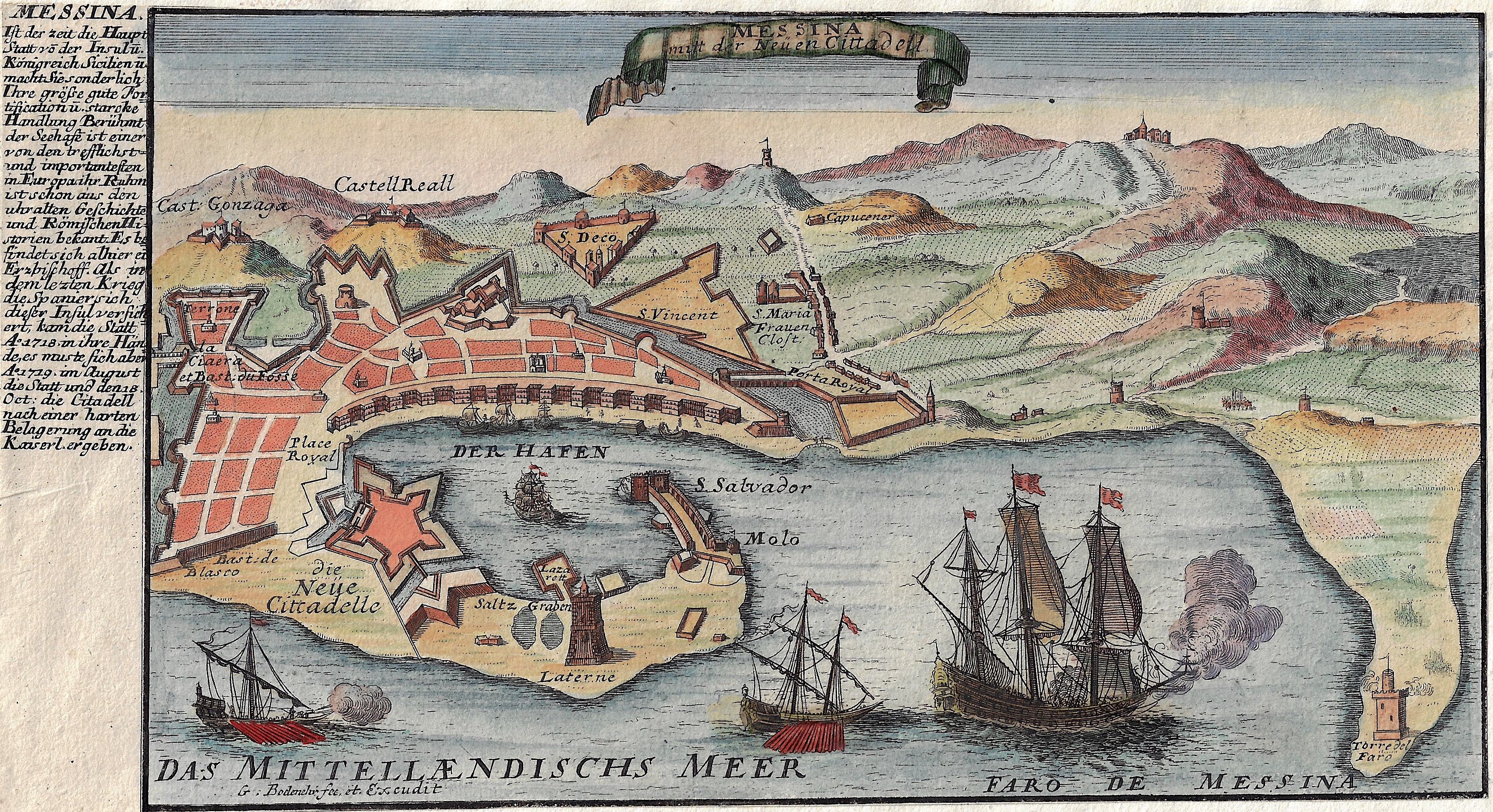
Messina

| Article ID | EUI4385 |
Title | Messina |
Description | Map shows the Sicilian city of Messina as a bird's eye view. |
| Year | ca. 1710 |
Artist | Bodenehr (1664-1765) |
Gabriel Bodenehr the Elder (1664-1765) was a German map maker and member of a famous engraver and publisher family of Augsburg. His main work was "Atlas Curieux" first published 1704. He was the son of Johann Georg Bodenehr (1631-1703). Gabriel's son was Gabriel Bodenehr the Younger (1705–1792). | |
Historical Description | Messina was founded in the 8th century BC. Because of its favorable location, it was settled by Ionian colonists after Thucydides from Kyme, followed shortly afterwards by other settlers from Kyme, Chalkis and other places in Evia. At the end of the First Punic War, Messina was a free city that was allied with Rome. It soon became part of the Province of Sicily. Until the 9th century, the city experienced an economic boom as an important trading center. In 843 the city was conquered by the Arabs, in 1061 by the Normans. In 1232 the city was the center of an unsuccessful uprising against Emperor Friedrich II. After the rule of the Staufer and Anjous, Messina became the capital of the Regno di Sicilia under the rule of Aragon. It was not until the 16th century that Palermo became the preferred seat of kings and viceroys. In 1783, an earthquake measuring 7.2 on the Richter scale hit the city. Much of the buildings, including the cathedral and palaces of the Palazzata, were destroyed by the quake and the subsequent tidal wave. The reconstruction was based on a regular city map with wide streets and spacious squares. The Palazzata was rebuilt in the classicist style from 1808 under the direction of Giacomo Minutoli. |
| Place of Publication | Augsburg |
| Dimensions (cm) | 15 x 28 cm |
| Condition | Margins mounted |
| Coloring | original colored |
| Technique | Copper print |