

- Alsace
- Aquitaine
- Auvergne
- Bourgogne
- Bourgogne-Franche-Comte
- Brittany
- Centre
- Champagne
- France Islands
- Gascogne
- Gironde
- Hauts-de-France
- Ile de France
- Languedoc
- Lothringen
- Midi-Pyrénées
- Nivernais
- Nord-Pas-de-Calais
- Normandie
- Occitanie
- Pas-de-Calais
- Pays de la Loire
- Picardie
- Poitou-Charentes
- Provence-Alpes-Cote d Azur
- Pyrénées
- Rhone- Alpes
- Saintonge
- Savoyen
- Tourain
- Westcoast
Adina Sommer
Antique and Contemporary Art
Winzerer Str. 154
80797 München
telephone
+49 89 304714
business hours:
by appointment
Email
![]()


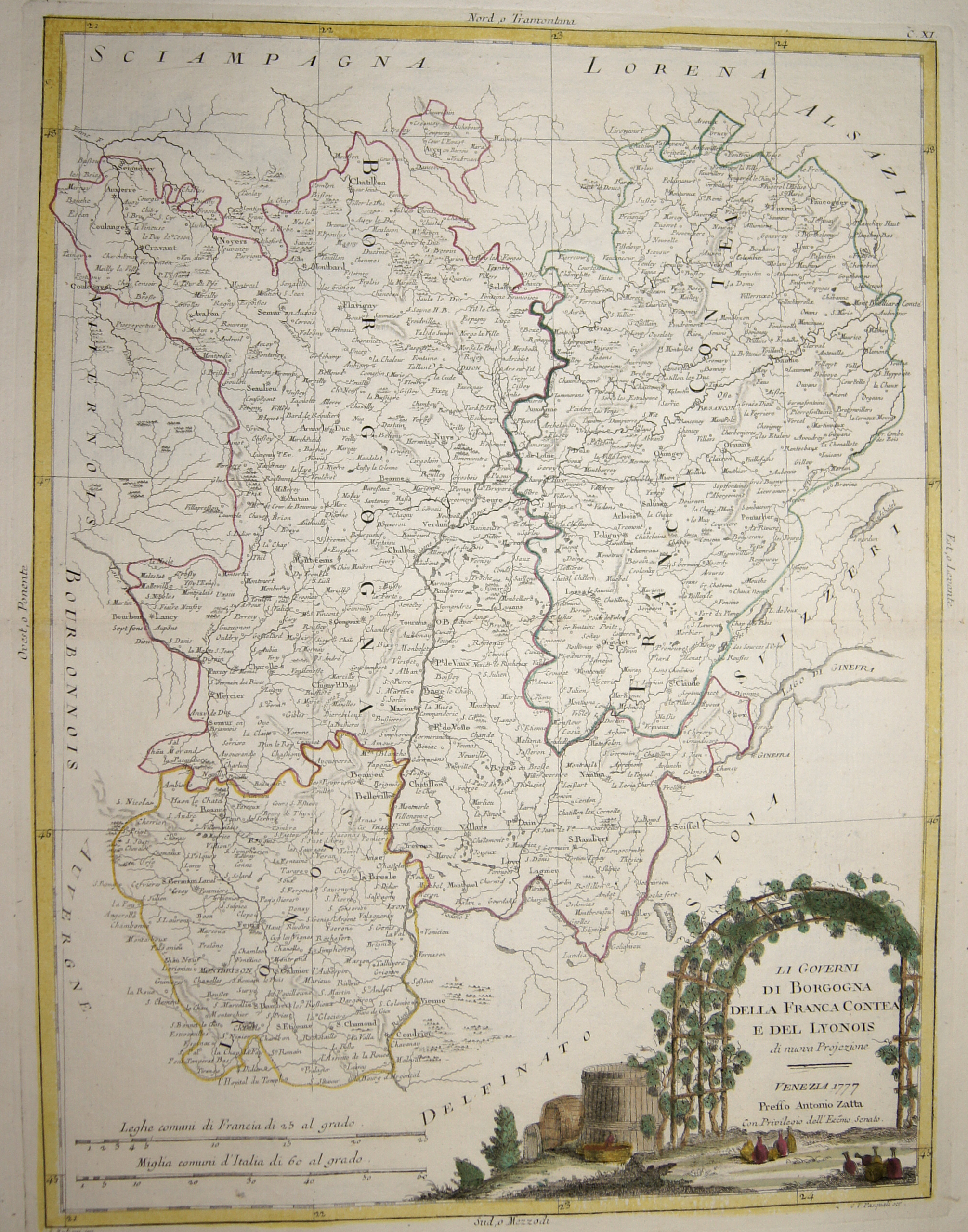
Li Governi di Borgogna della Franca Contea e del Lyonois

| Article ID | EUF3742 |
Title | Li Governi di Borgogna della Franca Contea e del Lyonois |
Description | Map shows the french region of Burgund, Franche-Comté, Lyonnais with a decorative title cartouche. |
| Year | ca. 1777 |
Artist | Zatta (1757-1797) |
Antonio Zatta (1757 – 1797) was an Italian cartographer who was based in Venice. One of his major contributions include the Atlante Novissimo, a four volume atlas of the world in very high scientific quality. | |
Historical Description | The present region was already inhabited by people in the Paleolithic Age. The Duchy of Burgundy was ruled by a side line of the French royal house, the Capetians, from 1032 to 1361. It passed to Philip of Valois in 1363, who founded the House of Burgundy as a collateral line of the French royal house of Valois. The duchy was dissolved after the French Revolution in the course of the division of the state into departments in 1790; with it disappeared the name Burgundy for a political-administrative unit. |
| Place of Publication | Venice |
| Dimensions (cm) | 41,5 x 31,5 |
| Condition | Perfect condition |
| Coloring | original colored |
| Technique | Copper print |