

Adina Sommer
Antique and Contemporary Art
Winzerer Str. 154
80797 München
telephone
+49 89 304714
business hours:
by appointment
Email
![]()


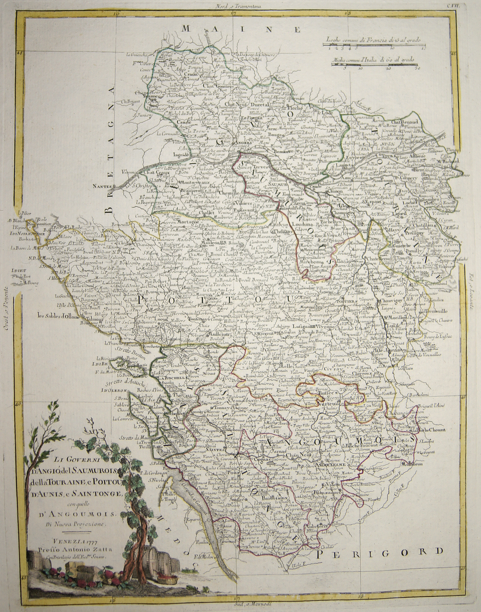
Li Governi d’Angió, del Saumurois, della Touraine, e Poitou, d’Aunis, e Saintonge, con quello d’Angoumois.

| Article ID | EUF3739 |
Title | Li Governi d’Angió, del Saumurois, della Touraine, e Poitou, d’Aunis, e Saintonge, con quello d’Angoumois. |
Description | Map shows the historical provinces of France Anjou (city Angers), Touraine (city Tours), Poitou (Poitiers), Aunis (city La Rochelle), Saintonge (city Saintes), Angoumois (city Angouleme), Saumurois (city Saumur) with a decorative title cartouche. At first Anjou was included in the gouvernement (or military command) of Orléanais, but in the 17th century was made into a separate one. Saumur, however, and the Saumurois, for which King Henry IV had in 1589 created an independent military governor-generalship in favour of Duplessis-Mornay, continued till the Revolution to form a separate gouvernement, which included, besides Anjou, portions of Poitou and Mirebalais. |
| Year | dated 1777 |
Artist | Zatta (1757-1797) |
Antonio Zatta (1757 – 1797) was an Italian cartographer who was based in Venice. One of his major contributions include the Atlante Novissimo, a four volume atlas of the world in very high scientific quality. | |
Historical Description | It is estimated that today's France was settled about 48,000 years ago. Important rock paintings from the Paleolithic period have been preserved in the Lascaux cave From 600 BC Chr. Phoenician and Greek traders founded bases on the Mediterranean coast, while Celts settled from the northwest the country that was later called by the Romans as Gaul. The French Middle Ages were marked by the rise of kingship in the constant struggle against the independence of the nobility and the secular violence of the monasteries and religious orders. Starting from today's Île-de-France, the Capetinians enforced the idea of a unitary state, which was underpinned by participation in various crusades. The Normans invaded Normandy repeatedly, hence its name; in 1066 they conquered England. A long series of armed conflicts with England began under Louis VII after Ludwig's divorced wife Eleonore von Poitou and Aquitaine married Heinrich Plantagenet in 1152 and thus about half of France's territory fell to England. Philip II August, together with the Hohenstaufen family, largely displaced England from France until 1299; the English king Henry III Ludwig IX. recognize as suzerain. From 1226 France became an inheritance monarchy; in 1250 Ludwig IX was one of the most powerful rulers in the West. In the 17th and 18th centuries, France held European leadership and supremacy. The political and cultural charisma was significant: The court of Louis XIV became the model for absolutist states throughout Europe and the French Revolution with the declaration of human and civil rights, together with occupations by Napoleon Bonaparte, started in many countries the time and again Setbacks interrupted development towards democracy. |
| Place of Publication | Venice |
| Dimensions (cm) | 40,5 x 31,5 |
| Condition | Perfect condition |
| Coloring | original colored |
| Technique | Copper print |