

Adina Sommer
Antique and Contemporary Art
Winzerer Str. 154
80797 München
telephone
+49 89 304714
business hours:
by appointment
Email
![]()


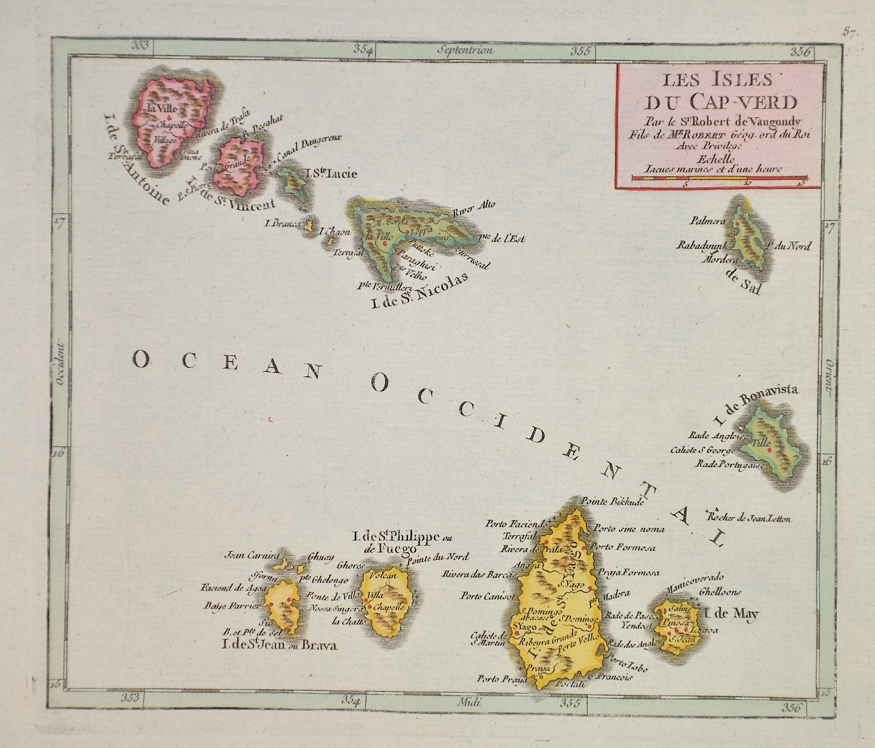
Les isles du Cap – Verd

| Article ID | AF068 |
Title | Les isles du Cap – Verd |
Description | Map shows the islands of Cap Verde. |
| Year | ca. 1748 |
Artist | Vaugondy,de (1723-1786) |
Didier Robert de Vaugondy (1723 -1786) also known as Le Sieur or Monsieur Robert, and his son, were leading cartographers in France during the 18th century. In 1757, Gilles and Didier Robert De Vaugondy published The Atlas Universel, one of the most important atlases of the 18th century. To produce the atlas, the Vaugondys integrated older sources with more modern surveyed maps. They verified and corrected the latitude and longitude of many regional maps in the atlas with astronomical observations. The older material was revised with the addition of many new place names. In 1760, Didier Robert de Vaugondy was appointed geographer to Louis XV. Gilles and Didier Robert De Vaugondy produced their maps and terrestrial globes working together as father and son. Globes of a variety of sizes were made by gluing copperplate-printed gores on a plaster-finished papier-mache core, a complicated and expensive manufacturing process, employing several specialists. In some cases it is uncertain whether Gilles or Didier made a given map. Gilles often signed maps as M.Robert, while Didier commonly signed his maps as ""Robert de Vaugondy"", or added ""fils"" or ""filio"" after his name. The Robert de Vaugondys were descended from the Nicolas Sanson family through Sanson's grandson, Pierre Moulard-Sanson. From him, they inherited much of Sanson's cartographic material, which they combined with maps and plates acquired after Hubert Jaillot's death in 1712 to form the basis the Atlas Universel. | |
Historical Description | The uninhabited islands were circled by António Fernandes in 1445 and discovered and entered for the first time in 1456 by the Venetian Alvise Cadamosto, who was in Portuguese service (Boa Vista). Antonio da Noli, a Genoese captain who also sailed on behalf of the Portuguese Prince Henry the Navigator, continued to explore the islands from 1458 in collaboration with Diogo Gomes, discovered most of the rest of the eastern Cape Verde Islands and baptized the archipelago with the name Ilhas de Cabo Verde and began settling the islands as governor of the Portuguese crown from 1461. In fact, Diogo Gomes later claimed to be the first of the two to have seen the island of Santiago from afar and also to have been the first to set foot on it. Antonio da Noli, however, managed to return to Portugal earlier, and he was then understandably rewarded by Heinrich the Navigator with the encouragement of the discovery, which, in the words of Diogo Gomes, "I, Gomes, discovered". Because of the rivalry between the two, Diogo Gomes is considered to be the true discoverer of the main island of Santiago in Portuguese historiography. The islands were named by the Portuguese after Cabo Verde (Green Cape) on the west coast of Africa. |
| Place of Publication | Paris |
| Dimensions (cm) | 16 x 19 |
| Condition | Very good |
| Coloring | colored |
| Technique | Copper print |