

Adina Sommer
Antique and Contemporary Art
Winzerer Str. 154
80797 München
telephone
+49 89 304714
business hours:
by appointment
Email
![]()


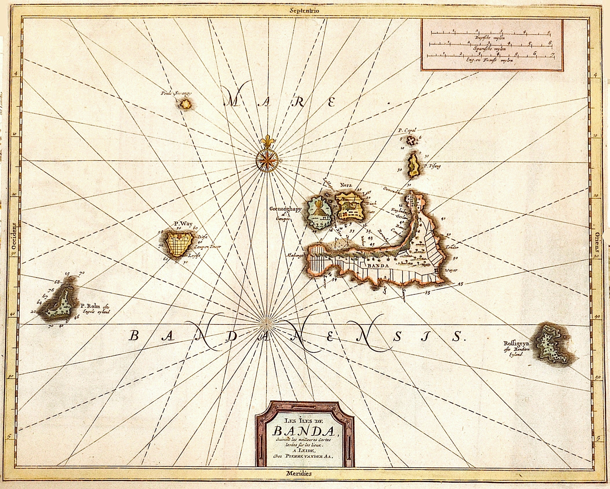
Les Iles de Banda,…

| Article ID | ASS1148 |
Title | Les Iles de Banda,… |
Description | Map shows the indonesia islands Banda (Banda Besar, Banda Neira,...) south of the Molucces. |
| Year | ca. 1730 |
Artist | Aa, van der (1659-1733) |
Pieter van der Aa ( 1659 - 1733) was a Dutch publisher best known for preparing maps and atlases, though he also printed pirated editions of foreign bestsellers and illustrated volumes. He also printed many maps that were often out of print, which he reissued. Some of his most popular maps were of the African continent, detailing locations such as Morocco and Madagascar. Many of his later works were printed for the general public in French and Dutch. Pieter van der Aa began his career at Leiden in 1683 as a Latin trade publisher, publishing classical texts pertaining to medicine and science. As he progressed, he began to publish atlases and maps, compiling numerous multi-volume collections of works. His ambition to become Leiden's most famous printer was fulfilled in 1715 with his appointment to head printer for the city and its university. One of Pieter van der Aa's largest compilations relates to the history of Italy and Sicily, an area of immense personal interest. Though he took credit for many of his compilations, several, such as the Dutch collection of travels to the East and West Indies, were admittedly simple improvements to others' works. | |
Historical Description | The Maluku Islands are an archipelago within Banda Sea, Indonesia. Tectonically they are located on the Halmahera Plate within the Molucca Sea Collision Zone. Geographically they are located east of Sulawesi, west of New Guinea, and north and east of Timor. The islands were known as the Spice Islands due to the nutmeg, mace and cloves that were originally exclusively found there, the presence of which sparked colonial interest from Europe in the 16th century. The Maluku Islands formed a single province from Indonesian independence until 1999, when it was split into two provinces. A new province, North Maluku, incorporates the area between Morotai and Sula, with the arc of islands from Buru and Seram to Wetar remaining within the existing Maluku Province. |
| Place of Publication | Leiden |
| Dimensions (cm) | 28 x 35 cm |
| Condition | Perfect condition |
| Coloring | colored |
| Technique | Copper print |