

Adina Sommer
Antique and Contemporary Art
Winzerer Str. 154
80797 München
telephone
+49 89 304714
business hours:
by appointment
Email
![]()


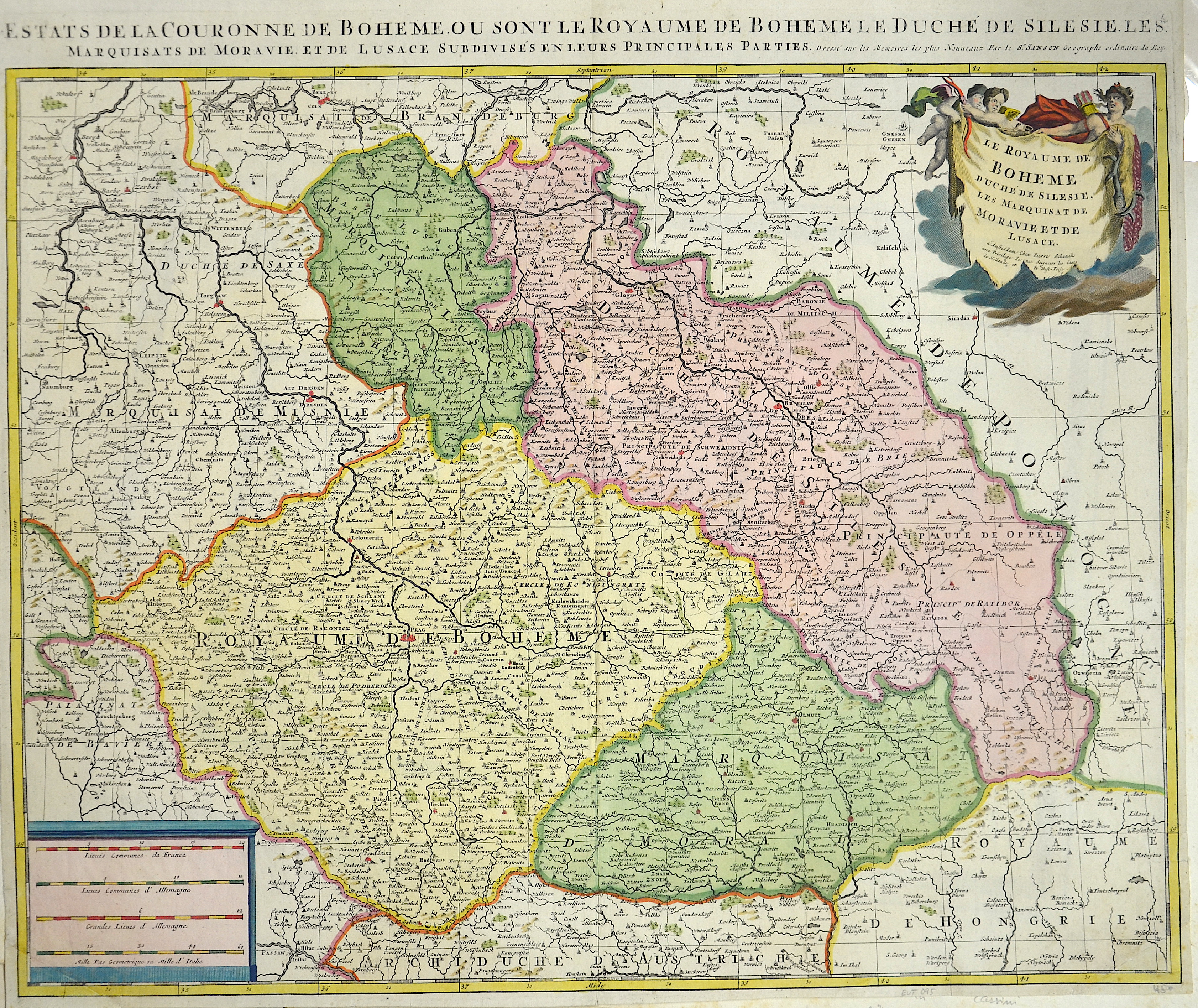
Les États de la Couronne de Boheme ou sont le Royaume de Boheme, le duché de Silesie…

| Article ID | EUT095 |
Title | Les États de la Couronne de Boheme ou sont le Royaume de Boheme, le duché de Silesie… |
Description | Map shows Bohemia, Silesia, Maehren, Lausitz and the pricipality Teschen. Decorative and detailed map with a title cartouche. |
| Year | ca. 1700 |
Artist | Schenk/ Sanson, Nicolas (1655-1718) |
Petrus Schenck, (1660 – 1711) was a German engraver and cartographer active in Amsterdam and Leipzig. Valck was married to Maria Bloteling, the sister of the Amsterdam engraver Abraham Bloteling. In 1687 Schenk married Gerard's sister Agatha Valck. In 1694, together with Valck, he bought some of the copperplates of the artdealer and cartographer Johannes Janssonius. Along with Valck and Bloteling, he produced prints for the London market, though it is not known if he ever went there with them. | |
Historical Description | Bohemia is the westernmost and largest historical region of the Czech lands in the present-day Czech Republic. In a broader meaning, Bohemia sometimes refers to the entire Czech territory, including Moravia and Czech Silesia, especially in a historical context, such as the Lands of the Bohemian Crown ruled by Bohemian kings. Bohemia was a duchy of Great Moravia, later an independent principality, a kingdom in the Holy Roman Empire, and subsequently a part of the Habsburg Monarchy and the Austrian Empire. After World War I and the establishment of an independent Czechoslovak state, Bohemia became a part of Czechoslovakia. Between 1938 and 1945, border regions with sizeable German-speaking minorities of all three Czech lands were joined to Nazi Germany as the Sudetenland. |
| Place of Publication | Amsterdam |
| Dimensions (cm) | 47,5 x 57 cm |
| Condition | Left and right lower corners replaced |
| Coloring | original colored |
| Technique | Copper print |