

Adina Sommer
Antique and Contemporary Art
Winzerer Str. 154
80797 München
telephone
+49 89 304714
business hours:
by appointment
Email
![]()


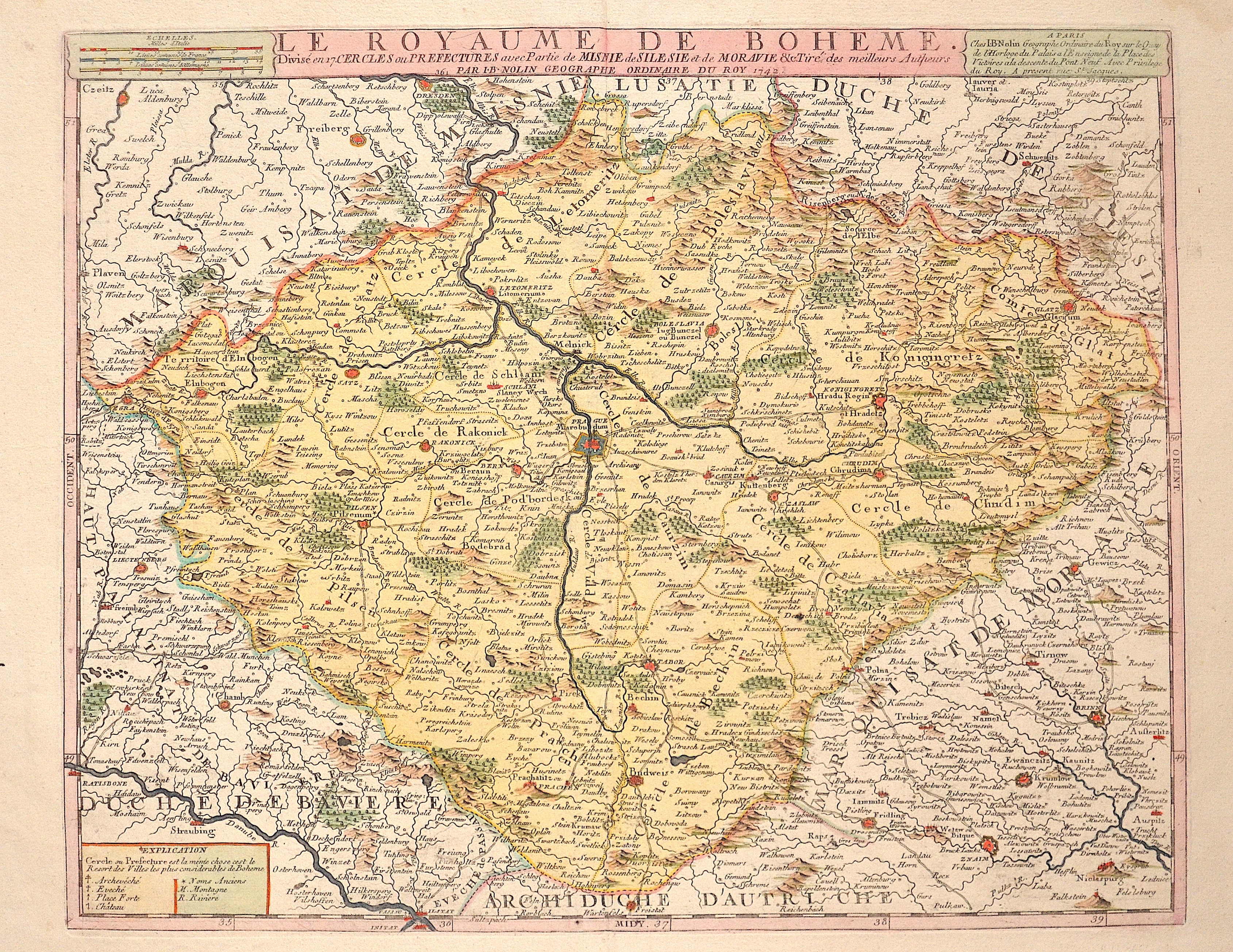
Le Royaume de Boheme. Divisé en 17. Cercles ou Prefectures avec Partie de Misnie de Silesie et de Moravie & c. Tiré des meilleurs Autheurs

| Article ID | EUT4309 |
Title | Le Royaume de Boheme. Divisé en 17. Cercles ou Prefectures avec Partie de Misnie de Silesie et de Moravie & c. Tiré des meilleurs Autheurs |
Description | Map shows all of Bohemia in the Czech Republic with the cities of Prague, Pilsen, Budweis, Tabor, etc. |
| Year | c. 1742 |
Artist | Nolin (1657-1725) |
Jean-Baptiste Nolin (ca. 1657-1708) set up the family publishing business in Paris. Many of his maps were based on the work of Vincenzo Coronelli and Sieur de Tillemon. His son (1686-1762), continued the business for many years and prepared an Atlas General which was published posthumously in 1783. | |
Historical Description | Bohemia is the westernmost and largest historical region of the Czech lands in the present-day Czech Republic. In a broader meaning, Bohemia sometimes refers to the entire Czech territory, including Moravia and Czech Silesia, especially in a historical context, such as the Lands of the Bohemian Crown ruled by Bohemian kings. Bohemia was a duchy of Great Moravia, later an independent principality, a kingdom in the Holy Roman Empire, and subsequently a part of the Habsburg Monarchy and the Austrian Empire. After World War I and the establishment of an independent Czechoslovak state, Bohemia became a part of Czechoslovakia. Between 1938 and 1945, border regions with sizeable German-speaking minorities of all three Czech lands were joined to Nazi Germany as the Sudetenland. |
| Place of Publication | Paris |
| Dimensions (cm) | 44,5 x 55 cm |
| Condition | Perfect condition |
| Coloring | original colored |
| Technique | Copper print |