

Adina Sommer
Antique and Contemporary Art
Winzerer Str. 154
80797 München
telephone
+49 89 304714
business hours:
by appointment
Email
![]()


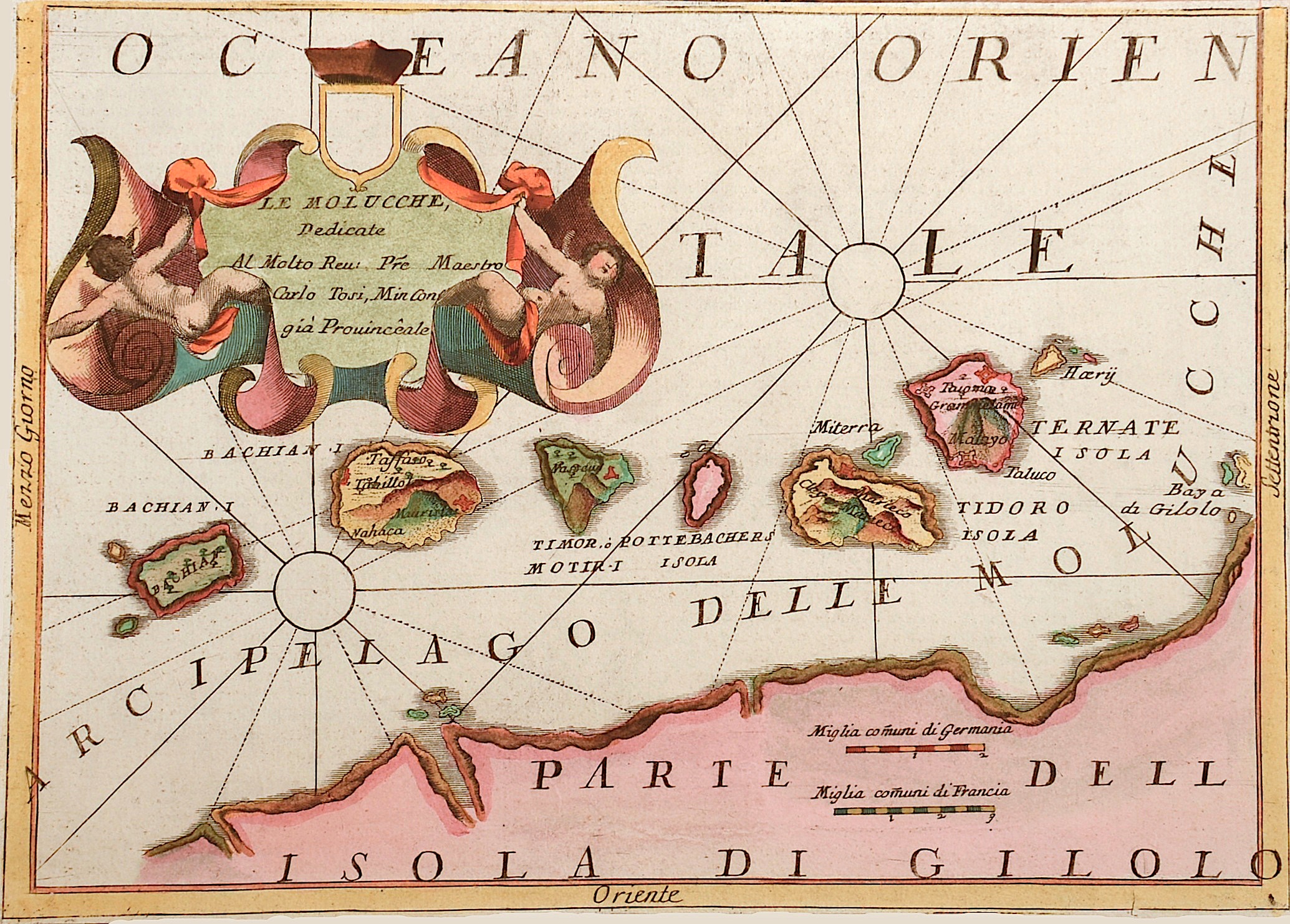
Le Molucche , dedictae al molto reu pre majestro carlo Tosi, Min Con gia Provinceale

| Article ID | ASS0409 |
Title | Le Molucche , dedictae al molto reu pre majestro carlo Tosi, Min Con gia Provinceale |
Description | Map shows the islands of the Molucces, Ternale, Tidore, Timor, Machian, Bachian, the coast of Dschailolo and a beautiful cartush. |
| Year | ca. 1690 |
Artist | Coronelli (1650-1718) |
Coronelli Vincenzo, (1650 – 1718). He was a cosmographer, geographer, biographer, encyclopedist, globe maker, inventor and an expert of engeneering and hydraulics. Extraordinarily versatile mind and an extremely tireless man, he produced more than 140 pieces in different genres. At the age of 15, he entered the Franciscan Order, which he then guided as Gran Generale from 1699. He became famous as geographer and mathematician, awakening the interest in these subjects in Italy at the end of the XVII century. | |
Historical Description | The Maluku Islands are an archipelago within Banda Sea, Indonesia. Tectonically they are located on the Halmahera Plate within the Molucca Sea Collision Zone. Geographically they are located east of Sulawesi, west of New Guinea, and north and east of Timor. The islands were known as the Spice Islands due to the nutmeg, mace and cloves that were originally exclusively found there, the presence of which sparked colonial interest from Europe in the 16th century. The Maluku Islands formed a single province from Indonesian independence until 1999, when it was split into two provinces. A new province, North Maluku, incorporates the area between Morotai and Sula, with the arc of islands from Buru and Seram to Wetar remaining within the existing Maluku Province. |
| Place of Publication | Venice |
| Dimensions (cm) | 23 x 31 |
| Condition | Margins cutted |
| Coloring | original colored |
| Technique | Copper print |