

Adina Sommer
Antique and Contemporary Art
Winzerer Str. 154
80797 München
telephone
+49 89 304714
business hours:
by appointment
Email
![]()


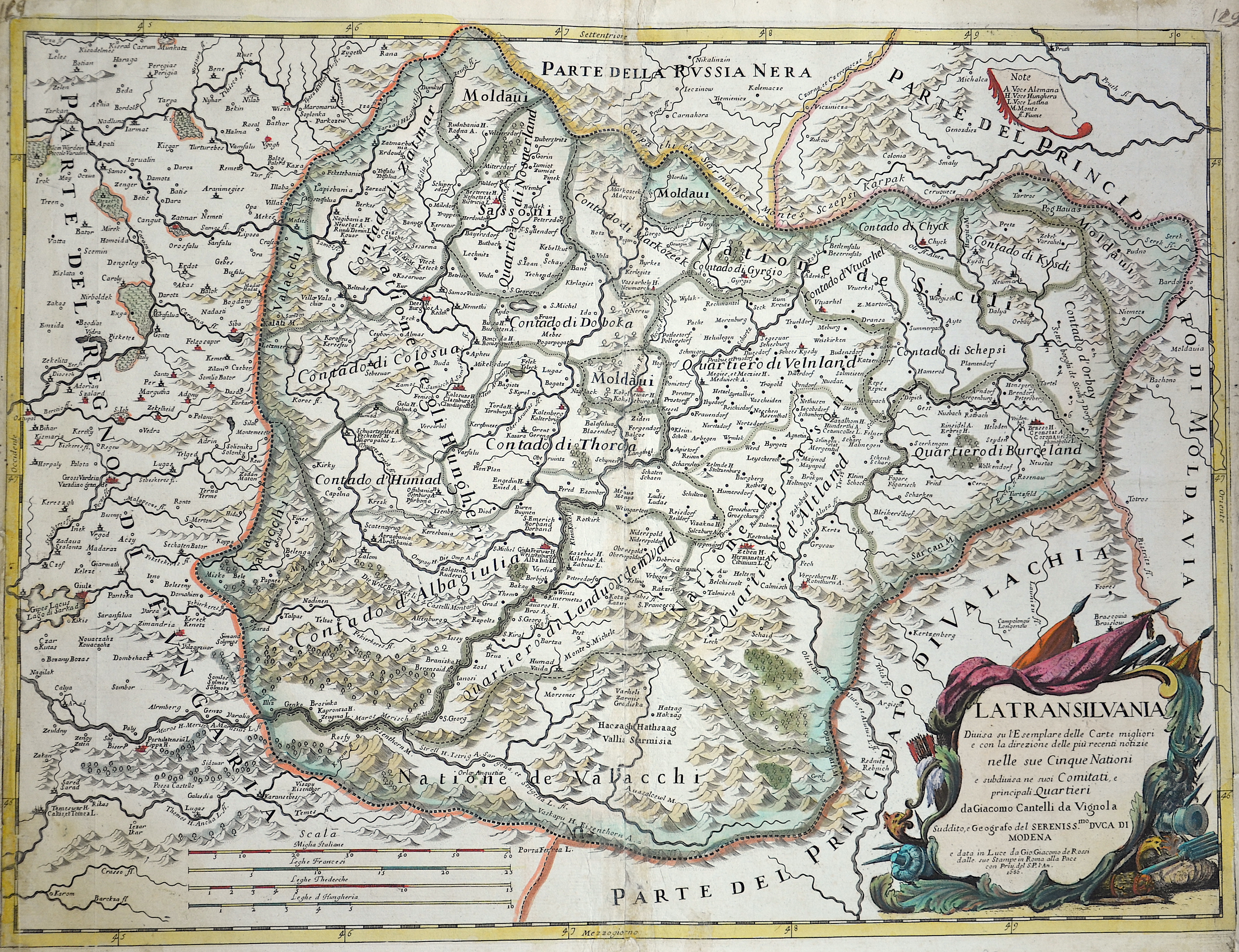
La Transilvania

| Article ID | EUR703 |
Title | La Transilvania |
Description | Map shows the entire Transylvania (Siebenbürgen) with a detailed representation of cities, forests, mountains, and a title cartouche. |
| Year | ca. 1686 |
Artist | Cantelli da Vignola (1643-1695) |
Giacomo Cantelli (1643–1695) studied literature in Bologna and later became secretary to the Marquis of Ferrara, Obizzi. He moved to Venice, where he gained recognition as a geographer, and likely traveled to Paris as part of a Venetian diplomatic mission to the court of Louis XIV. In Paris, he connected with cartographers such as Guillaume Sanson, Jacques-André Duval, and Michel-Antoine Baudrand. After returning to Italy, he served as secretary to Count Rinieri Marescotti in Bologna and traveled extensively, including to Rome, where he met publisher Giovanni Giacomo De Rossi. In 1672, De Rossi began publishing Cantelli’s maps, starting with the Holy Land, the Kingdom of Persia, and regions of the Ottoman Empire. In 1680–1681, Cantelli’s maps of Upper and Lower Lombardy appeared in the Mercury Geographic Atlas in Rome, showing strong influence from Giovanni Antonio Magini’s cartographic style. | |
Historical Description | Transilvania is a historical region located in what is today the central part of Romania. Bound on the east and south by its natural borders, the Carpathian mountain range, historical Transylvania extended westward to the Apuseni Mountains. The region of Transylvania is known for the scenic beauty of its Carpathian landscape and its rich history. It also contains major cities such as Cluj-Napoca, Brașov, Sibiu and Târgu Mureș. The Habsburgs acquired the territory shortly after the Battle of Vienna in 1683. In 1687, the rulers of Transylvania recognized the suzerainty of the Habsburg emperor Leopold I, and the region was officially attached to the Habsburg Empire. |
| Place of Publication | Modena |
| Dimensions (cm) | 42 x 46 cm |
| Condition | Perfect condition |
| Coloring | colored |
| Technique | Copper print |