

Adina Sommer
Antique and Contemporary Art
Winzerer Str. 154
80797 München
telephone
+49 89 304714
business hours:
by appointment
Email
![]()


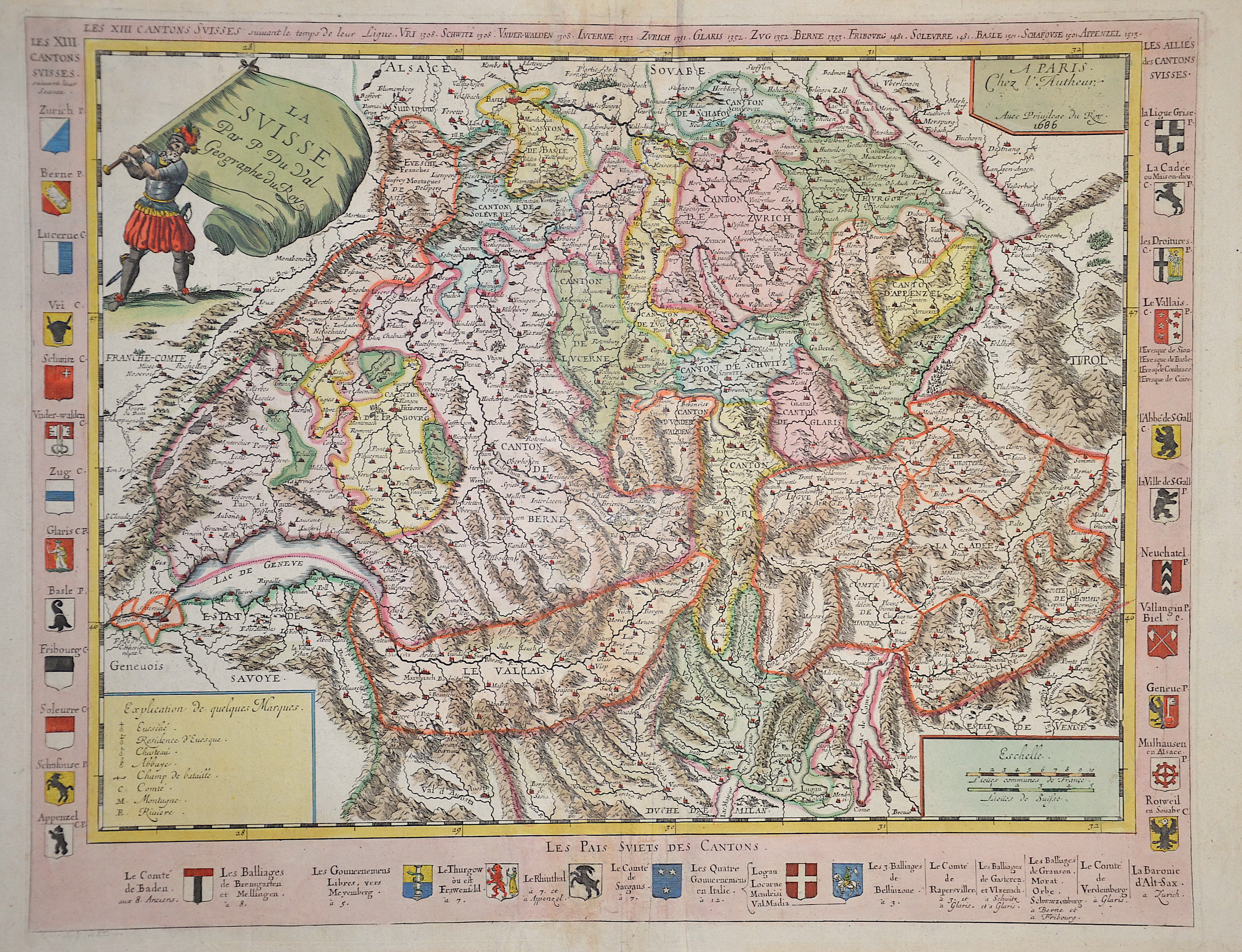
La Svisse Par P. Du Val / Les XIII Cantos Svisses ..

| Article ID | EUC4762 |
Title | La Svisse Par P. Du Val / Les XIII Cantos Svisses .. |
Description | Map shows the whole of Switzerland divided into cantons. Furthermore, a title cartouche depicting a Swiss flag bearer, an index and a mileage indicator. Entire map bordered with 31 coats of arms of the Swiss cantons. |
| Year | ca. 1686 |
Artist | Val, du (1618-1683) |
Pierre Duval (1618–1683) was a French geographer. Pierre Duval was born in Abbeville. He was the nephew and pupil of the geographer Nicolas Sanson. Encouraged by Louis XIV to move to Paris, he later became Geographe Ordinaire du Roy. | |
Historical Description | Since 1848, the Swiss Confederation has been a federal state of relatively autonomous cantons, some of which have a history of confederacy that goes back more than 700 years, putting them among the world's oldest surviving republics. The early history of the region is tied to that of Alpine culture. Switzerland was inhabited by Gauls and Raetians, and it came under Roman rule in the 1st century BC. Gallo-Roman culture was amalgamated with Germanic influence during Late Antiquity, with the eastern part of Switzerland becoming Alemannic territory. The area of Switzerland was incorporated into the Frankish Empire in the 6th century. In the high medieval period, the eastern part became part of the Duchy of Swabia within the Holy Roman Empire while the western part was part of Burgundy |
| Place of Publication | Paris |
| Dimensions (cm) | 40 x 52 cm |
| Condition | Restoration at centerfold |
| Coloring | original colored |
| Technique | Copper print |