

Adina Sommer
Antique and Contemporary Art
Winzerer Str. 154
80797 München
telephone
+49 89 304714
business hours:
by appointment
Email
![]()


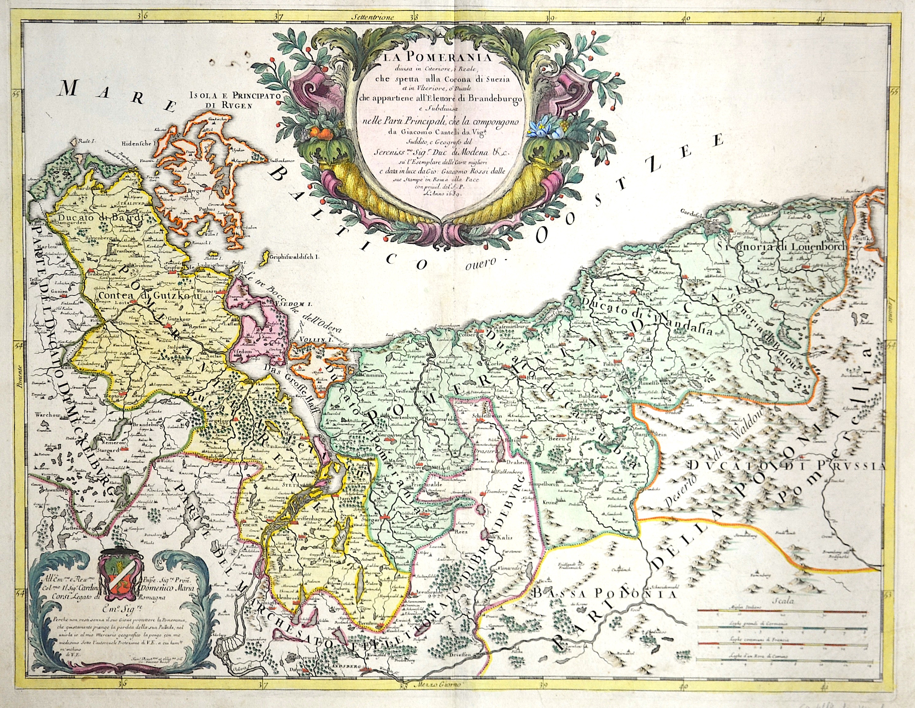
La Pomerania

| Article ID | EUD527 |
Title | La Pomerania |
Description | Map shows total Pommern |
| Year | dated 1689 |
Artist | Cantelli da Vignola (1643-1695) |
Giacomo Cantelli (1643–1695) studied literature in Bologna and later became secretary to the Marquis of Ferrara, Obizzi. He moved to Venice, where he gained recognition as a geographer, and likely traveled to Paris as part of a Venetian diplomatic mission to the court of Louis XIV. In Paris, he connected with cartographers such as Guillaume Sanson, Jacques-André Duval, and Michel-Antoine Baudrand. After returning to Italy, he served as secretary to Count Rinieri Marescotti in Bologna and traveled extensively, including to Rome, where he met publisher Giovanni Giacomo De Rossi. In 1672, De Rossi began publishing Cantelli’s maps, starting with the Holy Land, the Kingdom of Persia, and regions of the Ottoman Empire. In 1680–1681, Cantelli’s maps of Upper and Lower Lombardy appeared in the Mercury Geographic Atlas in Rome, showing strong influence from Giovanni Antonio Magini’s cartographic style. | |
Historical Description | The province of Pomerania, located in the north German lowlands, was the Prussian province formed from the Duchy of Pomerania after the Vienna Congress in 1815. It consisted of western Pomerania and Western Pomerania. Pomerania's capital was Szczecin. Through the Peace of Westphalia in 1648, Hinterpommern came to Brandenburg and Vorpommern became Swedish-Pommern. The Brandenburg Elector Friedrich Wilhelm I succeeded in conquering all of Swedish Pomerania in 1678, but he had to forego the majority of the conquered areas under pressure from France in the Peace of Saint-Germain (1679). After the end of the Great Northern War (1700-1721), the part of Western Pomerania south of the Peene came to Prussia (Old Western Pomerania). During the territorial reorganization of Europe in 1815, the last part of Western Pomerania, which remained Swedish, became Prussian with the island of Rügen (New Western Pomerania). At the same time, Pomerania received the districts of Dramburg and Schivelbein as well as the northern parts of the Arnswalde district with the town of Nörenberg from the Neumark, which otherwise remained with the province of Brandenburg. |
| Place of Publication | Modena |
| Dimensions (cm) | 43 x 56 |
| Condition | Centerfold perfetly restored |
| Coloring | colored |
| Technique | Copper print |