

Adina Sommer
Antique and Contemporary Art
Winzerer Str. 154
80797 München
telephone
+49 89 304714
business hours:
by appointment
Email
![]()


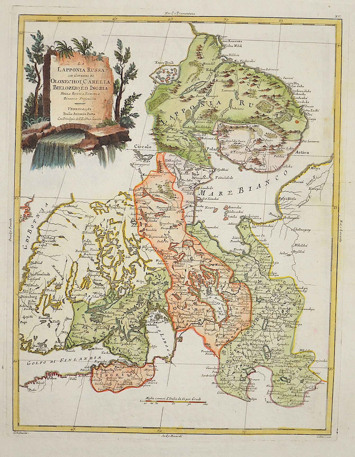
La Laponia Russa coi Governi di Olonechot Carelia, Bielozero ed Ingria nella Russia Europea

| Article ID | EUO1535 |
Title | La Laponia Russa coi Governi di Olonechot Carelia, Bielozero ed Ingria nella Russia Europea |
Description | Map shows partly Lappland and Finnland, the peninsula Kola, Carelia and Ingria with St. Petersbourg- Kronstadt. |
| Year | dated 1782 |
Artist | Zatta (1757-1797) |
Antonio Zatta (1757 – 1797) was an Italian cartographer who was based in Venice. One of his major contributions include the Atlante Novissimo, a four volume atlas of the world in very high scientific quality. | |
Historical Description | The Eastern European Plain occupies most of European Russia. It consists of wide lowlands interrupted by weakly indented ridges. Only a few elevations reach heights of more than 300 m. In Karelia and on the Kola Peninsula, which geologically belong to the Baltic Shield, the relief is more differentiated in the north. There, in the Chibines of the central Kola Peninsula, a maximum height of 1191 m is reached. In the south, the East European lowlands merge into the Caspian depression, which lies below sea level. During the last ice age a chain of terminal moraines was formed, which runs from the border area with Belarus eastward and north of Moscow to the Arctic coast west of the Pechora River. The region north of it consists of many lakes and swamps. The European part of the territory is much more densely populated and urbanized than the Asian part, which is over three times larger. The capital, Moscow, is one of the largest cities and metropolitan areas in the world. The second most important center is Saint Petersburg, which was the capital from 1712 to 1918 and is today an important cultural center. The next largest cities with over a million inhabitants are Novosibirsk, Yekaterinburg, Kazan and Nizhny Novgorod. In the European part of Russia, the most important river is the Volga. It is the longest river in Europe and runs exclusively through Russia. Together with its two tributaries Kama and Oka, it drains a large part of the East European Plain after 3534 km to the Caspian Sea in the southeast. As a waterway, the Volga has special significance, as it connects Eastern Europe with Central Asia. |
| Place of Publication | Venice |
| Dimensions (cm) | 40,5 x 31,5 cm |
| Condition | Very good |
| Coloring | original colored |
| Technique | Copper print |