

Adina Sommer
Antique and Contemporary Art
Winzerer Str. 154
80797 München
telephone
+49 89 304714
business hours:
by appointment
Email
![]()


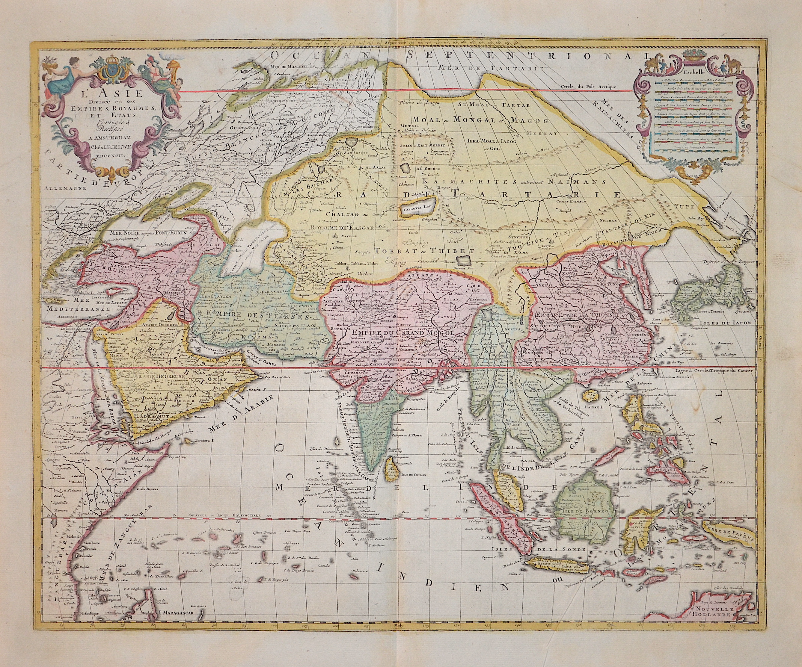
L’ Asie

| Article ID | ASX051 |
Title | L’ Asie |
Description | Map shows total Asia, Southeast Asia, a magnificent title cartouche and a mileage indicator cartouche. |
| Year | dated 1792 |
Artist | Elwe (1777-1777) |
Jan Barend Elwe ( 177 - 1815), was a Dutch publisher and book seller who reissued maps by De L´Isle and Ottens and some other cartographers in the late 18th century. His famous map "Amerique Septentrionale Divisee en ses Principales Parties" was derived mainly from Sanson’s and Jaillot’s maps of 1656 and 1676. At this time, California was no longer shown as an island, but as a peninsular, and the Great Lakes to the north are enclosed, which was another feature often shown incorrectly on earlier maps of America. This map has been published in 1792 in an Atlas which included 37 other maps of different countries. | |
Historical Description | Asia is Earth's largest and most populous continent, located primarily in the Eastern and Northern Hemispheres. The history of Asia can be seen as the distinct histories of several peripheral coastal regions: East Asia, South Asia, Southeast Asia and the Middle East, linked by the interior mass of the Central Asian steppes. The coastal periphery was home to some of the world's earliest known civilizations, each of them developing around fertile river valleys. The civilizations in Mesopotamia, the Indus Valley and the Yellow River shared many similarities. These civilizations may well have exchanged technologies and ideas such as mathematics and the wheel. Other innovations, such as writing, seem to have been developed individually in each area. Cities, states and empires developed in these lowlands. The central steppe region had long been inhabited by horse-mounted nomads who could reach all areas of Asia from the steppes. The earliest postulated expansion out of the steppe is that of the Indo-Europeans, who spread their languages into the Middle East, South Asia, and the borders of China, where the Tocharians resided. The northernmost part of Asia, including much of Siberia, was largely inaccessible to the steppe nomads, owing to the dense forests, climate and tundra. These areas remained very sparsely populated. The center and the peripheries were mostly kept separated by mountains and deserts. The Caucasus and Himalaya mountains and the Karakum and Gobi deserts formed barriers that the steppe horsemen could cross only with difficulty. While the urban city dwellers were more advanced technologically and socially, in many cases they could do little in a military aspect to defend against the mounted hordes of the steppe. However, the lowlands did not have enough open grasslands to support a large horsebound force; for this and other reasons, the nomads who conquered states in China, India, and the Middle East often found themselves adapting to the local, more affluent societies. |
| Place of Publication | Amsterdam |
| Dimensions (cm) | 46,5 x 58 cm |
| Condition | Perfect condition |
| Coloring | original colored |
| Technique | Copper print |