

Adina Sommer
Antique and Contemporary Art
Winzerer Str. 154
80797 München
telephone
+49 89 304714
business hours:
by appointment
Email
![]()


Karte zeigt die Karolinen Inseln im Pazifik No.9
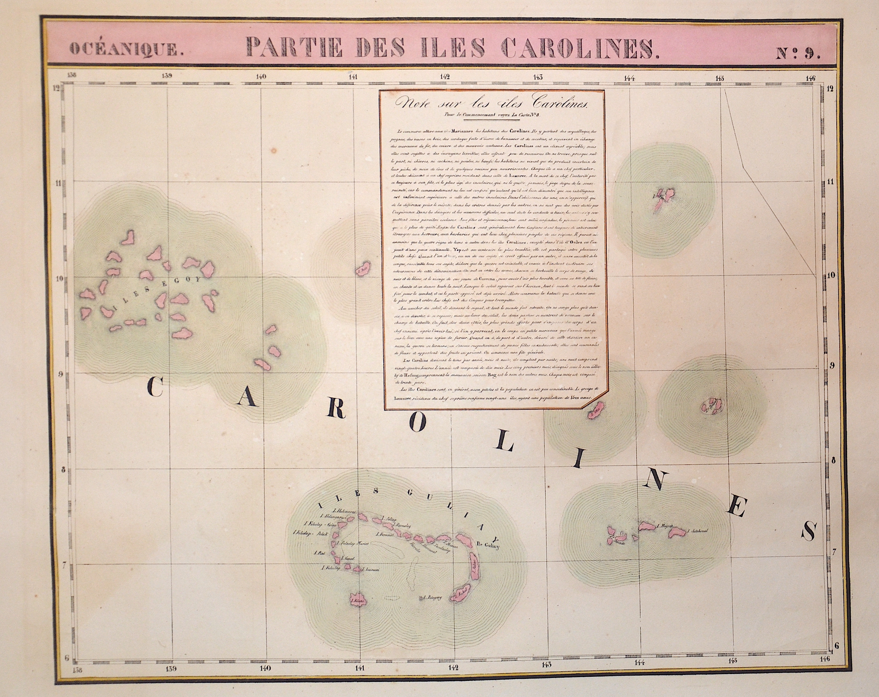

| Article ID | OZ0320 |
Title | Karte zeigt die Karolinen Inseln im Pazifik No.9 |
Description | Map shows the Caroline Isalnds in the Pacific Ocean |
| Year | ca. 1825 |
Artist | Vandermaelen |
| Place of Publication | Bruxelles |
| Dimensions (cm) | 46,5 x 56 |
| Condition | Very good |
| Coloring | original colored |
| Technique | Lithography |